

EXPIRED Severe T-Storm Warning — Parts of Walker, Winston Co. Until 4:15 pm
The National Weather Service in Birmingham has issued a
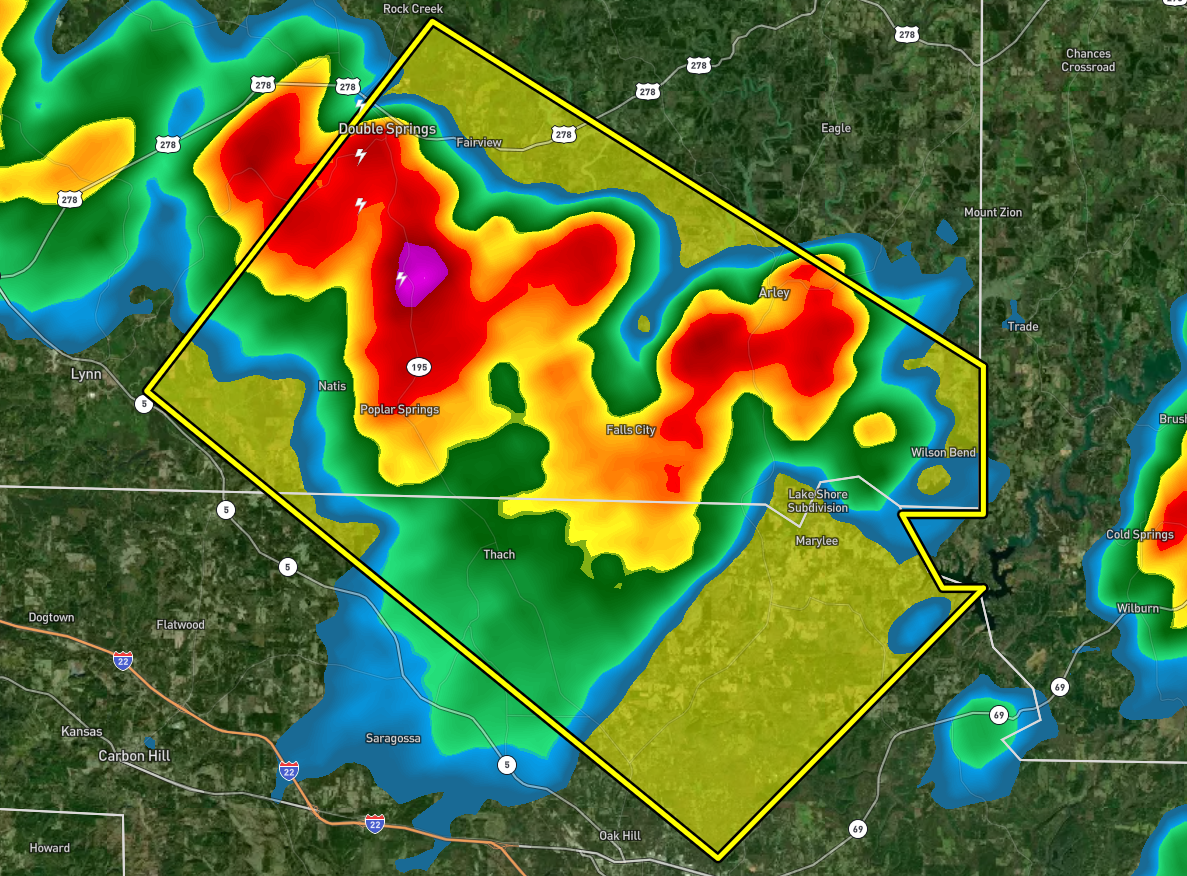
* Severe Thunderstorm Warning for…
North central Walker County in central Alabama…
Southeastern Winston County in northwestern Alabama…
* Until 415 PM CDT.
* At 331 PM CDT, a severe thunderstorm was located near Poplar
Springs, or 8 miles east of Lynn, moving southeast at 20 mph.
HAZARD…60 mph wind gusts and nickel size hail.
SOURCE…Radar indicated.
IMPACT…Expect damage to roofs, siding, and trees.
* Locations impacted include…
Jasper, Arley, Double Springs, Curry, Houston Recreational Area,
Camp McDowell, Smith Lake, Poplar Springs, Corinth Rec Area, Falls
City, Maple Branch, Hullett Branch, Clear Creek, Winston County
Airport, Cane Creek, Little Dismal Creek, Yellow Creek, Coon Creek,
Rockhouse Creek and Battle Branch.
PRECAUTIONARY/PREPAREDNESS ACTIONS…
For your protection move to an interior room on the lowest floor of a
building.
Category: Alabama's Weather, ALL POSTS, Severe Weather
About the Author (Author Profile)
Scott Martin is an operational meteorologist, professional graphic artist, musician, husband, and father. Not only is Scott a member of the National Weather Association, but he is also the Central Alabama Chapter of the NWA president. Scott is also the co-founder of Racecast Weather, which provides forecasts for many racing series across the USA. He also supplies forecasts for the BassMaster Elite Series events including the BassMaster Classic.Subscribe
If you enjoyed this article, subscribe to receive more just like it.


