Late Saturday Afternoon Weather Check
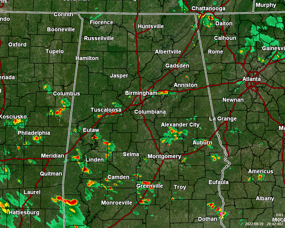
RADAR CHECK: Scattered showers and storms are most active along and south of the I-20/59 corridor, while only a few isolated showers are showing up north of that. Where it is not raining, there is a good bit of sunshine as skies are partly to mostly sunny. Temperatures are ranging from the upper 70s to the lower 90s across the area. The hot spot is Eufaula at 92 while the cool spot is Alexander City at 78. Birmingham was sitting at 86.
REST OF TODAY: We’ll continue to have scattered to numerous showers and storms likely through the remainder of the afternoon and early evening hours for all of Central Alabama, and for the northern 2/3rds of the area during the late night and overnight hours. South of I-85 will have lesser rain chances. Lows will be in the lower 70s.
SUNDAY’S WEATHER: Rain will be more likely on Sunday, especially during the afternoon and early evening hours. Otherwise, skies will be partly to mostly cloudy when it is not raining. Highs will top out in the 80s across the area.
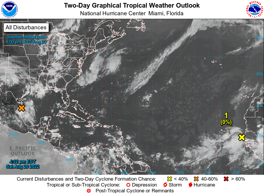
TROPICS: Satellite images and surface observations indicate that PTC-4 has not become any better organized this afternoon and still resembles a surface trough with
scattered showers and thunderstorms over the western Gulf of Mexico. Latest data showed maximum winds of about 35 mph. The chances of this system becoming a tropical storm continue to decrease as the trough is expected to move inland this evening. Even though the system will probably fall short of becoming a tropical cyclone, the expected impacts are unchanged as heavy rains and winds to tropical storm force, especially in gusts, are expected to spread across northeastern Mexico and southern Texas during the next several hours. After landfall, the disturbance is expected to weaken and dissipate on Sunday.
Also, a tropical wave located near the west coast of Africa is producing disorganized showers and thunderstorms. Environmental conditions are expected to be marginally conducive for gradual development of this system while it moves westward to west-northwestward at 15 to 20 mph across the eastern and central tropical Atlantic during the early to middle part of next week.
* Formation chance through 48 hours… low… near 0 percent.
* Formation chance through 5 days… low… 20 percent.
Category: Alabama's Weather, ALL POSTS, Tropical
About the Author (Author Profile)
Scott Martin is an operational meteorologist, professional graphic artist, musician, husband, and father. Not only is Scott a member of the National Weather Association, but he is also the Central Alabama Chapter of the NWA president. Scott is also the co-founder of Racecast Weather, which provides forecasts for many racing series across the USA. He also supplies forecasts for the BassMaster Elite Series events including the BassMaster Classic.Subscribe
If you enjoyed this article, subscribe to receive more just like it.


