

CANCELLED Flash Flood Warning for Parts of Madison Co. Until 10 pm
The National Weather Service in Huntsville has issued a
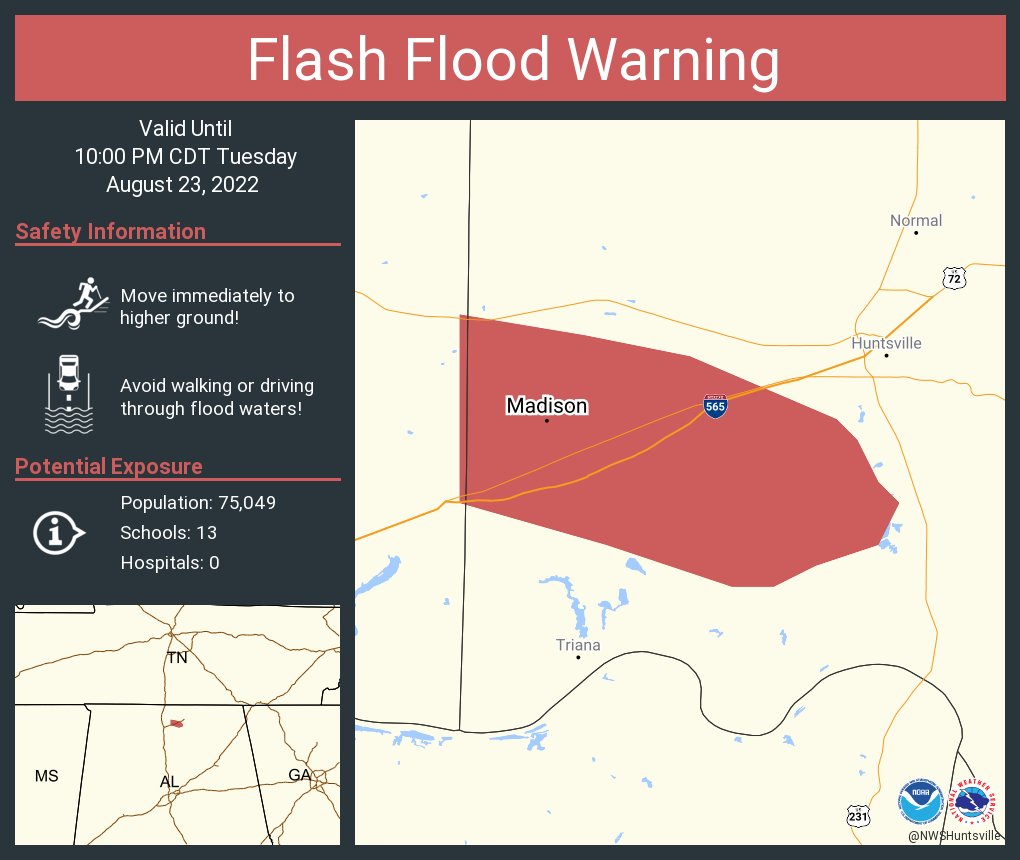
* Flash Flood Warning for…
West Central Madison County in north central Alabama…
* Until 1000 PM CDT.
* At 653 PM CDT, Doppler radar and automated rain gauges indicated
thunderstorms producing heavy rain across the warned area.
Rainfall of 2 to 3 inches in 30 minutes have been reported in
Madison. Flash flooding is ongoing or expected to begin shortly.
HAZARD…Flash flooding caused by thunderstorms.
SOURCE…Radar and automated gauges.
IMPACT…Flash flooding of small creeks and streams, urban
areas, highways, streets and underpasses as well as
other poor drainage and low-lying areas.
* Some locations that will experience flash flooding include…
Southwestern Huntsville, Madison, Redstone Arsenal, Marshall Space
Flight Center and Huntsville International Airport.
PRECAUTIONARY/PREPAREDNESS ACTIONS…
Be aware of your surroundings and do not drive on flooded roads.
Category: Alabama's Weather, ALL POSTS
About the Author (Author Profile)
Scott Martin is an operational meteorologist, professional graphic artist, musician, husband, and father. Not only is Scott a member of the National Weather Association, but he is also the Central Alabama Chapter of the NWA president. Scott is also the co-founder of Racecast Weather, which provides forecasts for many racing series across the USA. He also supplies forecasts for the BassMaster Elite Series events including the BassMaster Classic.Subscribe
If you enjoyed this article, subscribe to receive more just like it.


