A Brief Weather Check at Midnight; Wind Advisory Extended Southward
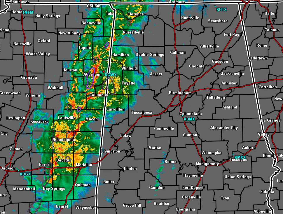
The line of showers and heavier rain is now moving into the western parts of the state from Mississippi, and the good news is that none of these storms are strong or severe. However, has the line moves farther into the area, we can expect the winds to increase, not from thunderstorms, but from a tightening pressure gradient. And speaking of wind…
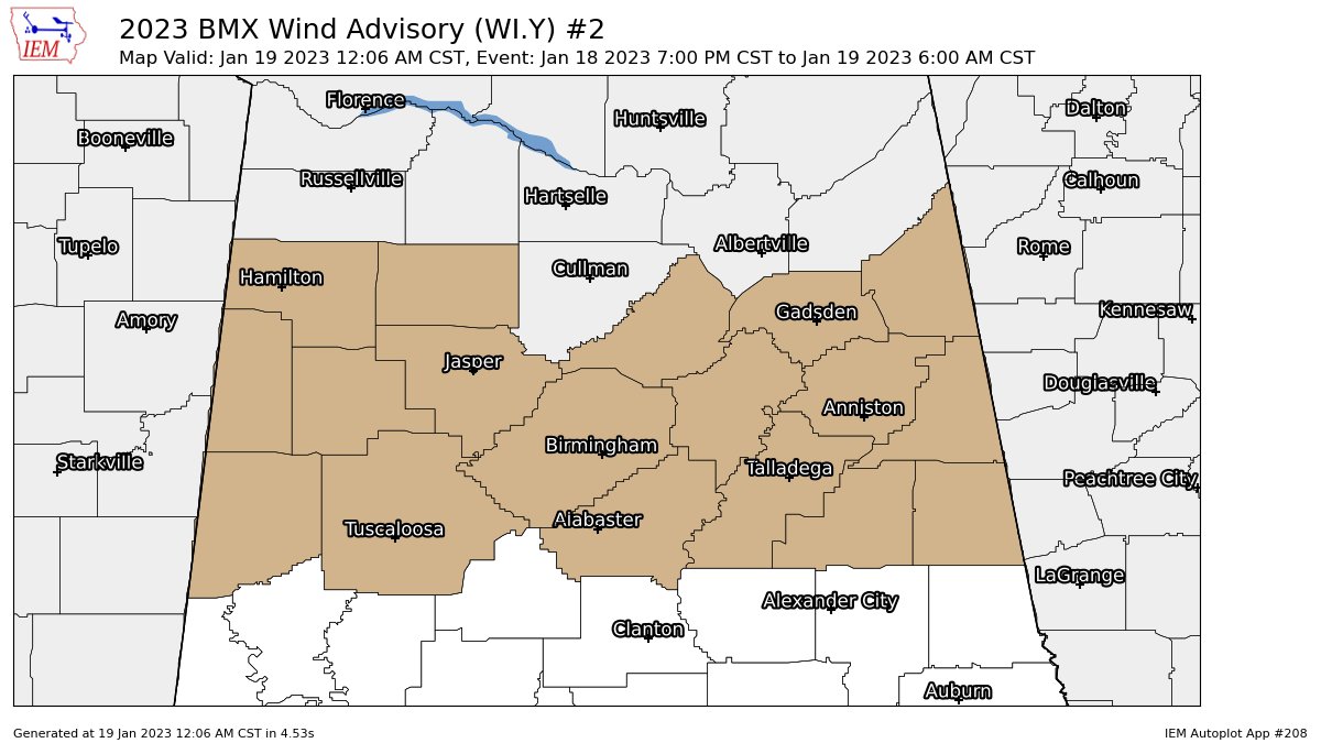
NWS Birmingham has extended the Wind Advisory farther to the south to now include Calhoun, Clay, Cleburne, Jefferson, Pickens, Randolph, Shelby, St. Clair, Talladega, and Tuscaloosa counties, to go along with Blount, Cherokee, Etowah, Fayette, Lamar, Marion, Walker, and Winston counties until 6 am Thursday morning. All of the Tennessee Valley counties are also under a Wind Advisory until 6 am as well.
The risk of severe weather continues to dwindle, and within a couple of hours, it will have totally ended. As a matter of fact, the new Day One Severe Weather Outlook for Thursday has been released and the general thunderstorm risk has been removed from all of Alabama.
I would say it is safe to go to bed and rest comfortably, but continue to have your way of receiving warnings active, so you can be alerted if a warning is issued for your location.
Category: Alabama's Weather, ALL POSTS, Severe Weather
About the Author (Author Profile)
Scott Martin is an operational meteorologist, professional graphic artist, musician, husband, and father. Not only is Scott a member of the National Weather Association, but he is also the Central Alabama Chapter of the NWA president. Scott is also the co-founder of Racecast Weather, which provides forecasts for many racing series across the USA. He also supplies forecasts for the BassMaster Elite Series events including the BassMaster Classic.Subscribe
If you enjoyed this article, subscribe to receive more just like it.


