

Mesoscale Discussion 358 — Severe Storms Remain Possible Through Late Afternoon
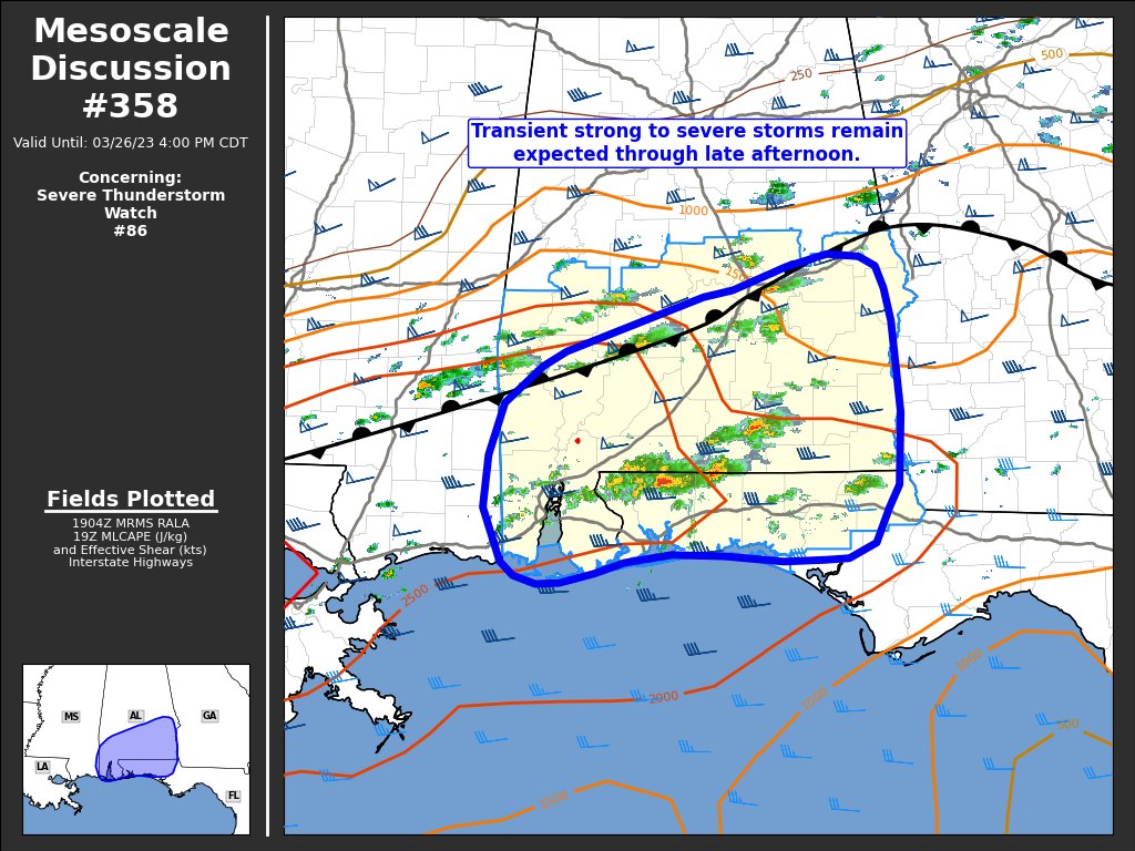
Transient strong to severe thunderstorms remain likely through the next several hours across southern Alabama and the western Florida Panhandle.
DISCUSSION… Isolated to scattered thunderstorms, including a couple of supercells, continue across portions of southern AL and the FL Panhandle. The strongest of these have featured organized mesocyclones, but have thus far largely struggled to maintain intensity for longer than 60 minutes. This is likely due to relatively weak forcing for ascent, given the displacement of larger-scale ascent to the west across east TX/LA. Based off recent surface observations and satellite trends, most lift has been focused along the residual stationary boundary and/or weak confluence zone within a modest warm advection regime near the surface. Consequently, individual storm longevity is relatively uncertain.
Despite this concern, recent observed 18 UTC soundings from LIX and TLH show ample buoyancy across the warm sector (1500-2500 J/kg MLCAPE) with minimal inhibition and 45 knots of effective bulk shear. This thermodynamic/kinematic environment is very conducive for severe convection in the presence of sufficient ascent. The expectation over the next several hours is for continued development of isolated to scattered thunderstorms, with a few transient supercells capable of severe hail/wind.
Category: Alabama's Weather, ALL POSTS, Severe Weather
About the Author (Author Profile)
Scott Martin is an operational meteorologist, professional graphic artist, musician, husband, and father. Not only is Scott a member of the National Weather Association, but he is also the Central Alabama Chapter of the NWA president. Scott is also the co-founder of Racecast Weather, which provides forecasts for many racing series across the USA. He also supplies forecasts for the BassMaster Elite Series events including the BassMaster Classic.Subscribe
If you enjoyed this article, subscribe to receive more just like it.


