

A Quick Mid-Morning Update, Including Out at Barber Motorsports Park
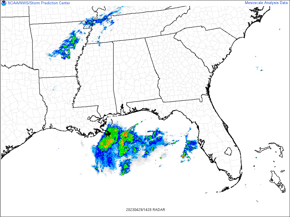
At 9:30 am, skies are mostly clear across much of Central Alabama, but we do have clouds encroaching from the west and southwest that are blocking out much of the sunshine across the southeastern portions of the area. The good news is that radar continues to be clear of any precipitation across all of Central Alabama, with the closest activity off of the Gulf Coast well south of Mobile, and up into the western portions of Tennessee and the extreme northern portions of Mississippi.
Temperatures as of the 9 am roundup were in the lower 60s to the lower 70s across Central Alabama. Eufaula and Troy were tied as the warm spots at 71º. Four different locations were tied as the cool spots at 63º. Birmingham was at 66º. Afternoon highs are expected to reach the upper 70s to the lower 80s.
Currently, out at Barber Motorsports Park for the Children’s of Alabama Indy Grand Prix weekend, we have bright sunshine and the temperature at 63º. Wind is currently calm at the track. The good news is that much of the day will be dry, but there will be an increase of shower and thunderstorm chances as we reach the late-afternoon to early evening hours, and will be likely during the night and overnight hours. While severe weather is not expected up this far north today, a strong storm tonight is possible with gusty winds, small hail, and dangerous lightning. Please be weather aware if camping at the track tonight.
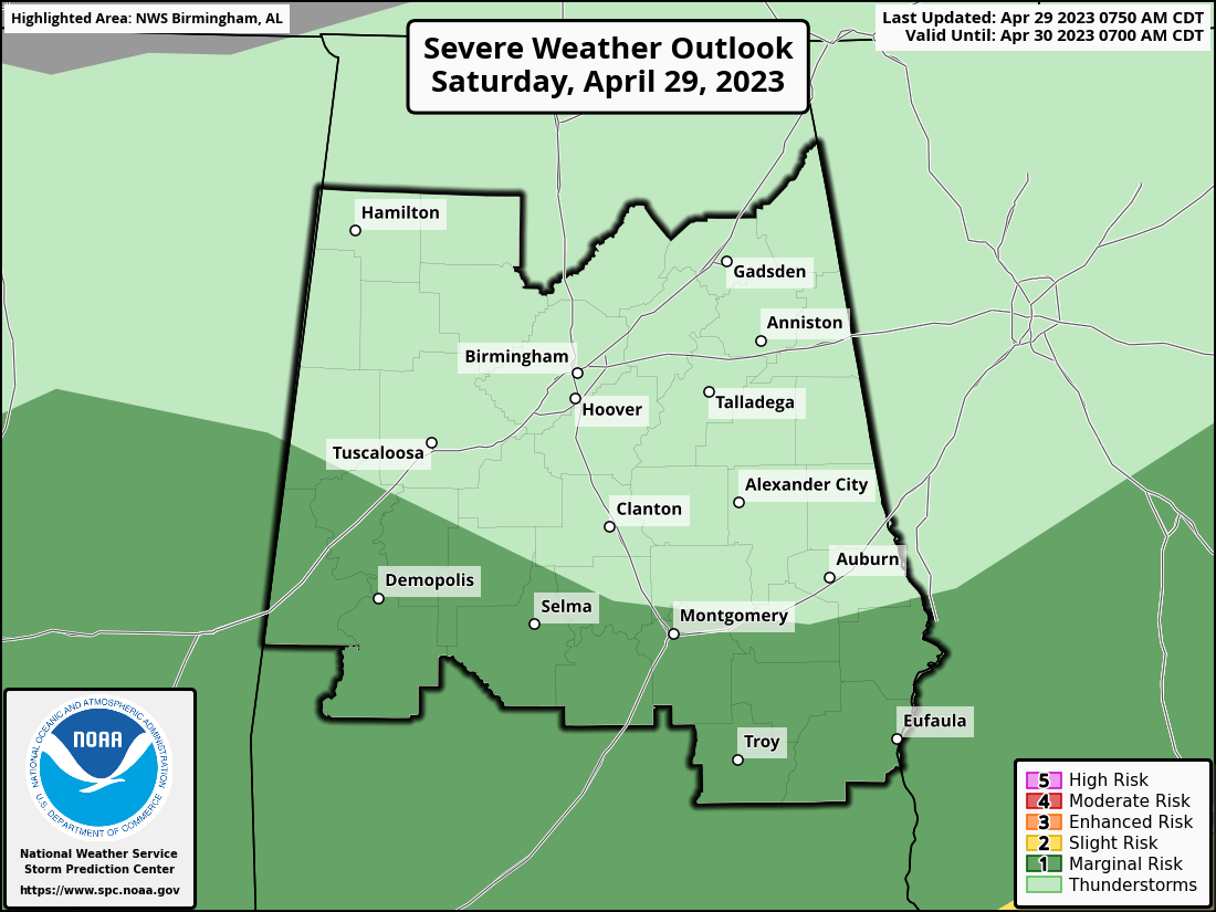
Speaking of stronger storms, the SPC has a Marginal Risk up for locations along and south of a line from Aliceville to Prattville to Smiths Station. The main window for this strong to severe weather threat will be from 1 pm this afternoon until 8 pm this evening from west to east. Isolated damaging wind gusts up to 60 mph and quarter size hail will be possible, but we also can’t rule out a brief tornado.
Rain and storms will develop out to our west and will begin to move into the western portions of the area this afternoon and slowly push eastward through the evening and overnight hours. No severe weather is expected north of the marginal risk locations, but a few strong storms cannot be ruled out. It will be a wet Saturday night across the area, with lows reaching the mid to upper 50s for most.
The good news is that rain and storms will be exiting the eastern parts of the area tomorrow morning, and skies will begin to clear out as drier and cooler air moves in. It will be breezy at times as winds may gust up to 20-25 mph. Temperatures will be a little cooler as highs will be in the upper 60s to the upper 70s.
Category: Alabama's Weather, ALL POSTS, Severe Weather
About the Author (Author Profile)
Scott Martin is an operational meteorologist, professional graphic artist, musician, husband, and father. Not only is Scott a member of the National Weather Association, but he is also the Central Alabama Chapter of the NWA president. Scott is also the co-founder of Racecast Weather, which provides forecasts for many racing series across the USA. He also supplies forecasts for the BassMaster Elite Series events including the BassMaster Classic.Subscribe
If you enjoyed this article, subscribe to receive more just like it.


