

Cleburne County Storm is near Severe Limits
The storm over northern Cleburne County has intensified this afternoon and is near severe limits.
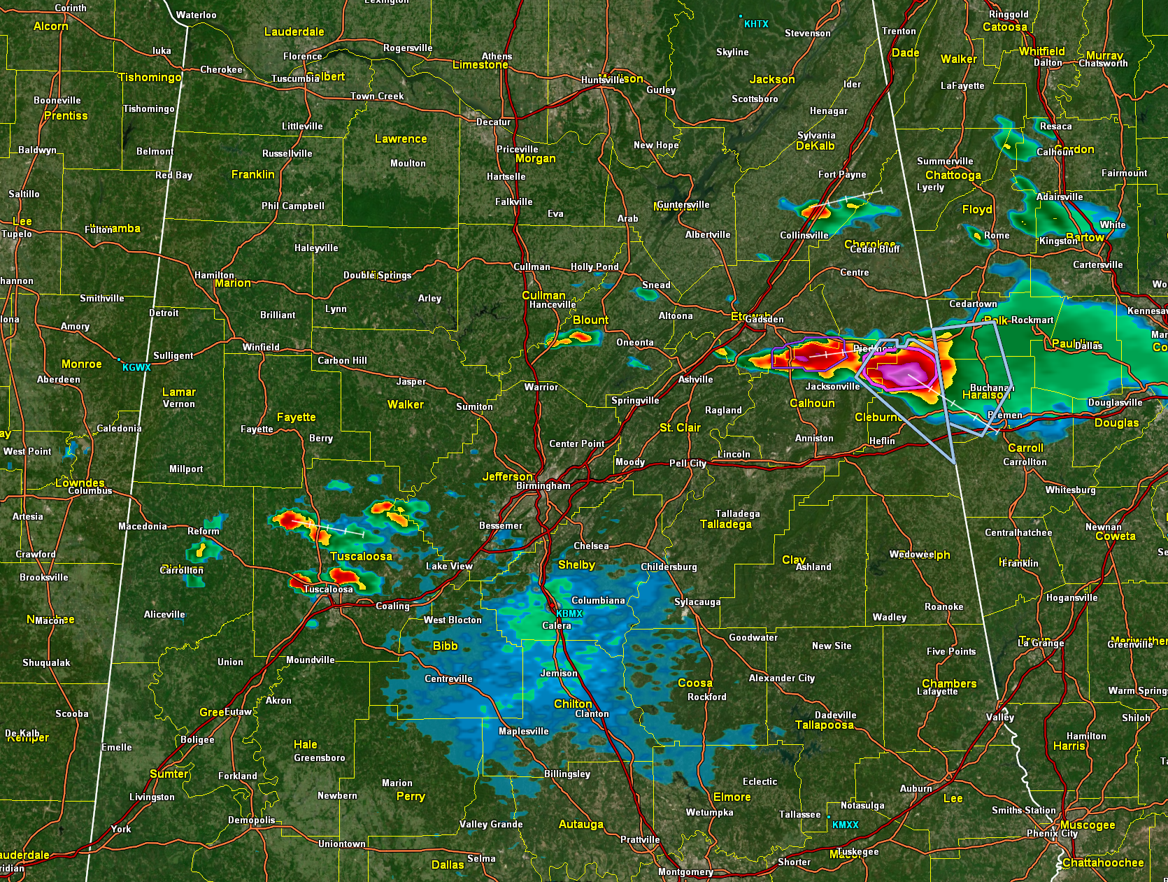
The NWS Birmingham has issued a significant weather advisory for the storm. Radar indicates that hail, potentially as large as 1 inch in diameter, could be approaching. Damaging wind gusts are also possible.
Lightning flash rates are approaching 40 per minute, which is impressive.
The core is between Oak Level and Borden Wheeler Springs, well north of Fruithurst. It is moving southeast at 20 mph. It will move over mainly forested territory and in the general direction of Tallapoosa, GA.
A short arc of storms extends back into southern Etowah County to near Southside, south of Gadsden.
There is another heavy shower over I-59 between Fort Payne and Collinsville.
Developing storms are over Tuscaloosa County and western Blount County at this hour.
Category: Alabama's Weather, ALL POSTS, Severe Weather
About the Author (Author Profile)
Bill Murray is the President of The Weather Factory. He is the site's official weather historian and a weekend forecaster. He also anchors the site's severe weather coverage. Bill Murray is the proud holder of National Weather Association Digital Seal #0001 @wxhistorianSubscribe
If you enjoyed this article, subscribe to receive more just like it.


