

Sunday Early Afternoon Update
Clouds are thick across the western two-thirds of Alabama on this Sunday afternoon, with a little more sunshine gracing easter sections of the state.
Temperatures are well into the 70s this afternoon on their way to the lower 80s.
Only a few isolated showers are expected today, mainly across West Central and South Central Alabama, as those readings reach the convective temperature this afternoon. No lightning is expected.
Strong to severe storms will move across eastern Oklahoma and Texas today, through Missouri, Arkansas, and Louisiana, and into Mississippi during the early morning and morning hours.
An area of scattered storms will reach western Alabama after lunch tomorrow and move slowly across the state through the afternoon and evening hours.
The storms tomorrow morning could be severe over southern Mississippi and into Southwest Alabama, but only those counties from southern Sumter down through Choctaw, Washington, and Mobile, at least according to the Storm Prediction Center.
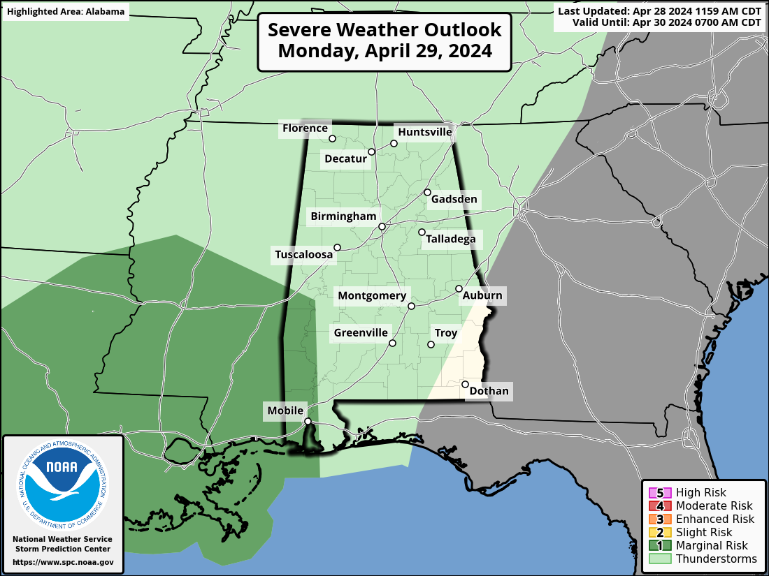
No other severe weather is expected across the state for the next 7-10 days.
Another round of scattered showers and storms will push through the Tennessee valley and North Central Alabama Monday night into early Tuesday.
Most of the state will see increasing clouds on Monday, with clearing eroding the clouds from the west on Tuesday. Highs tomorrow will be in the low 80s in most spots with upper 70s in some Tennessee Valley locations. Tuesday highs will be in the upper 80s north and lower to middle 80s elsewhere. Lows both mornings will be right around 60F.
Showers and storms will move into North Alabama late Thursday and affect much of the are on Friday. Showers and storms may stick around into the weekend. Might see some strong storms Saturday evening. But much of teh rest of the two weeks ahead looks to be severe weather free for Alabama. Can’t say the same for areas to the west. Wednesday night looks intense again for Oklahoma and Thursday further north.
Saturday night the 11th shows up as a potential severe weather threat for Alabama, but that’s a long way off.
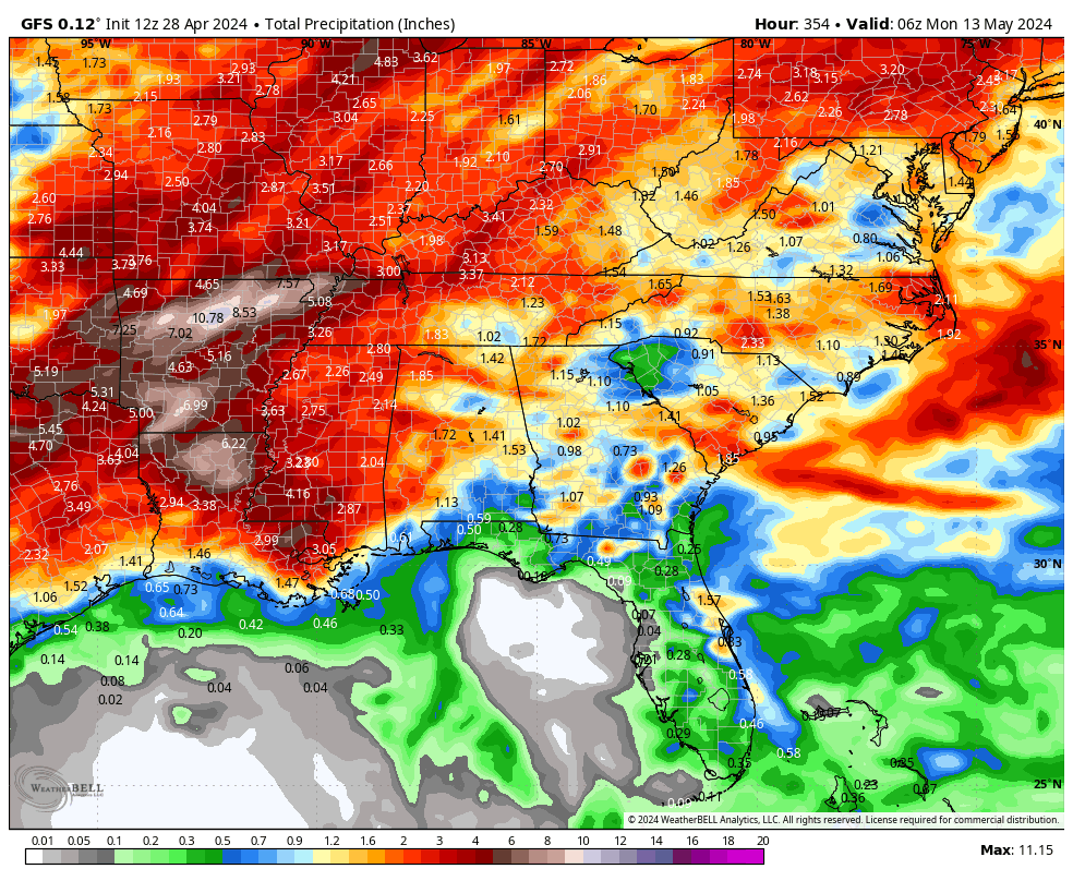
We need rain as things have gotten dry. No drought conditions, but Dr. Christy’s lawn and garden index is trending yellow and orange for a change. Deterministic GFS two week values for rain look like this:
Category: Alabama's Weather, ALL POSTS, Severe Weather
About the Author (Author Profile)
Bill Murray is the President of The Weather Factory. He is the site's official weather historian and a weekend forecaster. He also anchors the site's severe weather coverage. Bill Murray is the proud holder of National Weather Association Digital Seal #0001 @wxhistorianSubscribe
If you enjoyed this article, subscribe to receive more just like it.


