

Severe Thunderstorm Warning for Parts of Shelby County Until 630pm
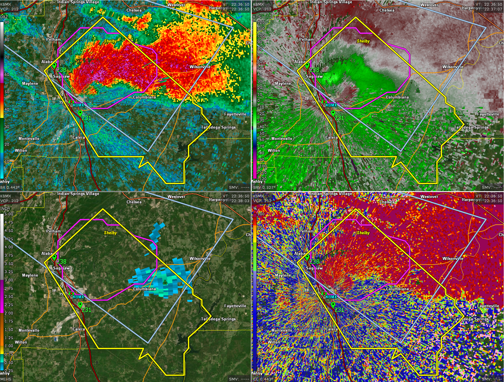
Dangerous storm in Shelby County east of I-65. The core is over Columbiana.
Lightning rate is up to 37 flashes per minute.
BULLETIN – IMMEDIATE BROADCAST REQUESTED
Severe Thunderstorm Warning
National Weather Service Birmingham AL
535 PM CDT Thu May 9 2024
The National Weather Service in Birmingham has issued a
* Severe Thunderstorm Warning for…
Southeastern Shelby County in central Alabama…
* Until 630 PM CDT.
* At 535 PM CDT, a severe thunderstorm was located near Shelby County
Airport, or near Alabaster, moving southeast at 20 mph.
HAZARD…60 mph wind gusts and quarter size hail.
SOURCE…Radar indicated.
IMPACT…Hail damage to vehicles is expected. Expect wind damage
to roofs, siding, and trees.
* Locations impacted include…
Alabaster, Pelham, Calera, Columbiana, Shelby County Airport, Lay
Lake, Shelby, Beeswax Creek Park, Alabama 4H Center, Shelby Shores,
Highway 145 and CR 46, Ballantrae, Kelley Branch, Camp Branch,
Saddle Lake Farms, Siluria, Bounds Lake, Spring Creek, and Saginaw.
PRECAUTIONARY/PREPAREDNESS ACTIONS…
For your protection move to an interior room on the lowest floor of a
building.
&&
LAT…LON 3318 8650 3317 8650 3316 8648 3315 8648
3313 8646 3312 8647 3309 8651 3307 8651
3306 8652 3302 8652 3302 8656 3306 8660
3305 8662 3307 8661 3307 8671 3323 8683
3333 8670
TIME…MOT…LOC 2235Z 316DEG 19KT 3322 8673
HAIL THREAT…RADAR INDICATED
MAX HAIL SIZE…1.00 IN
WIND THREAT…RADAR INDICATED
MAX WIND GUST…60 MPH
Category: Alabama's Weather, ALL POSTS, Severe Weather
About the Author (Author Profile)
Bill Murray is the President of The Weather Factory. He is the site's official weather historian and a weekend forecaster. He also anchors the site's severe weather coverage. Bill Murray is the proud holder of National Weather Association Digital Seal #0001 @wxhistorianSubscribe
If you enjoyed this article, subscribe to receive more just like it.


