Alabama 811 | Know What's Below.

Archive for October 17th, 2012

Watch May Be Required for West Alabama

Watch May Be Required for West Alabama

| October 17, 2012 @ 11:18 pm

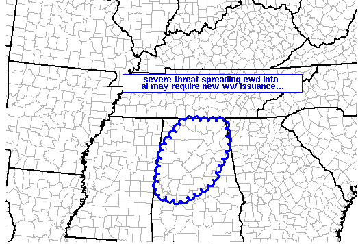
The SPC says there is a good chance that a watch will be required for parts of Alabama soon. MESOSCALE DISCUSSION 2071 NWS STORM PREDICTION CENTER NORMAN OK 1110 PM CDT WED OCT 17 2012 AREAS AFFECTED…PARTS OF NRN AND CENTRAL AL CONCERNING…SEVERE POTENTIAL…WATCH POSSIBLE VALID 180410Z – 180545Z PROBABILITY OF WATCH ISSUANCE…60 PERCENT SUMMARY…BAND […]

Read More

Storms Race Eastward

Storms Race Eastward

| October 17, 2012 @ 10:51 pm

Our storms over Mississippi are pushing east very quickly now, moving at 45 mph. TIMING The first storms will arrive in the following counties at the following times: Franklin County (Red Bay): 11:30 p.m. Marion County (Hamilton): Midnight Lamar County (Vernon): 12:15 a.m. Pickens County (Carrollton): 1:00 a.m . The storms should reach Birmingham between […]

Read More

Update from the NWS Birmingham

Update from the NWS Birmingham

| October 17, 2012 @ 10:19 pm

Here is a note from our friend Gary Goggins at the NWS Birmingham on the weather situation for Alabama: Good evening, everyone. Forecast updates for this evening are already out. The current severe threat area remains the same at this time, with our western tier of counties still under the threat of severe thunderstorms with […]

Read More

Warnings, Radar at 10 p.m.

Warnings, Radar at 10 p.m.

| October 17, 2012 @ 10:13 pm

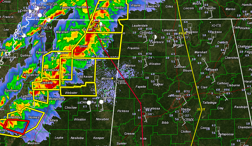
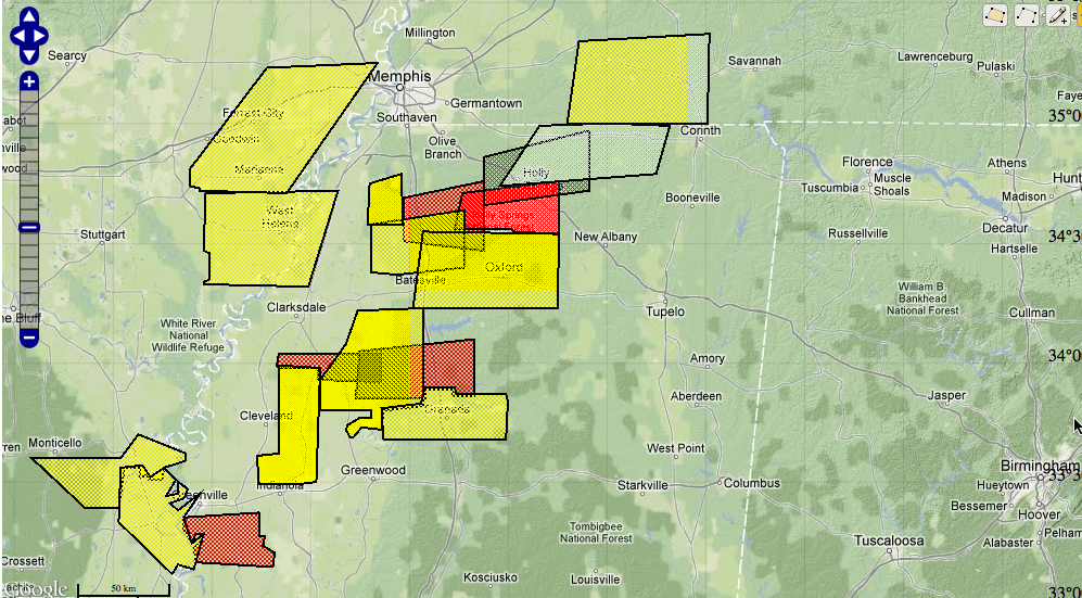
Here is the radar at 10 p.m. Here are the warnings: LATE REPORTS Wind damage at Senatobia MS at 9:30 and at Tunica at 9:30 p.m. also. No recent reports of tornadoes although several tornado warnings are in effect. WATCH ISSUED FOR NORTHWEST ALABAMA A severe thunderstorm watch has been issued for Northwest Alabama including […]

Read More

Tornado Headed Toward Holly Springs MS

Tornado Headed Toward Holly Springs MS

| October 17, 2012 @ 9:07 pm

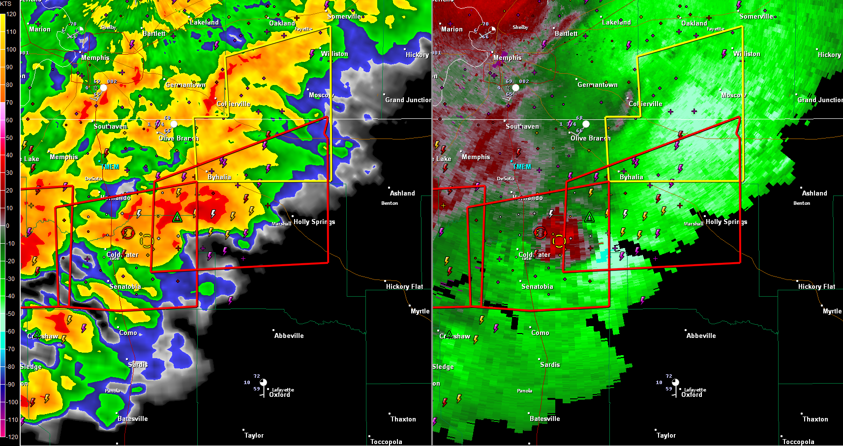
Trained spotters reported a tornado 10 miles south of Hernando at 8:50. This is just north of Senatobia. This tornado is moving toward Holly Springs. Tornado warning just issued that includes the city of Holly Springs. There is another possible tornado just west of Senatobia also. Memphis radar shows a TVS (tornado vortex signature) and […]

Read More

Updating Situation to our Northwest

Updating Situation to our Northwest

| October 17, 2012 @ 8:40 pm

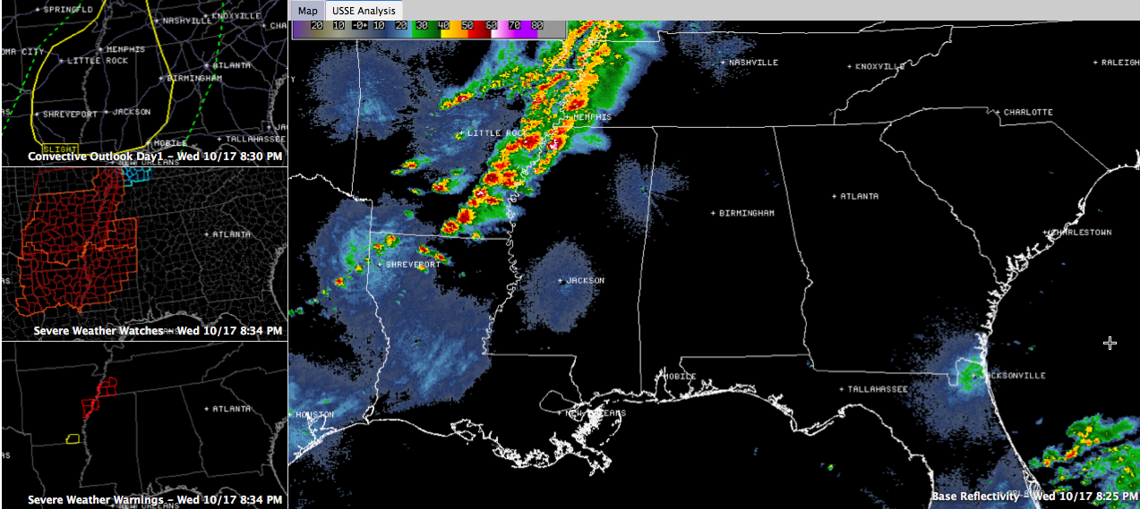
Click image to enlarge. Thunderstorms literally exploded this afternoon across Arkansas and several of them are severe at this hour for several counties in western Tennessee, Arkansas and northwestern Mississippi. A tornado crossed I-55 right now near Jehrico at 8:01. A tornado was reported to have touched down near the exit on I-55 there. This […]

Read More

Arkansas Tornado Warnings

Arkansas Tornado Warnings

| October 17, 2012 @ 7:00 pm

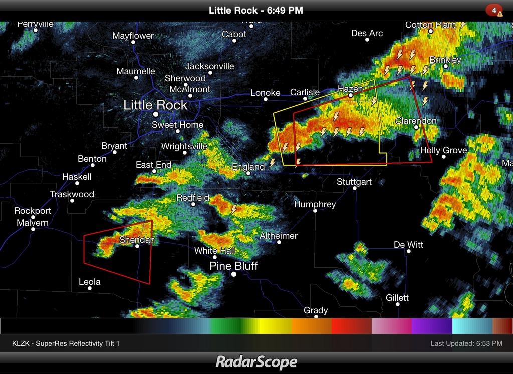
Two tornado warnings now for counties east and south of Little Rock. These storms will enter Northwest Alabama after 10:00 p.m. See the post below this one for the expected Alabama impact….

Read More

Severe Weather Threat For West Alabama Late Tonight

Severe Weather Threat For West Alabama Late Tonight

| October 17, 2012 @ 3:25 pm

An all new edition of the ABC 33/40 Weather Xtreme video is available in the player on the right sidebar of the blog. You can subscribe to the Weather Xtreme video on iTunes by clicking here. BEAUTIFUL AFTERNOON: Hard to believe are taking severe weather late tonight, as most of Alabama is bathed in bright […]

Read More

Storms Arrive Late Tonight

Storms Arrive Late Tonight

| October 17, 2012 @ 6:08 am

An all new edition of the ABC 33/40 Weather Xtreme video is available in the player on the right sidebar of the blog. You can subscribe to the Weather Xtreme video on iTunes by clicking here. CALM MORNING: All is quiet across Alabama this morning; the sky is fair and temperatures are generally in the […]

Read More