Alabama 811 | Know What's Below.

Archive for February 2nd, 2014

Heavy Rain and Gusty Winds at Times Tonight

Heavy Rain and Gusty Winds at Times Tonight

| February 2, 2014 @ 10:37 pm

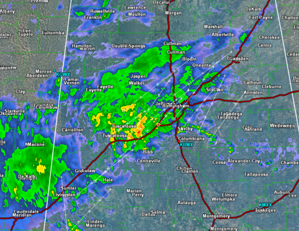
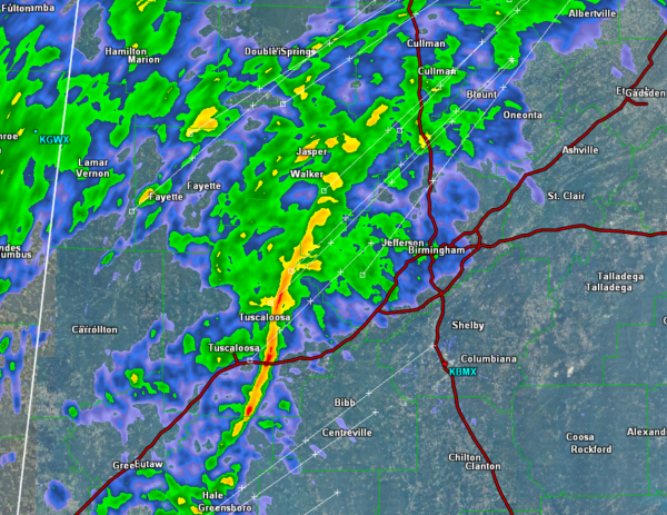
Some more intense showers and storms are moving from Tuscaloosa towards Birmingham. Gusty winds are the main threat with this line of convection. We are seeing some heavy rain accompany this line of convection as well. As this line passed through Tuscaloosa, winds increased to the upper 20s with higher gusts. Highest gust recorded at […]

Read More

Through the Overnight

Through the Overnight

| February 2, 2014 @ 10:18 pm

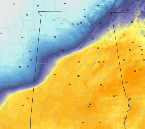
Cold front continues to sink towards the southeast across the state. The front is just to the north of Interstate 59 and is running parallel to it. Through the overnight, the cooler air will continue to settle into the state overnight. Currently we are seeing quite the range in temperatures across the state. The southern […]

Read More

A Very Wet Night Ahead

A Very Wet Night Ahead

| February 2, 2014 @ 8:17 pm

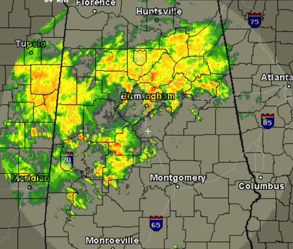
We have seen the showers and thunderstorms move into the Central Alabama throughout the evening hours. The rain will continue through the overnight hours and we are expecting a soaker of a night for all of Central Alabama. A majority of the rain has been along and north of the Interstate 20 corridor and that […]

Read More

Another Quick Look at the Radar

Another Quick Look at the Radar

| February 2, 2014 @ 5:46 pm

Many locations across Central Alabama are seeing the showers and storms increasing. Very heavy rain is falling with this activity and we are getting reports of gusty winds. All storms currently remain below severe limits. We are not expecting any organized or widespread severe weather tonight. All activity continues to move off to the northeast […]

Read More

Central Alabama Radar Check

Central Alabama Radar Check

| February 2, 2014 @ 4:26 pm

We are seeing showers and a few thunderstorms overspreading Central Alabama this afternoon. Heaviest rain is falling along the Intestate 20/59 corridor currently and is impacting areas from Tuscaloosa to Birmingham. We will continue to see the showers and storms lift towards the northeast the next few hours. With these showers and storms, we are […]

Read More

Showers and Storms Spreading East

Showers and Storms Spreading East

| February 2, 2014 @ 2:44 pm

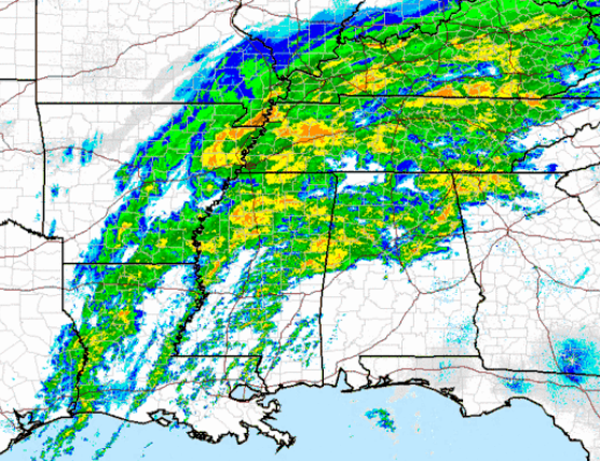
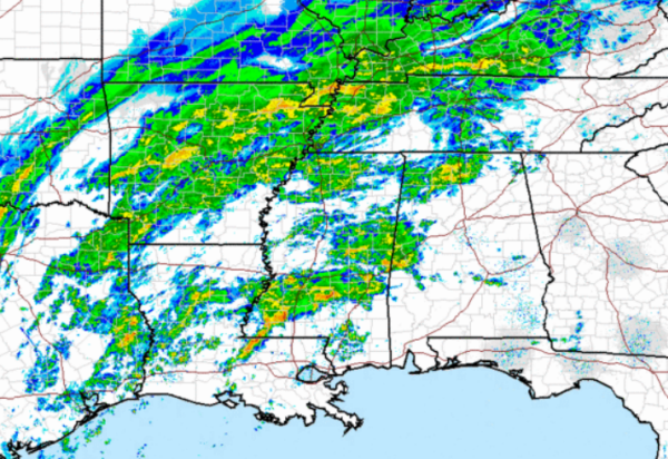
Many areas across the state remain dry, but we are beginning to see showers increasing across western portions of the state. The radar is filling into our west and we can expect that rain and some embedded thunderstorms to continue to shift east throughout the afternoon and into the evening. The SPC has issued a […]

Read More

Possible Rainfall Totals the Next Few Days

Possible Rainfall Totals the Next Few Days

| February 2, 2014 @ 12:10 pm

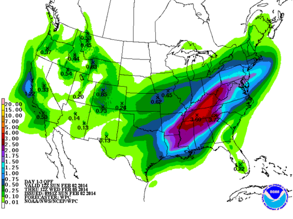
Much of the Southeast well have a couple of rounds of showers and thunderstorms to next few days. We have a very moist air mass in place as precipitable water values range 1.5 to 3 inches across the state. Looking at the QPF off the GFS model from this morning shows a very wet time […]

Read More

Severe Weather Risk to our West

Severe Weather Risk to our West

| February 2, 2014 @ 10:44 am

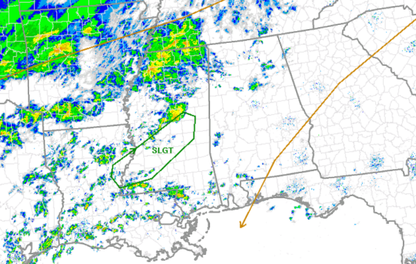
The SPC has issued their standard slight risk for severe weather just to the west of Alabama. Much of Central Mississippi has been included in the risk area outlined in green. The does include Interstates 20 & 55 as well as the city of Jackson. Cold front moving in from the northwest and southerly flow […]

Read More

Dense Fog and Rain

Dense Fog and Rain

| February 2, 2014 @ 8:08 am

An all new edition of the ABC 33/40 Weather Xtreme video is available in the player on the right sidebar of the blog. You can subscribe to the Weather Xtreme video on iTunes by clicking here. No shadows for groundhogs in Central Alabama as dense fog and clouds blanket a good portion of the Southeast […]

Read More