Central Alabama Radar Check
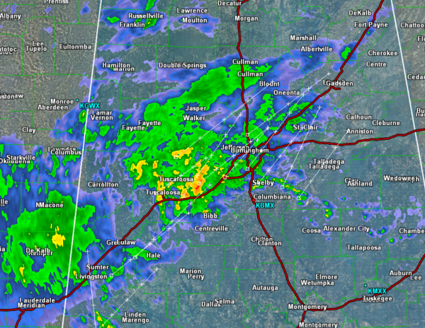
We are seeing showers and a few thunderstorms overspreading Central Alabama this afternoon. Heaviest rain is falling along the Intestate 20/59 corridor currently and is impacting areas from Tuscaloosa to Birmingham. We will continue to see the showers and storms lift towards the northeast the next few hours.
With these showers and storms, we are seeing some gusty winds and heavy rainfall. At this time, there are currently no severe storms anywhere, despite a warning over East-Central Mississippi earlier this afternoon. We could see some strong storms the next several hours, and there could be a very isolated chance for a severe storm. Most of the activity remains very unorganized this afternoon.
As we head through the evening hours, we are expecting more showers and storms to move into the state and all of Central Alabama will see a soaking rain during the overnight hours.
Category: Alabama's Weather
About the Author (Author Profile)
Macon, Georgia Television Chief Meteorologist, Birmingham native, and long time Contributor on AlabamaWX. Stormchaser. I did not choose Weather, it chose Me. College Football Fanatic. @Ryan_StinnetSubscribe
If you enjoyed this article, subscribe to receive more just like it.


