Alabama 811 | Know What's Below.

Archive for February 16th, 2015

Icy Travel Likely

Icy Travel Likely

| February 16, 2015 @ 9:52 pm

Here is the text of a “civil emergency message” issued by the NWS Birmingham and the state of Alabama EMA: BULLETIN – EAS ACTIVATION REQUESTED CIVIL EMERGENCY MESSAGE ALABAMA EMERGENCY MANAGEMENT AGENCY CLANTON ALABAMA RELAYED BY NATIONAL WEATHER SERVICE BIRMINGHAM AL 948 PM CST MON FEB 16 2015 THE FOLLOWING MESSAGE IS TRANSMITTED AT THE […]

Read More

Hazardous Road Conditions Expected Overnight

Hazardous Road Conditions Expected Overnight

| February 16, 2015 @ 9:50 pm

Many school systems are delaying their start times for Tuesday morning, which is a very good idea given the rapid drops in temperature tonight quickly following on the heels of the heavy rains this evening. The actions of the school systems should remind all Central Alabama businesses, organizations and individuals to take stock of the […]

Read More

Colder Air Moving Into West Alabama

Colder Air Moving Into West Alabama

| February 16, 2015 @ 6:45 pm

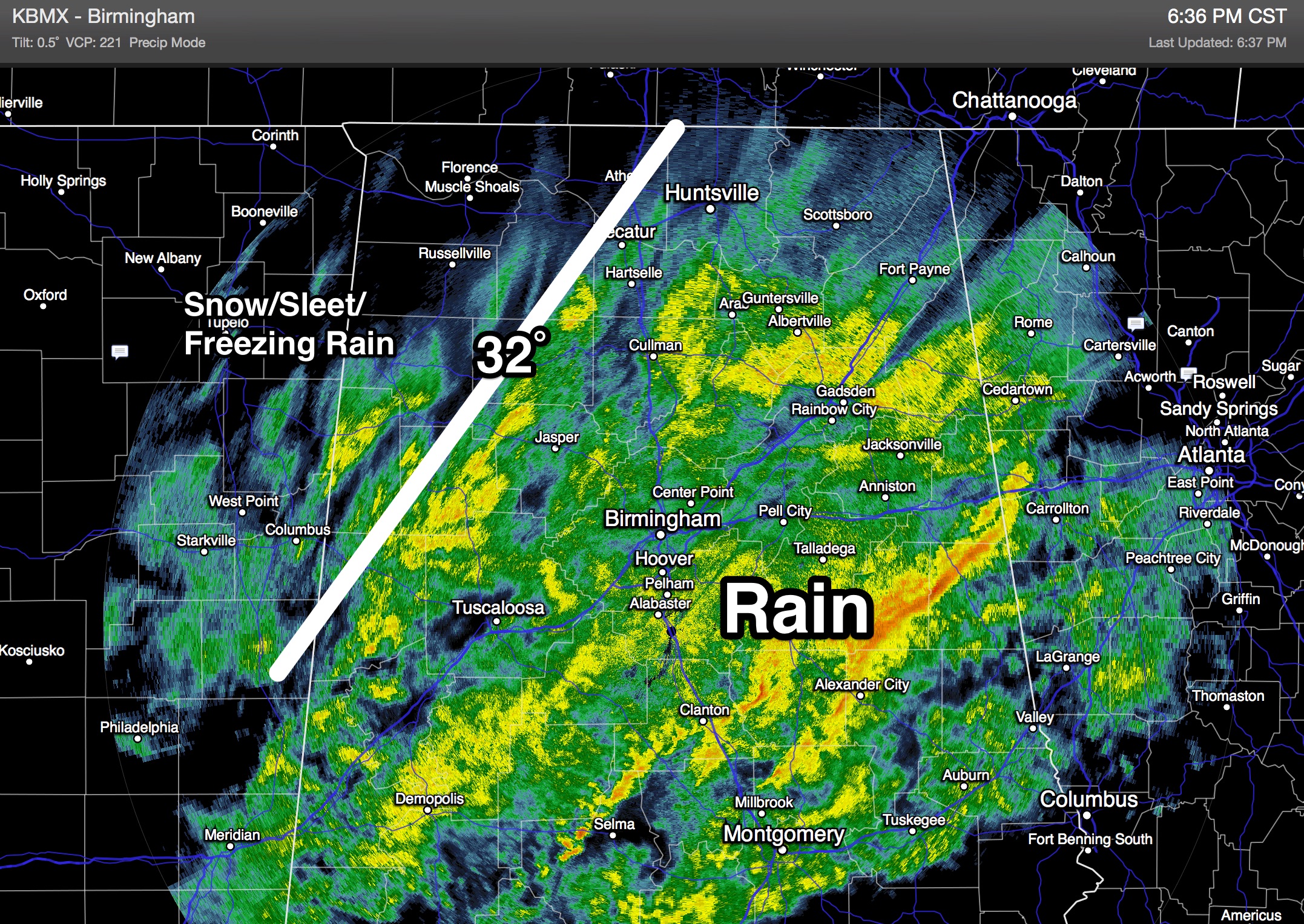
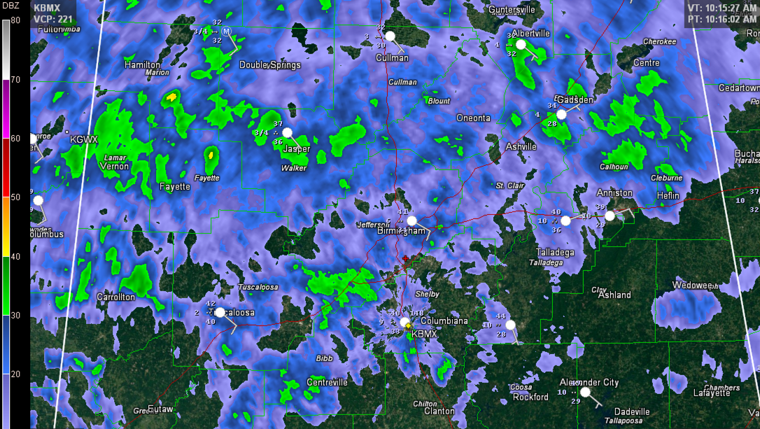
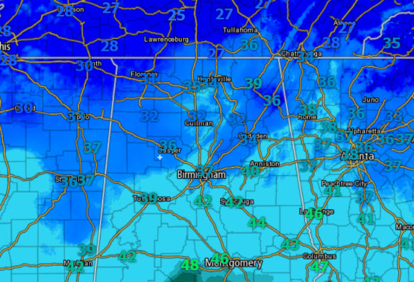
Temperatures are falling into the sub-freezing rain over parts of far West and Northwest Alabama… The freeze line will move steadily to the southeast during the next few hours. The temperature will be below freezing at Tuscaloosa and Gadsden by 9 p.m… Birmingham by 10 p.m… and Anniston by 10-11 p.m. Before the rain ends […]

Read More

Patchy Ice Tonight/Early Tomorrow

Patchy Ice Tonight/Early Tomorrow

| February 16, 2015 @ 3:28 pm

An all new edition of the ABC 33/40 Weather Xtreme video is available in the player on the right sidebar of the blog. You can subscribe to the Weather Xtreme video on iTunes by clicking here. RADAR CHECK: Widespread rain is falling across North and Central Alabama this afternoon; a few strong storms are even […]

Read More

Forecast Verification

Forecast Verification

| February 16, 2015 @ 2:23 pm

A look back at the forecast for today, since it has brought out a number of Facebook trolls. LAST FRIDAY: This is the forecast I produced Friday morning, 72 hours before this morning’s event… While this was not correct, note we never forecast a snow event for Birmingham, Tuscaloosa, Anniston, and Gadsden. Looked like it […]

Read More

Quick Check of 12Z Model Runs…For Friday

Quick Check of 12Z Model Runs…For Friday

| February 16, 2015 @ 2:23 pm

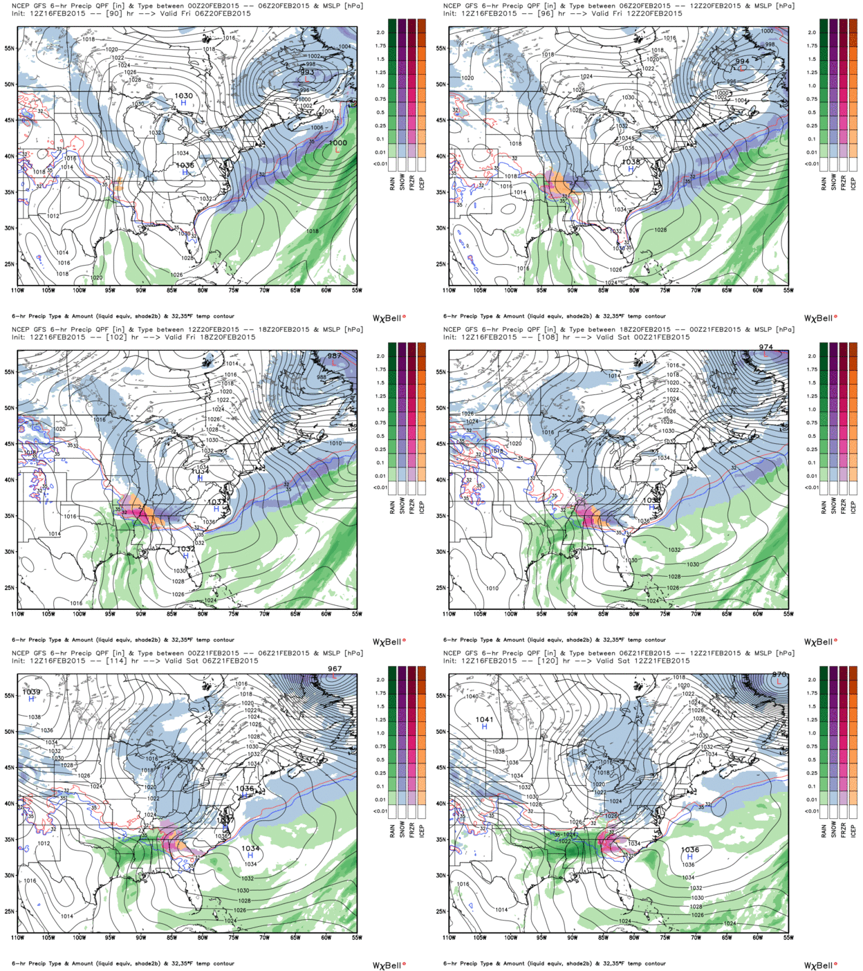
Here is an animation of what the GFS run from this morning is saying about Friday’s potential winter storm. The European is warmer and less bullish on the idea of any freezing or frozen precip. The solid blue line is the critical 540 thickness line which is the usual rain/snow dividing line. As you can […]

Read More

Concerning Tonight

Concerning Tonight

| February 16, 2015 @ 12:13 pm

This post is primarily concerned with the weather tonight across North and Central Alabama. First I should mention we have many reports of ice on exposed objects over counties like Blount and St. Clair… This is ice accumulation in Springville… Photo from Steven Skinner… The good news is that roads are just wet; we have […]

Read More

Late Morning Update

Late Morning Update

| February 16, 2015 @ 10:23 am

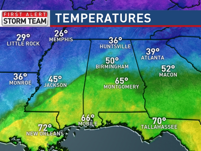
Everything is unfolding sort of as planned in our morning forecast with widespread light to occasionally moderate rain spreading across North and Central Alabama. The only real difference is that the rain is arriving a bit before I thought it would this morning. The good news is that temperatures are behaving with readings in the […]

Read More

Mid-Morning Update

Mid-Morning Update

| February 16, 2015 @ 9:19 am

The rain continues to overspread the state this morning and for the next several hours we will see a cold rain persist. Looking at the regional radar, there is a lot of precip spreading east across the Mississippi Valley and we are in for a rather day across the state. The rain will last through […]

Read More

Messy Monday; Then Much Colder

Messy Monday; Then Much Colder

| February 16, 2015 @ 6:40 am

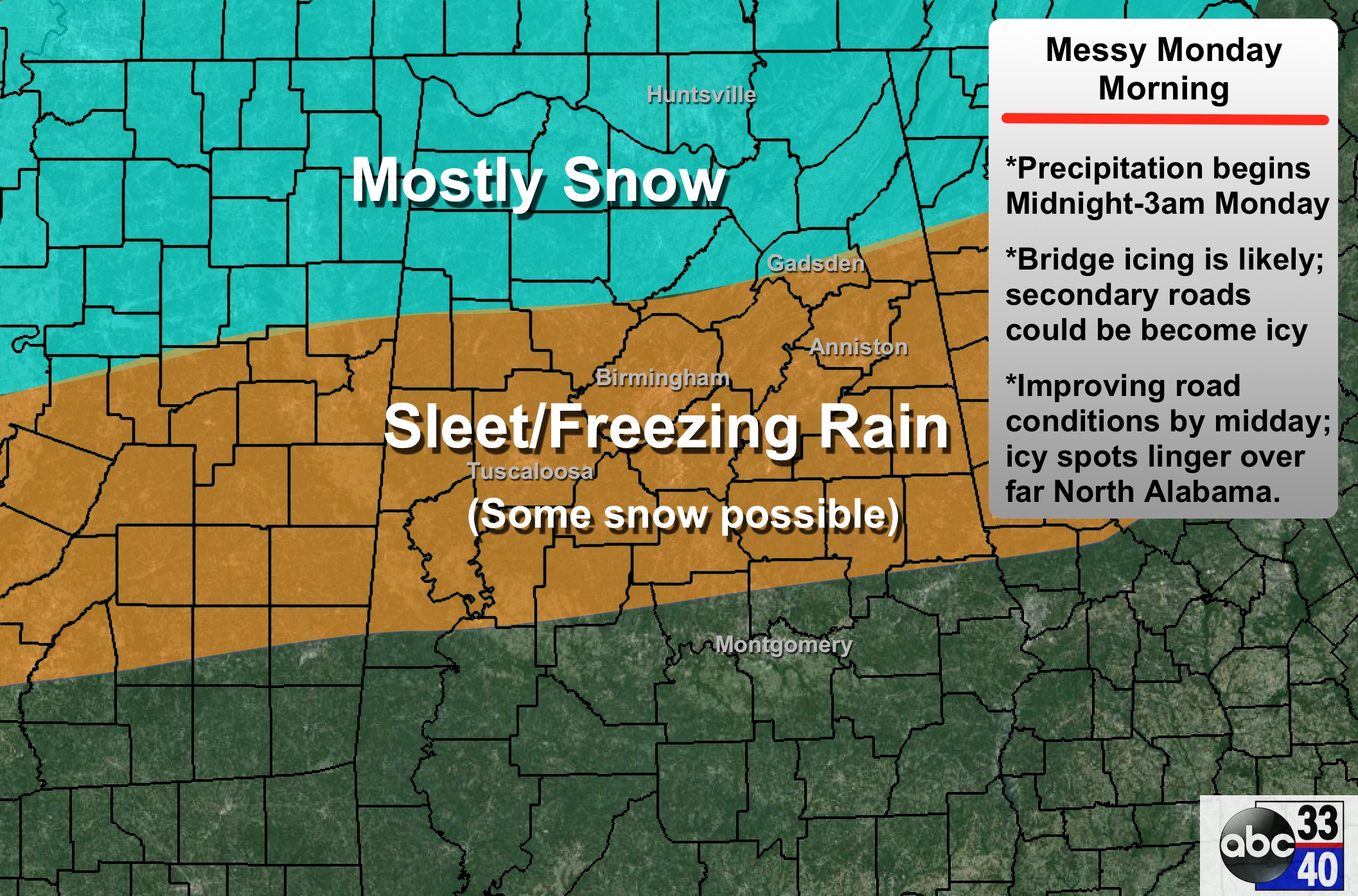
An all new edition of the ABC 33/40 Weather Xtreme video is available in the player on the right sidebar of the blog. You can subscribe to the Weather Xtreme video on iTunes by clicking here. CHALLENGING FORECAST: I posted this on Twitter last week, and I will post it again this week. The forecast […]

Read More

Early Monday Morning Update

Early Monday Morning Update

| February 16, 2015 @ 5:03 am

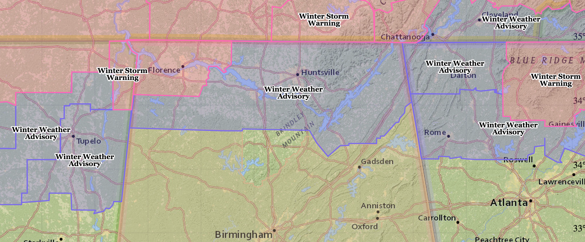
The NWS Huntsville has issued a winter storm warning for Colbert and Lauderdale Counties (including Florence and Muscle Shoals), where higher ice accumulation is likely due to freezing rain. A winter weather advisory remains in effect for the rest of the Tennessee Valley… TEMPERATURES: They have slowly been warming since midnight, but they are still […]

Read More

Late Night Check

Late Night Check

| February 16, 2015 @ 2:47 am

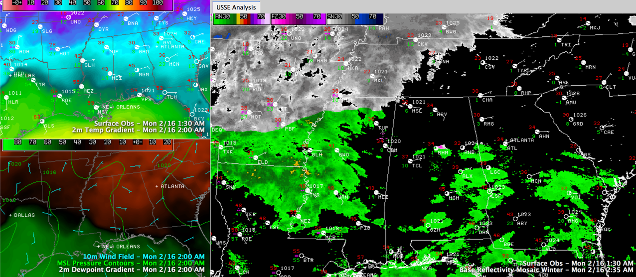
Things are calm across Alabama at this late hour as we continue to watch developments to the west of us. Across Central Alabama right now, we see 33F at Birmingham and Anniston with 38F at Tuscaloosa. It was 30F at Gadsden. Skies are cloudy with variable winds at Birmingham, northeasterly winds at Anniston continuing to […]

Read More