Alabama 811 | Know What's Below.

Archive for February 24th, 2015

Snow Update For Alabama Tomorrow

Snow Update For Alabama Tomorrow

| February 24, 2015 @ 8:55 pm

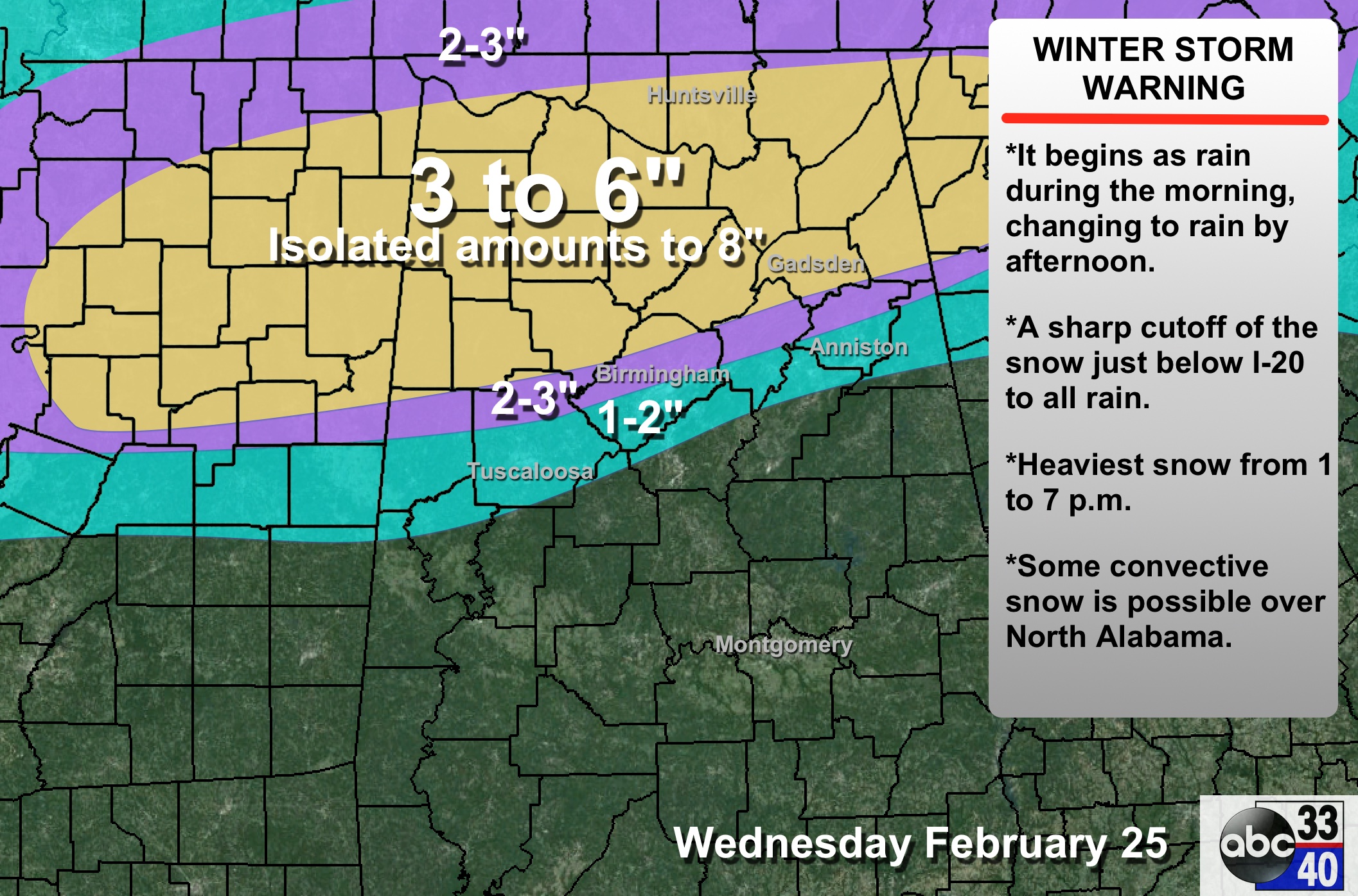
New data is rolling into the office tonight. A few notes… *We have forecast this, but we want to stress it looks like the precipitation will begin for many in the form of rain tomorrow morning, with a quick change over to snow where thermal profiles are cold enough tomorrow afternoon. *The window for the […]

Read More

Evening Update

Evening Update

| February 24, 2015 @ 5:44 pm

A winter storm warning remains in effect for much of North Alabama tomorrow. The warning is from Aliceville, Tuscaloosa, Brent, Calera, Sylacauga, Ashland, Roanoke, and points north. To the south, tomorrow will be just a cold, rainy day. Our forecast…. TIMING: The HRRR model suggests rain or snow could move into far West Alabama as […]

Read More

A Message From Alabama Power

A Message From Alabama Power

| February 24, 2015 @ 4:30 pm

The following useful preparedness content is provided by our friends at Alabama Power. Their generous sponsorship helps make AlabamaWX’s content possible. From Ike Pigott, Alabama Power Weather forecasts are a tricky business, and winter weather can be some of the most difficult to predict. A thunderstorm forecast might be off by 30 miles and no […]

Read More

Some February Snow Notes

Some February Snow Notes

| February 24, 2015 @ 3:37 pm

Okay, I just had to do it. So the forecast is calling for a snow event in Central Alabama. So, using National Weather Service (NWS) data for the Birmingham Shuttlesworth International Airport, just how much has it snowed in Februarys past? The answer to that is that since 1900, there have been only nine (9) […]

Read More

Winter Storm Warning

Winter Storm Warning

| February 24, 2015 @ 2:25 pm

**No afternoon Weather Xtreme video today; having to spend most of my time dealing with TV!** WINTER STORM WARNING: NWS offices in Birmingham and Huntsville have issued winter storm warnings for much of North and down into Central Alabama. Winter storm warnings are up for Birmingham, Anniston, Gadsden, and Tuscaloosa. We should note a winter […]

Read More

Some Weather Notes

Some Weather Notes

| February 24, 2015 @ 2:17 pm

There is a tremendous amount of energy being expended today as weather forecasters all across the Southeast US are working diligently to provide everyone with the best possible forecast on what we can expect from the impending winter storm. I’ve been spending a good deal of time this morning and early afternoon looking over the […]

Read More

The BIG Picture

The BIG Picture

| February 24, 2015 @ 1:57 pm

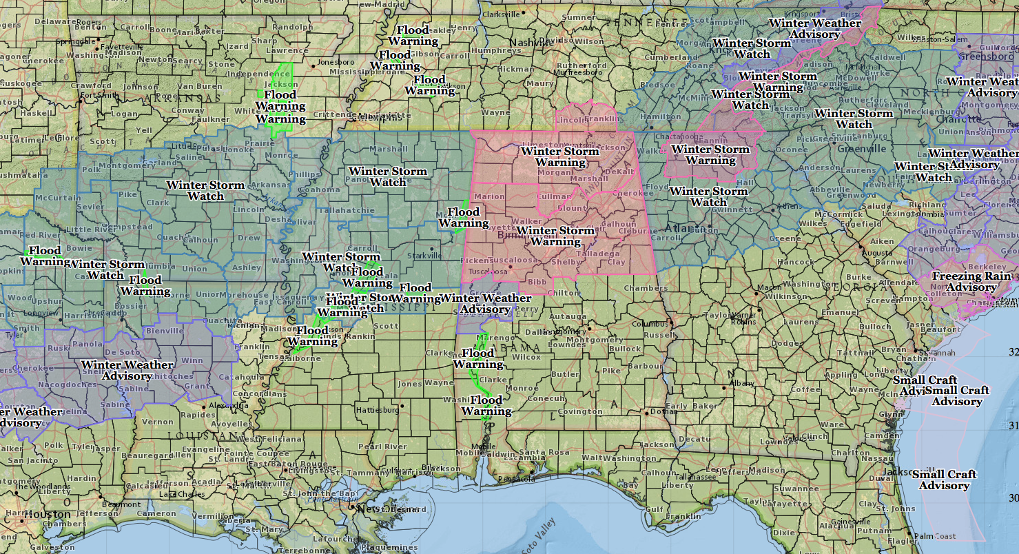
Here is a map of the current warnings, watches, and advisories currently in effect just before 2 pm. There will be changes to this as additional offices upgrade from winter storm watches to winter storm warnings or winter weather advisories. But this gives you the bigger picture. More to come, I’m sure. ALABAMA POWER IS […]

Read More

Mid-Afternoon Update

Mid-Afternoon Update

| February 24, 2015 @ 1:56 pm

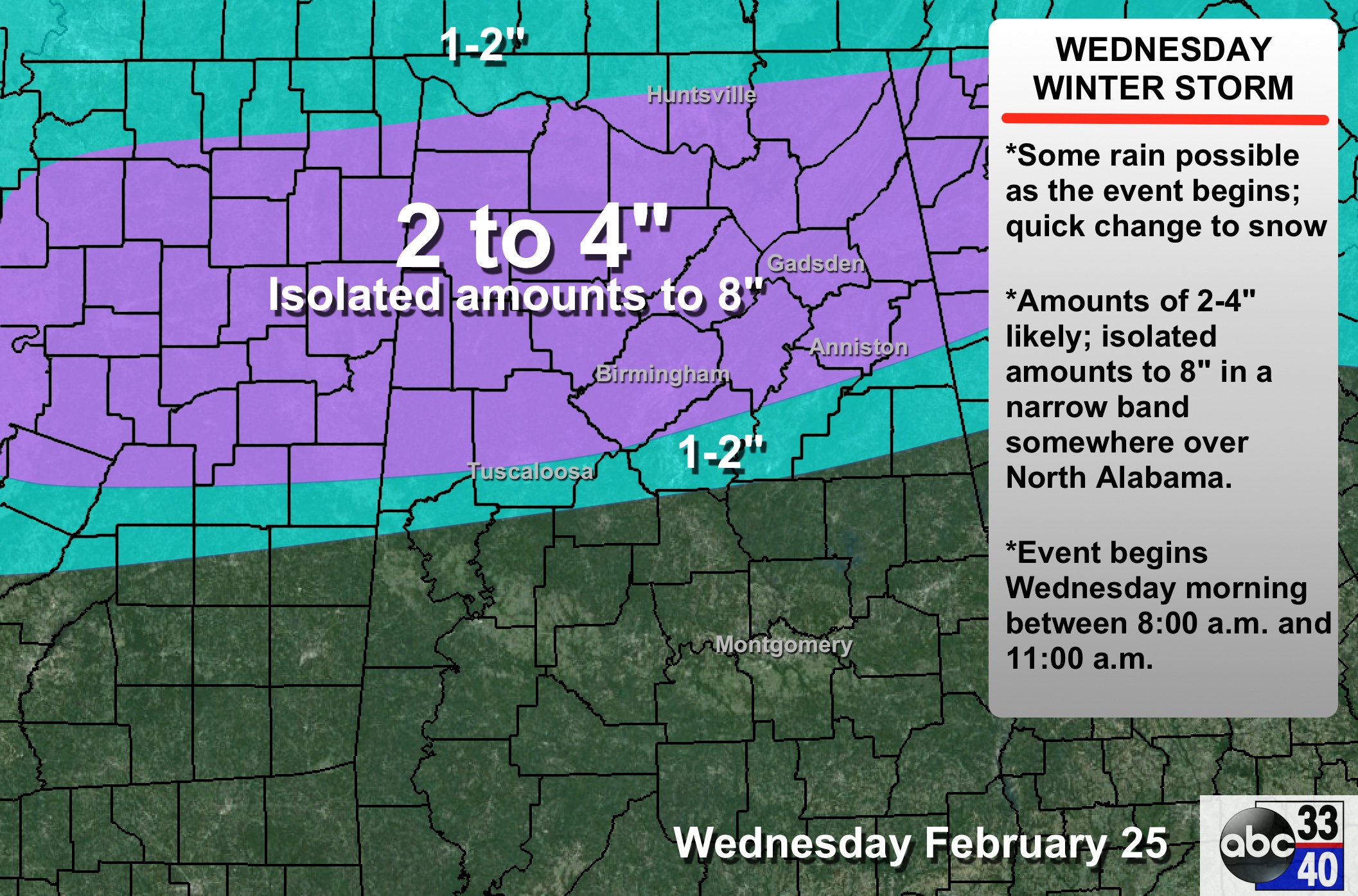
As you can see from Brian’s post below, the NWS Birmingham has issued a winter storm warning for cities like Birmingham, Tuscaloosa, Anniston, and Gadsden. And, below is our more detailed accumulation projection for tomorrow… Scroll down for posts with timing and impact details. A new discussion will be up shortly. ALABAMA POWER IS READY, […]

Read More

Winter Storm Warning 2

Winter Storm Warning 2

| February 24, 2015 @ 1:46 pm

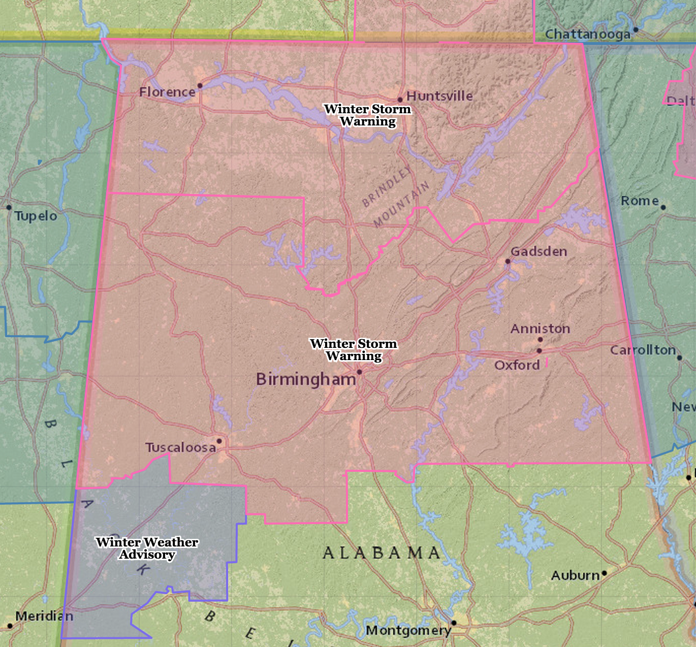
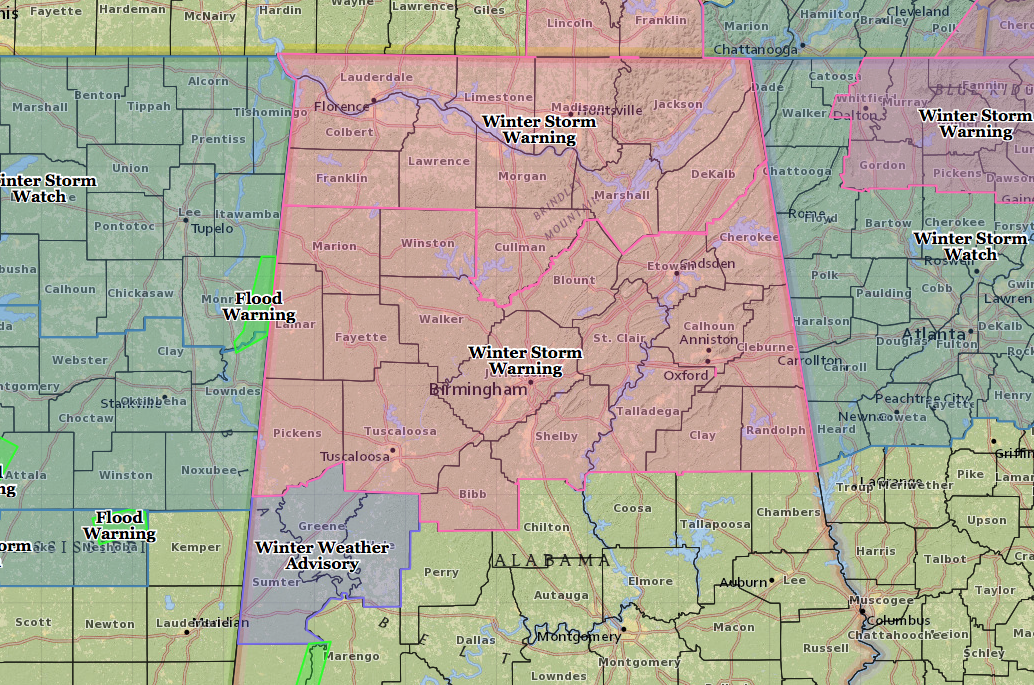
Well, it didn’t take long for a change to come along. Here is the map of Central Alabama which has been updated for the winter storm warning upgrade from the National Weather Service in Birmingham. The text of the warning is shown below. -Brian- WWUS44 KBMX 241942 WSWBMX URGENT – WINTER WEATHER MESSAGE NATIONAL WEATHER […]

Read More

Winter Storm Warning

Winter Storm Warning

| February 24, 2015 @ 1:26 pm

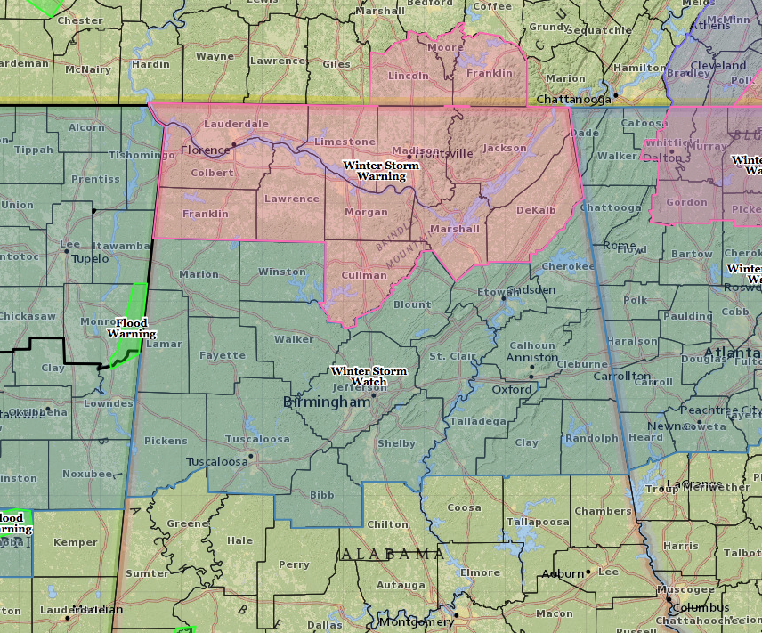
The National Weather Service in Huntsville, AL, has upgraded their winter storm watch to a warning. Here’s the latest map showing the winter storm watch for Central Alabama and the winter storm warning for the Tennessee Valley counties. And here’s the text of the warning from Huntsville. Additional changes are likely to be coming out, […]

Read More

Model Comps

Model Comps

| February 24, 2015 @ 12:52 pm

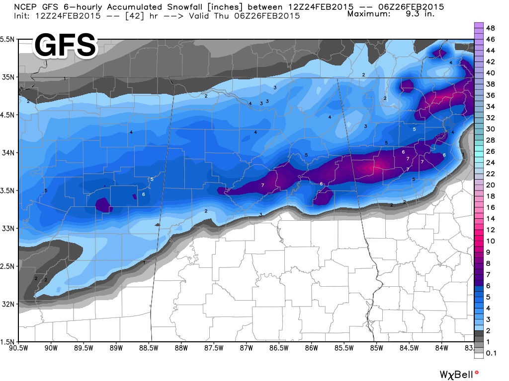
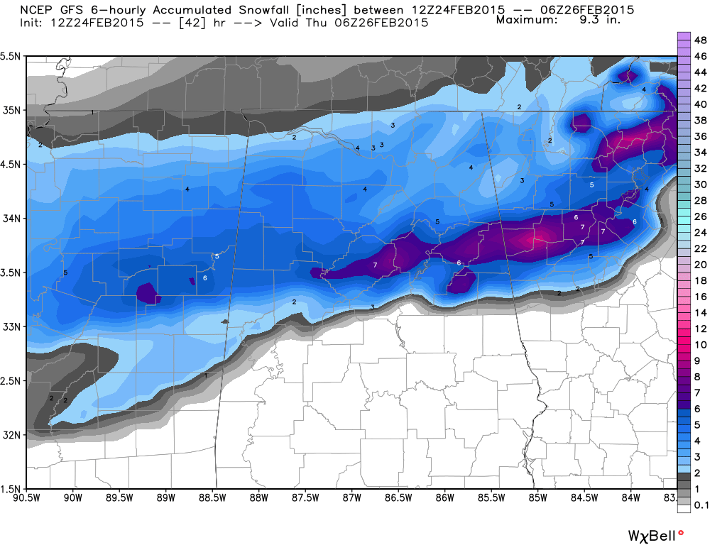
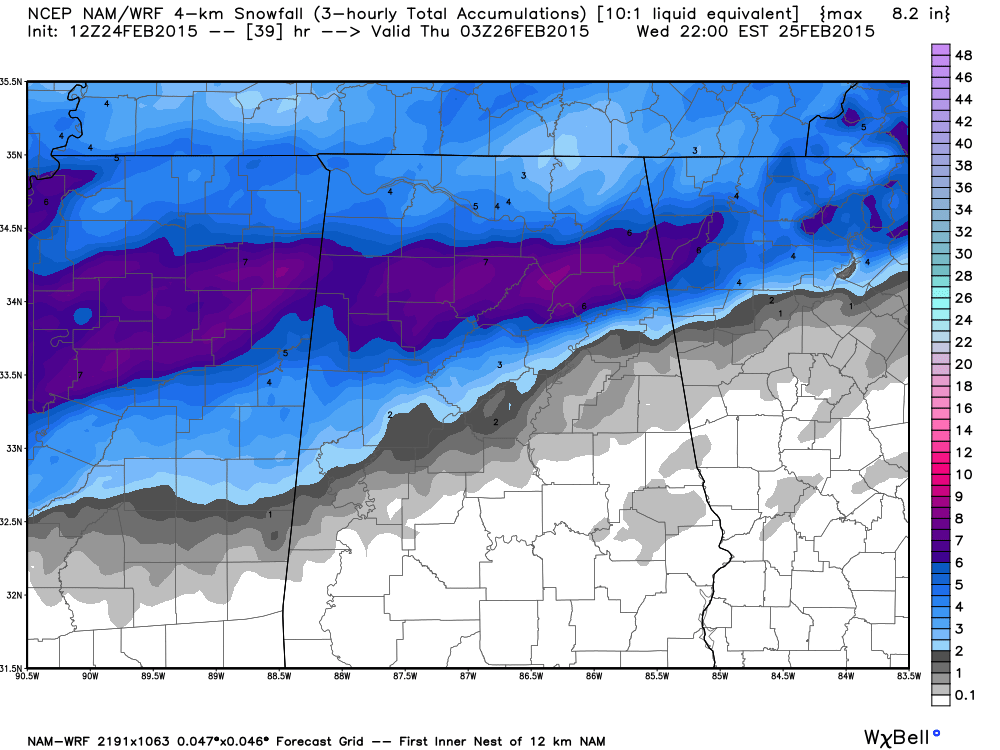
There is actually very good agreement in NWP forecasts concerning the snow event in Alabama tomorrow. Here is a look at them (the 12Z runs)… And, our public forecast is below. YES… this can and will change. Most challenging parts of the forecast are the boundary between rain and snow, and the placement of the […]

Read More

Midday Look

Midday Look

| February 24, 2015 @ 12:00 pm

After a review of the 12Z model data set, here is our public forecast for the event tomorrow. The 75th percentile snow potential forecast from the Weather Prediction Center (a branch of the NWS), is a bit more aggressive… The 75th percentile output has verified nicely in recent weather events, but that is just guidance. […]

Read More

Late Morning Update

Late Morning Update

| February 24, 2015 @ 9:58 am

The 12Z run of the GFS model is in…. I think the 7″ number printed at Birmingham is too aggressive, but not impossible. Someone will probably see 8″ on the high end in a few places, but the strip of heavier snow, most likely will be north of Birmingham. But understand nobody knows at this […]

Read More

Mid Morning Update

Mid Morning Update

| February 24, 2015 @ 8:51 am

New model data is coming in this morning; it will all be evaluated and a winter storm warning will be needed for much of North, and parts of Central Alabama later today concerning the event tomorrow. Here is the new run (12Z) of the NAM model… showing the axis of heavier snow generally between I-20 […]

Read More