Alabama 811 | Know What's Below.

Archive for July 1st, 2015

James Spann App Update

James Spann App Update

| July 1, 2015 @ 9:22 pm

Again, I apologize to all of you who have not been able to access weather data from the James Spann 24/7 app over the past 48 hours. Here is the situation…. *Unfortunately, the James Spann 24/7 app is going away. Functionality will not return. *The developer was sold, and they opted not to support the […]

Read More

Strong Storms Affecting SE Walker, Northern Jefferson

Strong Storms Affecting SE Walker, Northern Jefferson

| July 1, 2015 @ 4:59 pm

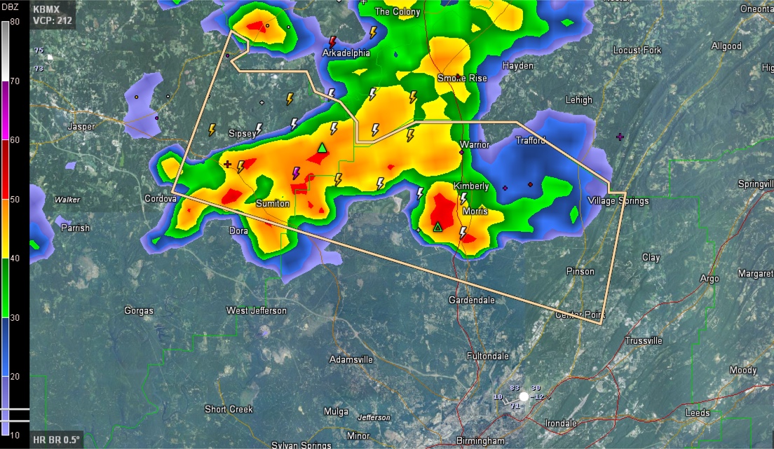
The NWS has issued a Significant Weather Alert for southeastern Walker and northern Jefferson Counties. Strong storms from Dora and Sumiton over to Morris and Kimberly will push east southeast, affecting Pinson, Gardendale and Center Point. Heavy rain, frequent lightning and gusty winds will accompany the storm. They do not show signs of becoming severe […]

Read More

Severe Thunderstorm Warning for Calhoun County

Severe Thunderstorm Warning for Calhoun County

| July 1, 2015 @ 3:34 pm

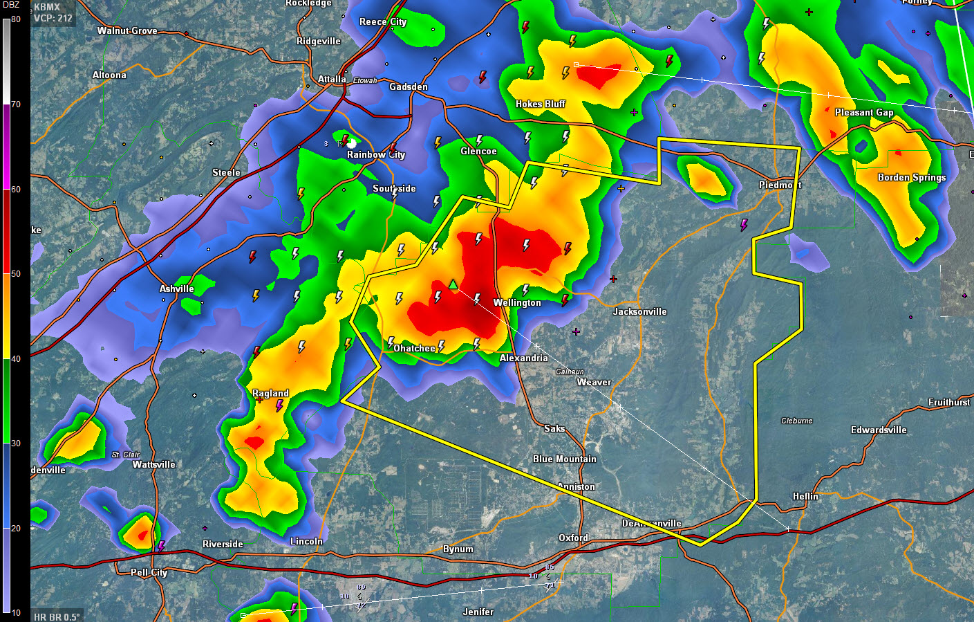
Strong thunderstorms moving from Etowah County into Calhoun County have intensified and are now considered to be severe. They extend from Hokes Bluff to Ohatchee to Ragland. Areas in the path include Piedmont, Wellington, Jacksonville, Weaver and northern parts of Anniston. Damaging winds are the primary threat, but frequent lightning, torrential rains and some hail […]

Read More

Strong Storms Over North Alabama

Strong Storms Over North Alabama

| July 1, 2015 @ 3:30 pm

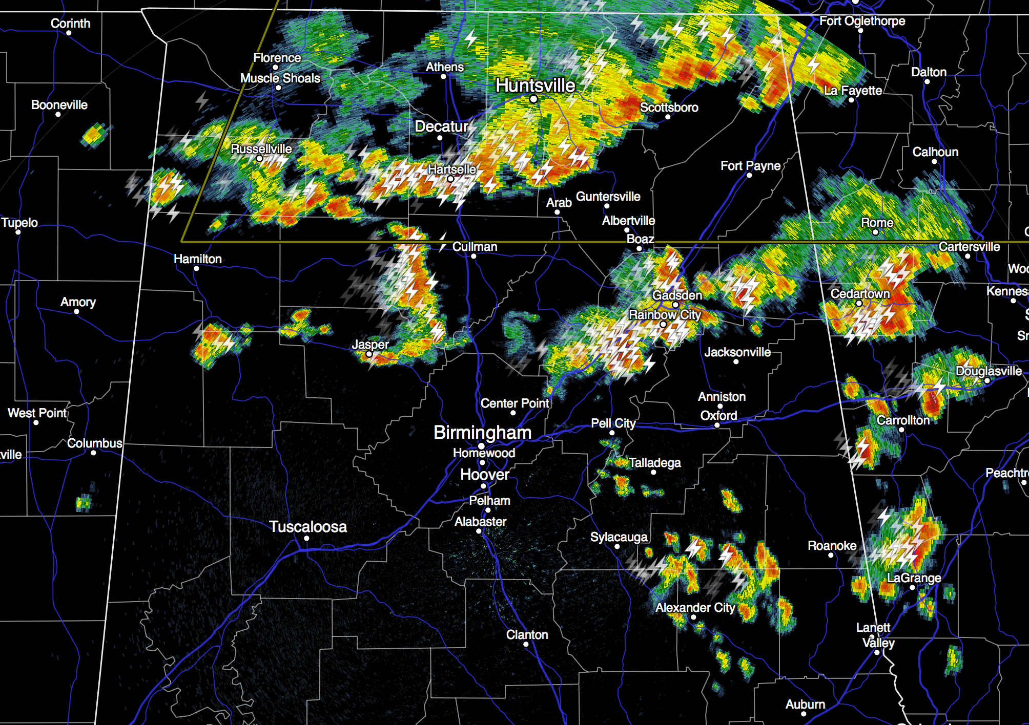
RADAR CHECK: Strong storms with frequent lightning, and winds gusting to 45 mph continue to move eastward through North/Central Alabama this afternoon… Storms will settle down late tonight. TOMORROW THROUGH THE HOLIDAY WEEKEND: The overall weather pattern won’t change much. Intervals of sunshine each day, and the risk of a few passing showers or storms […]

Read More

Thunderstorms Continuing Throughout North-Central Alabama

Thunderstorms Continuing Throughout North-Central Alabama

| July 1, 2015 @ 2:27 pm

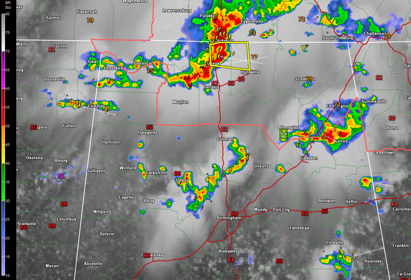
This just in at 2:40 of storm clouds moving into Limestone County by Blake Williams: ORIGINAL POST: Showers and thunderstorms continue forming over North-Central Alabama this afternoon. Storms are also affecting Southern Walker County and Cullman Counties, moving eastward toward Blount and northern Jefferson County. A Significant Weather Alert has been issued for Blount County. […]

Read More

Severe Thunderstorm Watch Includes North Alabama & North Georgia

Severe Thunderstorm Watch Includes North Alabama & North Georgia

| July 1, 2015 @ 12:17 pm

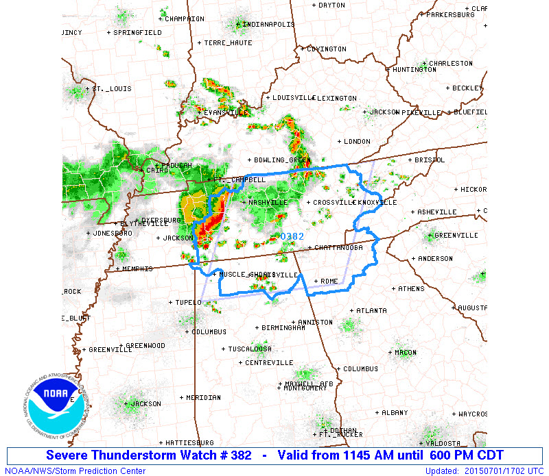
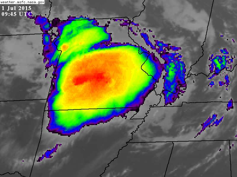
The National Weather Service has issued a Severe Thunderstorm Watch in effect until 6:00 p.m. for portions of Northern Alabama, Northern Georgia, extreme Western North Carolina and Middle/East Tennessee. This Severe Thunderstorm Watch includes the following counties in Alabama: Dekalb, Lawrence, Marshall, Jackson, Limestone, Morgan, Lauderdale, and Madison. Thunderstorms over Tennessee associated with an upper […]

Read More

App Issues

App Issues

| July 1, 2015 @ 8:52 am

Most all of you have noticed by now the “James Spann 24/7” app is not functioning. The issue started early yesterday, and there has been no resolution as of this morning. It seems as though the company that developed the app for us has been sold, and they have decided “not to support” it anymore. […]

Read More

Summer Mix Of Sun And Storms

Summer Mix Of Sun And Storms

| July 1, 2015 @ 6:33 am

EARLY THIS MORNING: Unlike yesterday morning, the radar is quiet across North/Central Alabama at daybreak with temperatures are mostly in the low 70s. We have the same upper air configuration across the nation; a hot ridge over the western states, and a deep upper trough over the east. Winds aloft over Alabama are from the […]

Read More