

Improving Weather Today
THIS MORNING: A cold front is passing through Central Alabama early this morning in dry fashion; behind the front some places across North Alabama are in the 50s, but we have 60s south and east of the front. Early morning clouds will give way to a sunny sky today, and the high will be in the mid 60s for most communities.
Tomorrow will be delightful, with ample sunshine and a high around 70 degrees. And, a decent part of the day Wednesday should be dry, although clouds will gradually increase, and we reach the low to mid 70s Wednesday afternoon.
STRONG STORMS/HEAVY RAIN LATER THIS WEEK: A deep surface low will move through the Upper Midwest and the Great Lakes, dragging a cold front in our direction… that will set the stage for active weather Wednesday night and Thursday.
SPC has the southern two-thirds of the state in a severe weather risk on Thursday (Day 4)…
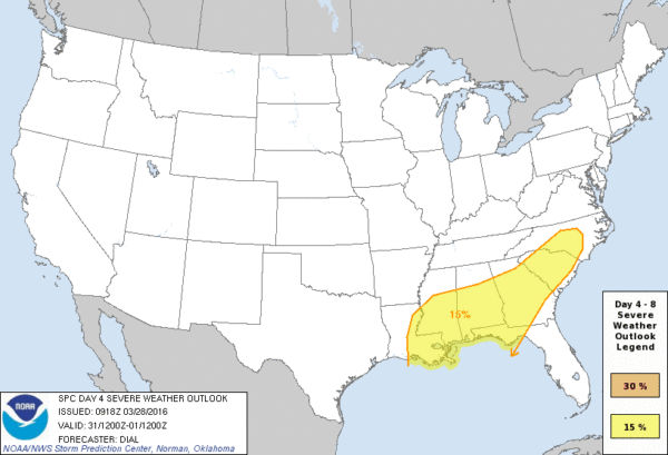
Quite frankly at this stage being really specific with the severe weather threat is a challenge; widespread rain, with some thunderstorms, is likely Wednesday night into the day Thursday, and this could severely limit instability values and mitigating the severe weather risk. But, if breaks in the rain develop and instability values are higher than forecast, we could very well see a severe weather issue. And, projected shear values suggest a tornado or two will certainly be possible.
For now it looks like the prime risk of severe storms, if the conditions allow, will come from late morning through the afternoon Thursday. We will have a much better handle on this risk by tonight and tomorrow.
FLOODING? No doubt this system will bring lots of rain to our state; amounts of 2-3 inches look likely Wednesday night and Thursday, and some flash flooding issues could very well develop.
FRIDAY: Clearing, breezy, and colder is the forecast; many North Alabama communities won’t get out of the 50s with a cool north breeze.
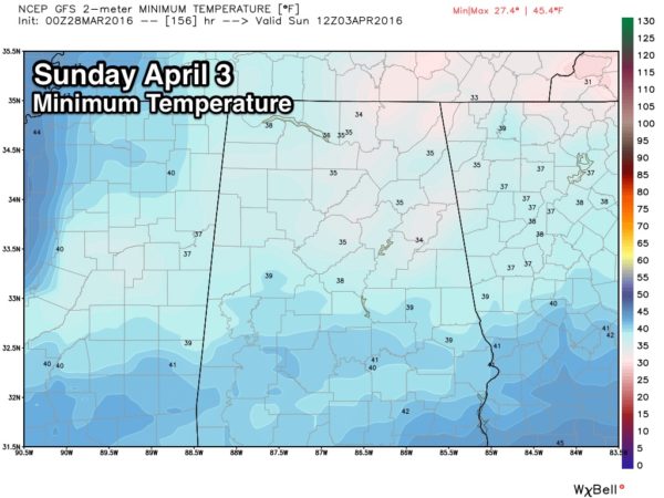
THE ALABAMA WEEKEND: We expect a sunny sky Saturday and Sunday, but mornings will be cold for early April. Lows in the upper 30s are possible at daybreak Saturday, but Sunday morning could be colder. With a clear sky and light wind, some frost is certainly possible Sunday morning, with potential for a light freeze for the colder valleys and protected areas.
The high Saturday will be in the low 60s, followed by upper 60s Sunday.
NEXT WEEK: Dry weather continues for the first half of the week with warmer afternoons… see the Weather Xtreme video for maps, graphics, and more details.
AT THE BEACH: Mostly sunny weather on the Gulf Coast today and tomorrow, but rain and storms return Wednesday night and Thursday. Then, Friday and the upcoming weekend look dry with a good supply of sunshine each day. Highs mostly in the 70s, with 60s on the immediate coast due to the cool ocean water (the sea water temperature early this morning at the Dauphin Island Sea Lab is 66 degrees). See a very detailed Gulf Coast forecast here.
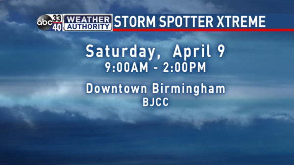
STORM SPOTTER TRAINING: Storm Spotter Xtreme is coming up Saturday, April 9 at the BJCC from 9am to 2pm. This will feature both the basic and advanced SKYWARN classes, along with a session from Kevin Laws of the Birmingham NWS office. And, if you come, you get free admission to the Alabama International Auto Show, going on at the BJCC that same day. There is no cost and no need to register. Just show up with a curious mind. Kids 10 and older will also enjoy this if they love weather and want to learn more. Please help us make the severe weather warning process better!
WEATHER BRAINS: Don’t forget you can listen to our weekly 90 minute netcast anytime on the web, or on iTunes. This is the show all about weather featuring many familiar voices, including our meteorologists here at ABC 33/40. We will produce this week’s show tonight at 8:30 CT… you can watch it live here.
CONNECT: You can find me on all of the major social networks…
Facebook
Twitter
Google Plus
Instagram
I will be doing a program this morning at the Pinson Public Library… look for the next Weather Xtreme video here by 4:00 this afternoon. Enjoy the day!
Category: Alabama's Weather
About the Author (Author Profile)
James Spann is one of the most recognized and trusted television meteorologists in the industry. He holds the AMS CCM designation and television seals from the AMS and NWA. He is a past winner of the Broadcast Meteorologist of the Year from both professional organizations.Subscribe
If you enjoyed this article, subscribe to receive more just like it.


