

Warming Trend Setting In
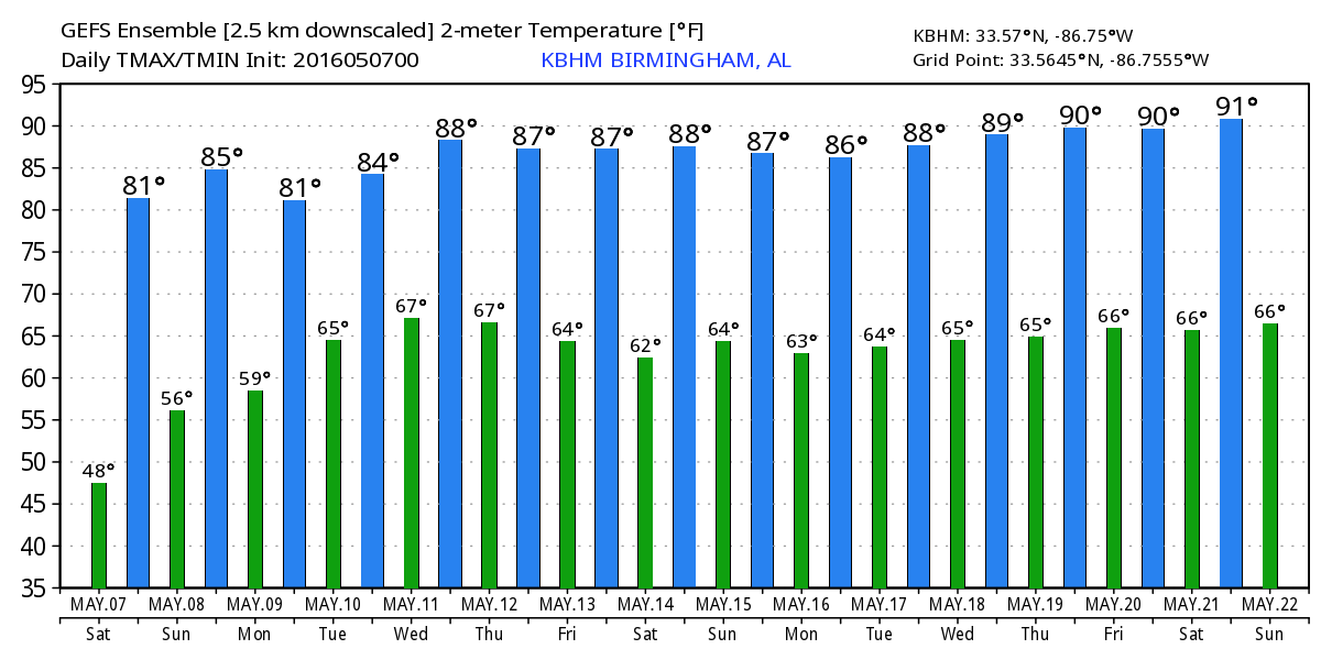
Another cool morning across the Southeast US, and probably the last cool morning for at least a while. Our morning lows average around 57 for early May, but most of Central Alabama saw lows about 10 degrees below those averages. A warming trend begins today with highs climbing to near 80 today and into the 80s for much of the week ahead while lows will warm into the 60s.
Good weather continues for the weekend as we remain dry under a surface high pressure system along with an upper ridge aloft. That upper ridge will slowly migrate east warming up the eastern half of the country. It is this same upper ridge that brought very warm temperatures all the way to Minnesota yesterday where Two Harbors set a record with 93 degrees and Minneapolis-St. Paul broke the old record of 89 with a high of 90. Two Harbors tied McAllen, Texas, for the Nation’s warmest reading yesterday.
At the beach, gorgeous weather will continue along the beaches of Alabama and Northwest Florida through the weekend. You can expect lots of sunshine along with afternoon highs mainly in 70s with a few 80s possible just inland. The water temperature was running in the upper 70s and lower 80s at various locations from Dauphin Island east to Panama City. You can find the complete Gulf Coast 7 Day Planner here.
The Regions Traditions Golf Tournament returns to beautiful Greystone Golf and Country Club May 18-22. Way too early for event specific forecast, but today’s long range model data output suggest that weekend will be warm with a scattered showers and storms possible. Of course, this may change as we get closer to the event. Click here for Regions Traditions Tickets.
The upper ridge will keep the start of the week warm and dry, but that changes for Tuesday as the ridge gets beaten down by a trough coming out of the Rockies. It is this trough coming out of the Rockies on Sunday and Monday that will set the stage for severe weather in the Central US. SPC has an enhanced risk for severe weather on Sunday from about San Angelo, TX, northward across Oklahoma, KS, and into Central Nebraska. The severe weather risk shifts slightly southeastward on Day 3, Monday, into Arkansas, Missouri, eastern Oklahoma, and Northeast Texas.
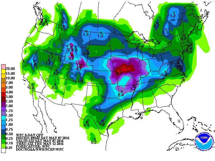
For us in Alabama and the Southeast US, moisture will increase Tuesday and Wednesday under strong southerly flow. This means the introduction of showers for these days.
With the traveling weather systems well to our north beating down the ridge, our flow aloft gradually goes northwesterly while at the surface, the remnants of a front gradually wash out on Thursday. With a solid ridge to our west for Friday and Saturday, we should remain in a northwesterly flow regime. Both the GFS and the Euro depict a weak frontal system coming through the Southeast US on Thursday just in time to bring a dry but warm end to the week and into the weekend. While there are minor differences in the two models, the overall agreement to the major features gives a slight boost in the confidence to the forecast that far out.
One word of caution, however. Northwesterly flow patterns can result in creation of large mesoscale convective systems (MCSs) over the Central Plains states which can then travel long distances and produce a serious threat in the form of heavy rain and potentially severe weather. The GFS and Euro do not show anything of that nature at this time, but we must also remember that these global models do not always handle these small scale features very well. As weather forecasters, we have to remain vigilant and watch for this type of feature to develop and forecast it from then.
Looking out into voodoo country, the upper flow remains northwesterly for us in the Southeast US well into week 2. By the latter part of the week, the pattern morphs into a broad general ridge over the middle of the country. This pattern keeps our weather somewhat docile and warm.
I expect to have the next Weather Xtreme Video posted here by 8 am or so on Sunday. Enjoy your Saturday. Godspeed.
-Brian-
Category: Alabama's Weather
About the Author (Author Profile)
Brian Peters is one of the television meteorologists at ABC3340 in Birmingham and a retired NWS Warning Coordination Meteorologist. He handles the weekend Weather Xtreme Videos and forecast discussion and is the Webmaster for the popular WeatherBrains podcast.Subscribe
If you enjoyed this article, subscribe to receive more just like it.


