

Morning Storms, Minor Flooding
An upper level disturbance across western Alabama has triggered an area of showers and thunderstorms.
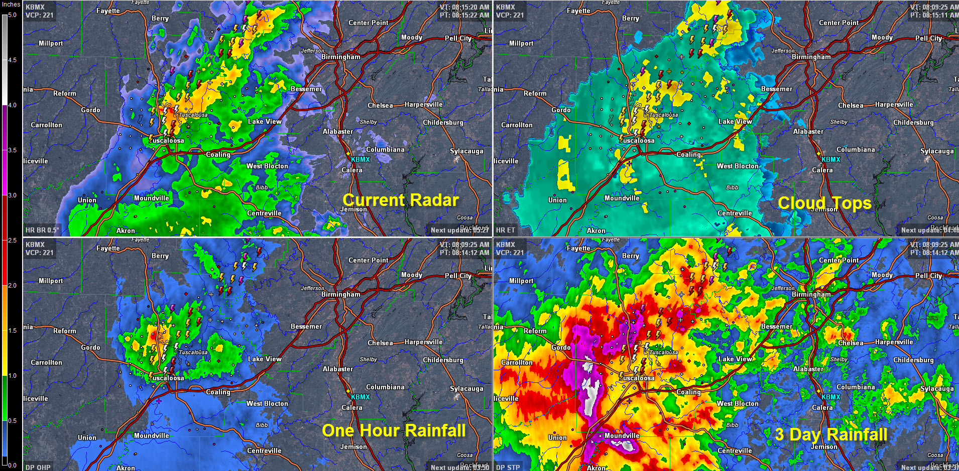
There are two main areas of convection:
One is over northern Tuscaloosa County and southern Walker County from the City of Tuscaloosa to south of Sumiton. Lots of lightning in the Tuscaloosa area right now. Heavy rain is also capable of producing minor flooding. 0.85 inches of rain in the past hour at the Tuscaloosa Airport. Winds never rose about 12 mph there.
One hour rainfall amounts are over one inch in this heavy thunderstorm activity.
The second area is over South Central Alaama in Dallas County near Selma, spreading toward Montgomery. Lots of lightning, heavy rain and gusty winds with this activity.
In the Birmingham Metro area, rain has overspread the western part of Jefferson county but it is not heavy at the time. A band of heavier rain and some lightning will slide southeastward out of Walker County and across the Metro over the next 75 minutes.
Category: Alabama's Weather
About the Author (Author Profile)
Bill Murray is the President of The Weather Factory. He is the site's official weather historian and a weekend forecaster. He also anchors the site's severe weather coverage. Bill Murray is the proud holder of National Weather Association Digital Seal #0001 @wxhistorianSubscribe
If you enjoyed this article, subscribe to receive more just like it.


