

Sun To The Max At Midday Across Central Alabama, But Rain Is On Its Way
SUNNY AND COOL AT MIDDAY, BUT RAIN IS ON ITS WAY
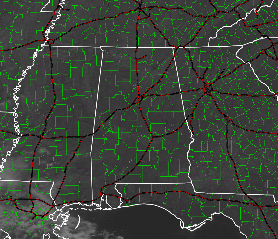
Maximum sunshine and cool temperatures is the story across Central Alabama at the 11 o’clock hour, but the main focus will be on the beneficial rain that we’ll receive during the next few days starting tomorrow. Temperatures across the area at this time are mainly in the 50s, with Troy being the warm spot at 59 degrees, and Pell City as the cool spot at 52 degrees.
BIRMINGHAM’S CLIMATOLOGY AND RECORDS
The normal high for December 2nd is 59, while the normal low is 38. The record high for today was set back in 1991 at 76. The record low was set back in 1960 at 20.
FOR THE REST OF TODAY
A sun filled sky and cool temperatures will be the story for the remainder of the afternoon hours. Afternoon highs will top out in the low to mid 60s across the area, which is actually just a couple of degrees above normal for this time of year. Cloud cover will start to move in during the late evening and increase during the overnight hours. Lows will stay above freezing for the most part due to the increase in cloud cover, with mid to upper 30s expected. A few of the colder spots may dip below 32 for an hour or two.
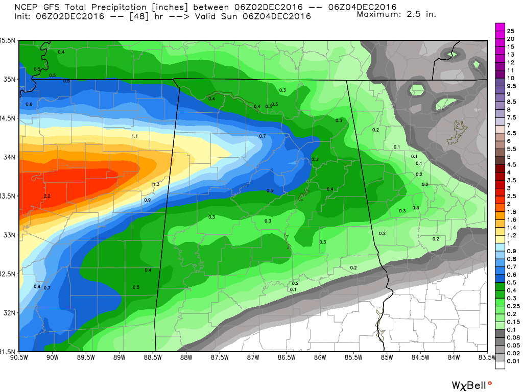
Latest GFS Run: Total Rainfall Up To Midnight Tomorrow Night
SATURDAY’S FORECAST
The morning will start of with mostly cloudy skies across Central Alabama, and rain may start to fall in the western counties of the area during the late morning hours. As the day progresses, rain chances will increase from the west to the east, and rain will be likely for everyone in the area by the late evening hours. Afternoon highs will mainly be in the 50s, with a few locations in the southeastern parts of the area touching the low 60s. Rain totals will vary throughout the area, with heavier amounts to the west, and lighter amounts to the east. Latest model guidance has Birmingham receiving around 1/4 inch of rain by midnight.
HEADED TO THE BEACH
Sunny skies and windy today across the beaches of Fort Morgan all the way over to Panama City Beach, with highs in the 60s. Rain and thunderstorms likely through Monday, with gusty winds and highs in the 60s and 70s. Mostly sunny skies with a few scattered showers through Thursday, with highs near 70 for Tuesday and Wednesday, and dropping into the 50s on Thursday. See a very detailed Gulf Coast forecast here.
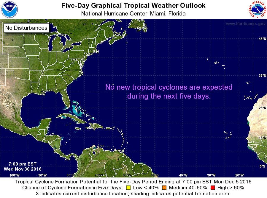
THE TROPICS
Good news, the tropics are all quiet at this time, and development is not expected for the next 5 days. This will be the last update on the tropics until late Spring of 2017, unless something develops. The Atlantic Basin Hurricane Season runs from June 1st to November 30th.
NUMBER OF THE DAY: 90
The warmest high temperature across the nation was recorded in Stuart Florida when the mercury soars to an unseasonably warm temperature of 90 degrees.
ON THIS DAY IN 1925
A late season hurricane caused extensive damage across the Florida peninsula, then moved off the Georgia coast crossing Cape Hatteras as a tropical storm. The storm produced whole gales along the Middle Atlantic and Southern New England coast. Winds gusted to 60 mph at Block Island RI, and reached 64 mph at Atlantic City NJ.
FOLLOW THE BLOG ON TWITTER
Be sure to follow the Alabama Wx Weather Blog on Twitter. Just click here to start following our feed.
WEATHERBRAINS
This is the weekly netcast that’s all about weather featuring many familiar voices, including our meteorologists at ABC 33/40. This week, the “Brains” chatted with Mike Wolfinbarger, from RadarScope. You can listen anytime on the web, or on iTunes. You can find it here.
Forecaster: Scott Martin (Twitter: @scottmartinwx)
Category: Alabama's Weather
About the Author (Author Profile)
Scott Martin is an operational meteorologist, professional graphic artist, musician, husband, and father. Not only is Scott a member of the National Weather Association, but he is also the Central Alabama Chapter of the NWA president. Scott is also the co-founder of Racecast Weather, which provides forecasts for many racing series across the USA. He also supplies forecasts for the BassMaster Elite Series events including the BassMaster Classic.Subscribe
If you enjoyed this article, subscribe to receive more just like it.


