

New Tornado Watch Issued Northwest of Alabama
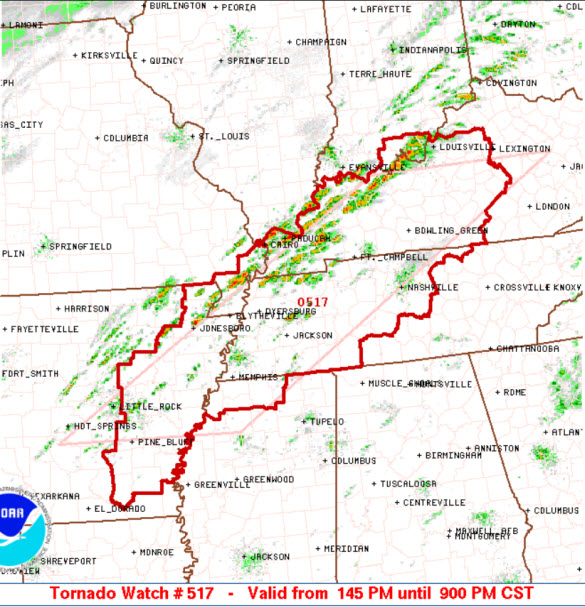
Effective from 145 PM until 900 PM CST and includes portions of eastern Arkansas, northern Mississippi, West and Central Tennessee and Kentucky, and extreme SE Missouri.
Primary threats include…A few tornadoes likely with a couple intense tornadoes possible, scattered damaging wind gusts to 70 mph likely, isolated large hail events to 1.5 inches in diameter possible.
The rest of this afternoon and into the evening hours, thunderstorms will intensify along and ahead of a cold front moving across the watch area. The strongest storms will pose a risk of damaging wind gusts and a few tornadoes.
REMEMBER…A Tornado Watch means conditions are favorable for tornadoes and severe thunderstorms in and close to the watch area. Persons in these areas should be on the lookout for threatening weather conditions and listen for later statements and possible warnings.
We will be watching developments to our northwest the next several hours. Still yet to be seen how far south and east the overall severe weather threat will be. Stay tuned and check the blog through for updates heading into tonight.
Category: Alabama's Weather, Severe Weather
About the Author (Author Profile)
Macon, Georgia Television Chief Meteorologist, Birmingham native, and long time Contributor on AlabamaWX. Stormchaser. I did not choose Weather, it chose Me. College Football Fanatic. @Ryan_StinnetSubscribe
If you enjoyed this article, subscribe to receive more just like it.


