Update On The Central Alabama Weather At 2:15 PM
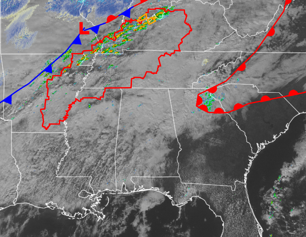
Moisture continues to flow in from the south into the area at this time well ahead of the approaching cold front, which has now progressed into central Arkansas through the southeastern tip of Oklahoma, and back into north Texas. Showers and thunderstorms have developed in front of the cold front and the low moving into Kentucky at this moment, and a couple of severe thunderstorm warnings are in effect a few locations in southern Indiana and northern Kentucky. A tornado watch is in effect from 1:45 PM until 9:00 PM CST and includes portions of eastern Arkansas, northern Mississippi, West and Central Tennessee and Kentucky, and extreme SE Missouri. Primary threats include a few tornadoes with a couple intense tornadoes possible, scattered damaging wind gusts to 70 mph, and isolated large hail events to 1.5 inches in diameter. The rest of this afternoon and into the evening hours, thunderstorms will intensify along and ahead of a cold front moving across the watch area. The strongest storms will pose a risk of damaging wind gusts and a few tornadoes.
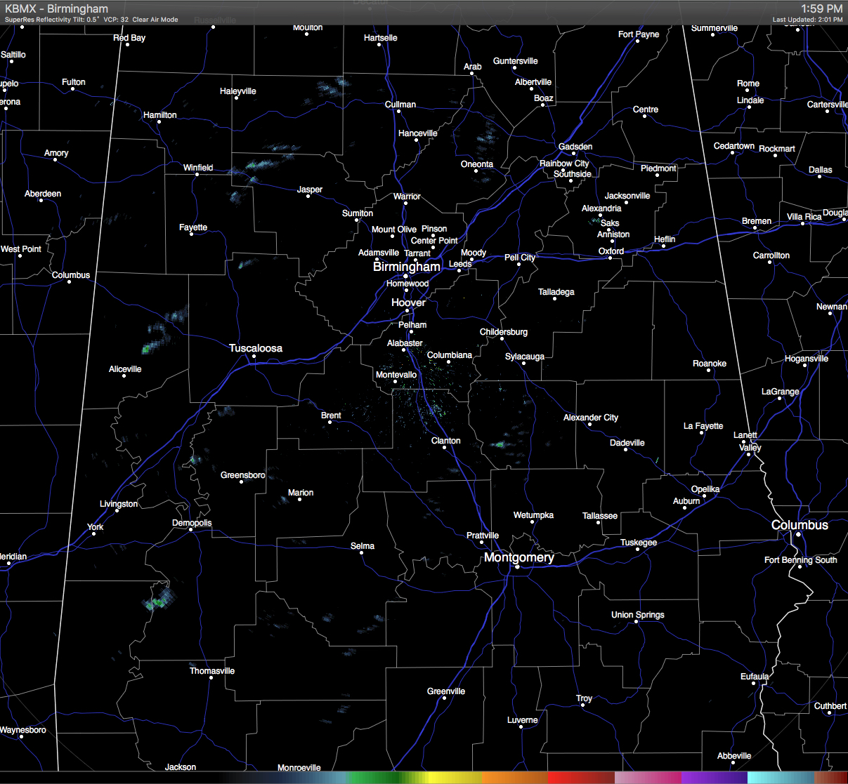
As far as our area is concerned, not much is happening in our neck of the woods. Little to no convective activity is occurring at this time across Central Alabama. Only a few sprinkles to very light showers are showing up on radar, with most of those showing up west of I-65.
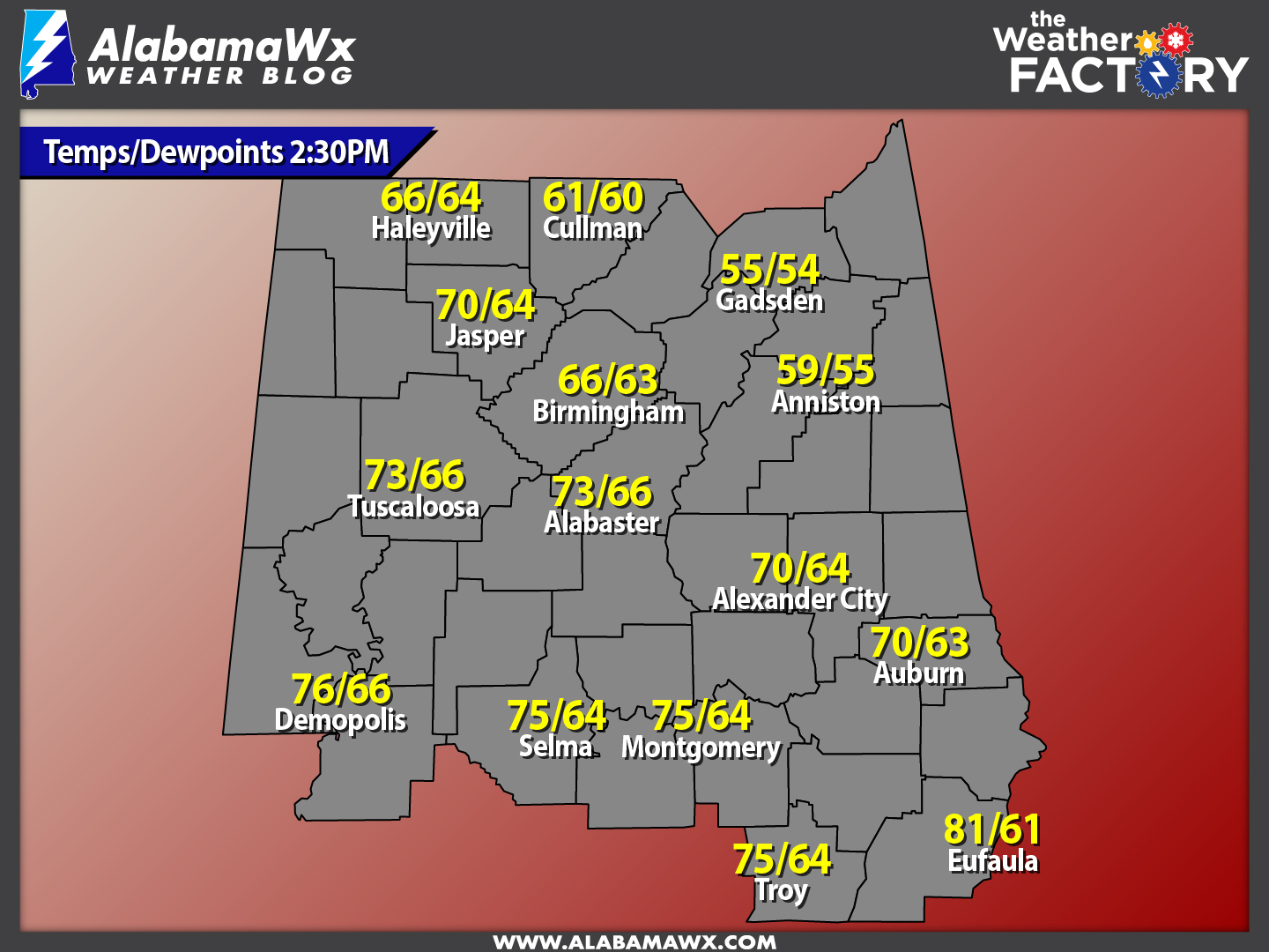
Dewpoints will continue to rise throughout the remainder of the afternoon, and with an unstable airmass, some wind shear, and lifting due to the approaching front, ingredients are there for thunderstorm development. The main time frame for any severe weather for the Central Alabama area will be from 10PM tonight until 4AM on Sunday morning, with the main threats being damaging straight-line winds, some small hail, and an isolated tornado or two.
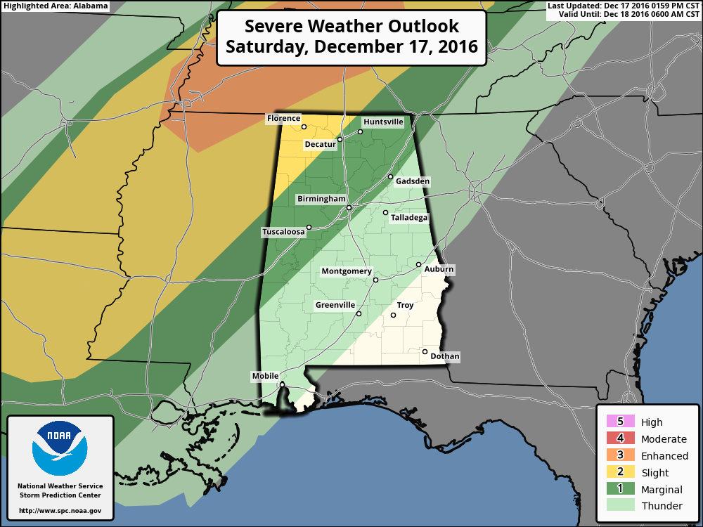
The best dynamics will be in the northwestern parts of the state, where the Storm Prediction Center continues to define that area in the “Slight Risk” for severe weather for tonight and into tomorrow morning, with areas east of that to just past the I-59 corridor in a “Marginal Risk.” We do note that the extreme northern part of Mississippi and most of the western half of Tennessee in an “Enhanced Risk” for severe storms. In our area, there is a very slight possibility that a cell or two could develop well ahead of the front and take on a supercellular look, but the main event will be in the form of a squall line. The squall line may not reach the Tuscaloosa, Birmingham, and Gadsden areas until the 3-5AM time frame on Sunday morning, with the line being much weaker from when it entered the state.
As Ryan mentioned in his earlier post, it will be an unpleasant Sunday for the area weather-wise. As the front pushes through the area during the early morning areas, you will notice that the temperatures will quickly drop from the 60s to the 40s and then the 30s rather quickly. There is still a very small risk of some freezing rain in parts of Marion, Winston, and Lamar counties as temperatures could drop to freezing or just below, but soil temperatures are well above freezing and little to no impact is expected.
We’ll continue to keep you updated.
Category: Alabama's Weather, Severe Weather
About the Author (Author Profile)
Scott Martin is an operational meteorologist, professional graphic artist, musician, husband, and father. Not only is Scott a member of the National Weather Association, but he is also the Central Alabama Chapter of the NWA president. Scott is also the co-founder of Racecast Weather, which provides forecasts for many racing series across the USA. He also supplies forecasts for the BassMaster Elite Series events including the BassMaster Classic.Subscribe
If you enjoyed this article, subscribe to receive more just like it.


