Update On The Central Alabama Weather At 5:30 PM
Currently across Central Alabama, only a few light showers are even showing up on radar. There are a few showers just south of Haleyville up in western Winston County, and a few more in southern Dallas County. Temperatures are mostly in the 70s with dewpoints in the mid 60s across the area at this point, with a little cold air wedge invading the northeast corner keeping temperatures down in the 50s and 60s, and dewpoints in the 50s..
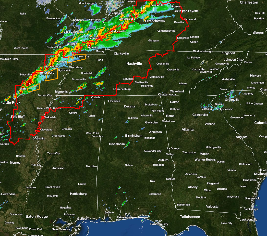
The big story at this moment is happening to our north and northwest, as a line of strong to severe thunderstorms has developed along and ahead of the could front. This line is currently stretching from just south of Cincinnati, Ohio, back to the southwest through Owensboro, Madisonville, and Mayfield, Kentucky, through Jonesboro and Batesville, Arkansas, before tapering off in Little Rock. There are a few severe thunderstorm warnings in effect for several locations in Arkansas and extreme northwestern corner of Tennessee, along with a tornado warning for portions of Craighead, Mississippi, and Poinsett counties in Arkansas until 5:45 PM.
The cold front will be moving towards the state later tonight, and the squall line associated with the front should enter the northwest corner of the state around the 10PM-Midnight time frame, reaching Tuscaloosa, Birmingham, and Gadsden by the 3AM-5AM time frame, and making it to Alexander City and Montgomery by 6AM-8AM. Even though the CAPE values will still be rather low, with the highest values west of I-65 throughout the early morning hours until the front passes. Significant tornado parameter values will still be greatest in the northwestern corner of the area, but will decrease as well as helicity (shear) values as the line pushes to the east through Central Alabama.
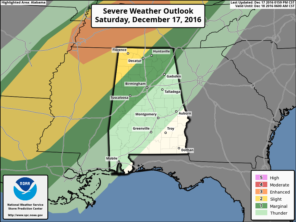
The SPC still has the northwest corner of the state under a slight risk for severe storms through tomorrow morning, with areas east of that to just east of the I-59 and I-20/59 corridors in a marginal risk. The main threat at this time in the slight risk area will mostly be for damaging straight-line winds, and the possibility of a few isolated tornadoes. As the line progresses to the east, the threat mainly will be from damaging winds, even though the chances of a brief spin-up tornado are not zero. As always with thunderstorms, expect the unexpected.
We’ll keep you posted throughout the weekend!
Category: Alabama's Weather, Severe Weather
About the Author (Author Profile)
Scott Martin is an operational meteorologist, professional graphic artist, musician, husband, and father. Not only is Scott a member of the National Weather Association, but he is also the Central Alabama Chapter of the NWA president. Scott is also the co-founder of Racecast Weather, which provides forecasts for many racing series across the USA. He also supplies forecasts for the BassMaster Elite Series events including the BassMaster Classic.Subscribe
If you enjoyed this article, subscribe to receive more just like it.


