Update On The Central Alabama Weather At 9:00 PM
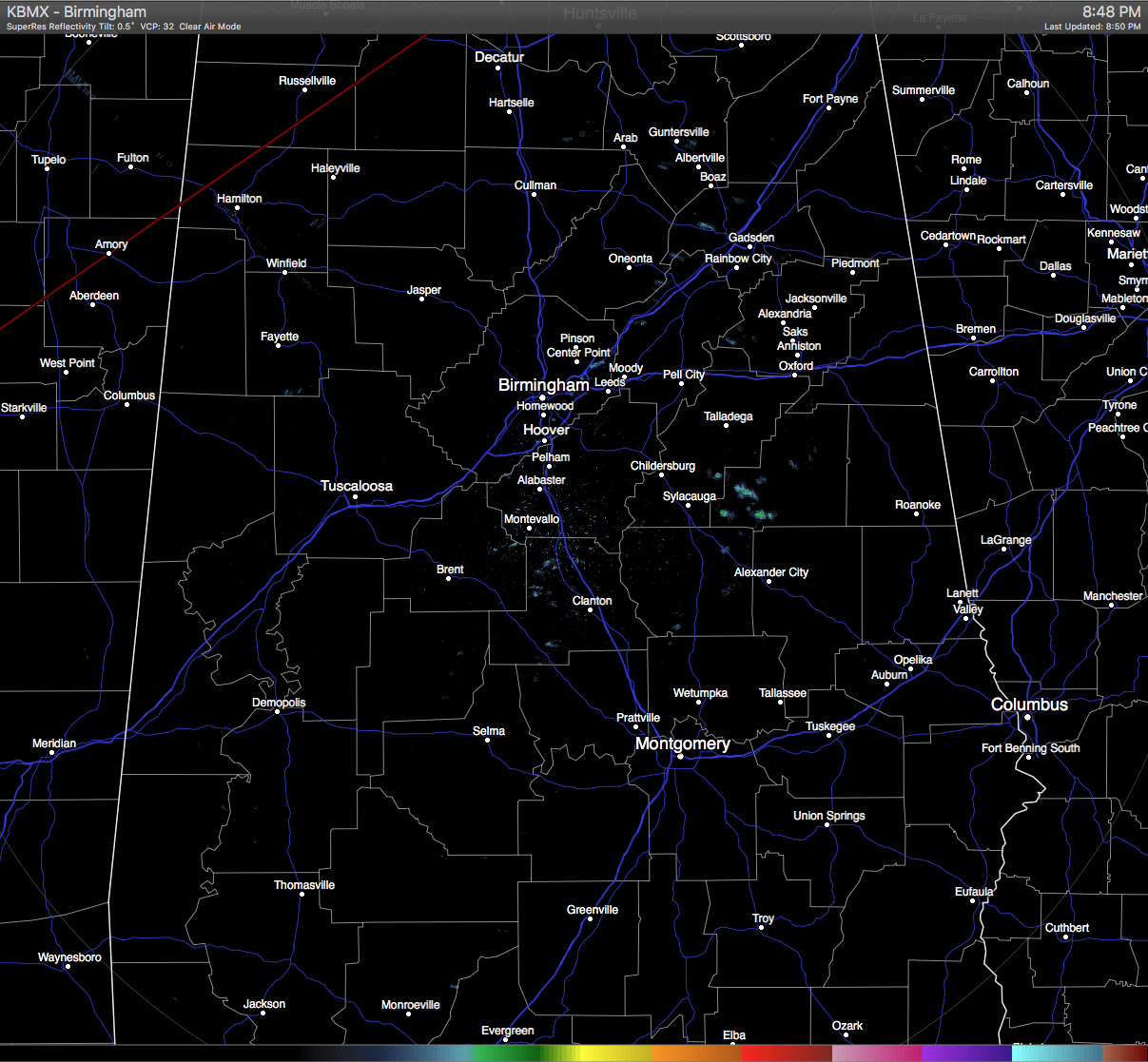
Almost everyone in Central Alabama at this time is up in the 70s, with dewpoints in the mid to upper 60s. The exception is in the northeastern corner of the area (east of I-65 and north of I-20) where temperatures are still in the mid to upper 60s. Shower activity is pretty much nonexistent in the area at the moment, with the only rainfall showing up in southern Talladega and southwestern Clay counties. We do want to mention that Tuscaloosa broke the old record high of 75 degrees that was set in 1990. Today’s high reached 76 degrees.
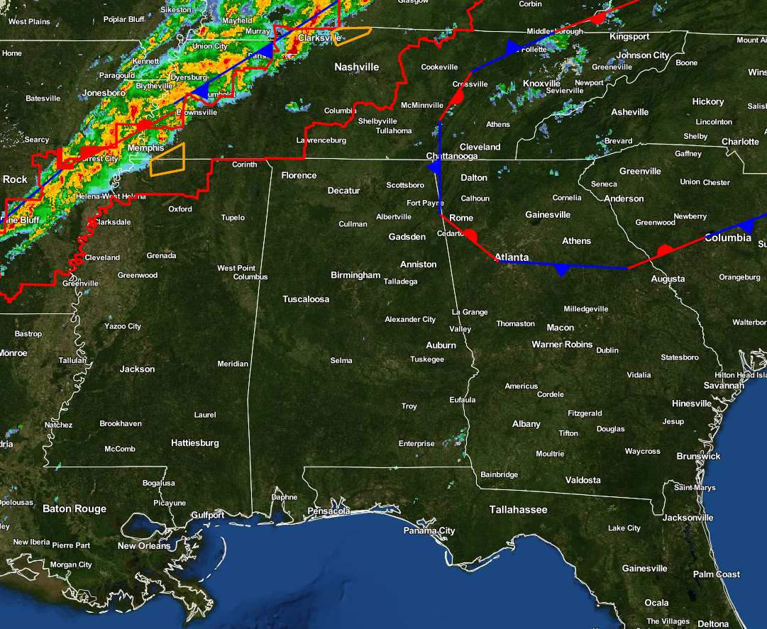
A tornado watch in effect ahead of the cold front that includes portions of south and central Kentucky, west and central Tennessee, extreme northwestern Mississippi, and eastern Arkansas until 3:00 AM CST.
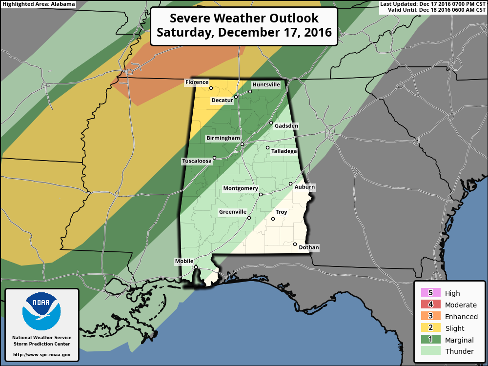
The SPC is still holding to their thoughts that the main risks for severe storms will be just north of the state in western Tennessee and northern parts of Mississippi, as they are defined in an enhanced risk for severe storms through the morning. The northwestern corner of Alabama still remains in the slight risk, with a marginal risk stretching out to the east from there to just east of the I-59 and I-20/59 corridors. The main threat will be from damaging straight-line thunderstorm winds, but an isolated tornado or two is definitely not out of the question at this time.
Showers and thunderstorms have finally developed farther south along the cold front which now stretches down to just east of College Station Texas. Good news for our area is that the cold front is actually starting to move ahead of the squall line. If this continues into our area, this will allow the storms to become elevated and take away any severe risk for our area. We’ll keep our eye on it as it progresses towards Central Alabama, as there is a very small possibility that a few discrete cells could develop out ahead of the front. If that happens, that is where your main threat for severe storms could be, and they will be developing in a more unstable airmass. Another note of good news is that the latest BMX sounding is showing a big cap in place at the 700 mb level. This should keep storm development out of the question until the cold front arrives.
After the front passes in the morning, colder air will start to work into the area. Temperatures will drop from the mid to upper 60s, to the mid and upper 30s within a few hours. For some areas, it will be close to a 40 degree difference between today’s highs and tomorrow’s late afternoon temperatures. As the rain starts to push out of the area, temperatures should be above freezing for much of the area, with the exception of a few sleet pellets or a few minutes of freezing rain in Marion, Lamar and Winston Counties. Even if the air temperatures fall below freezing, the event will be short, and there will be little to no impact as soil temperatures will be well above freezing. There is the possibility for some small ice accumulation along the Alabama/Tennessee state line, and NWS Huntsville has issued a winter weather advisory for those areas.
We’ll keep you updated throughout the remainder of the night and throughout the day tomorrow. Check back often, and be sure to follow us on Twitter, and on Facebook.
Category: Alabama's Weather, Severe Weather
About the Author (Author Profile)
Scott Martin is an operational meteorologist, professional graphic artist, musician, husband, and father. Not only is Scott a member of the National Weather Association, but he is also the Central Alabama Chapter of the NWA president. Scott is also the co-founder of Racecast Weather, which provides forecasts for many racing series across the USA. He also supplies forecasts for the BassMaster Elite Series events including the BassMaster Classic.Subscribe
If you enjoyed this article, subscribe to receive more just like it.


