

Coldest Weekend This Season
Sorry for the delayed Weather Xtreme Video. It was a very long day yesterday and the effects of the snow/sleet continue into this morning. At this writing, do not plan to get out in Central Alabama until the early afternoon. Roads are a mess and with the cold air in place are likely to stay that way for several more hours.
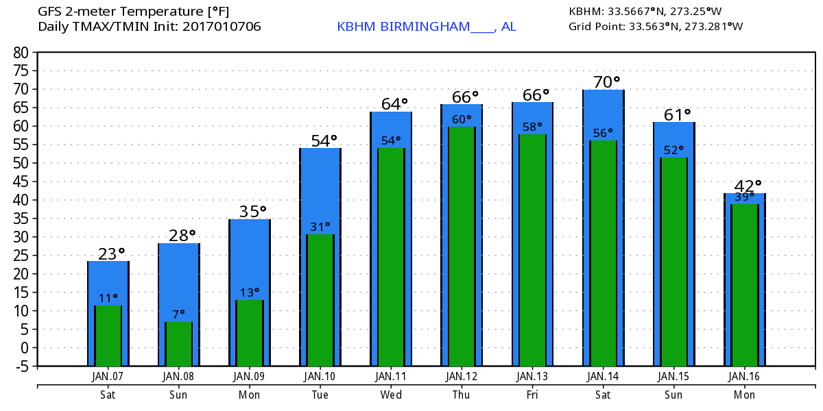
The sky is clear across Central Alabama with a stiff north wind and temperatures in the teens. Just before 8 am Anniston was the warm spot at 20! Not many days in the Southeast US you can say 20 is warm! Cold air advection as the surface high to our west settles across the Southeast US tonight will keep temperatures in check with highs not expected to get out of the 20s. Want something above the freezing mark? You’ll need to go south but even in South Alabama readings are not expected to get out of the 30s!
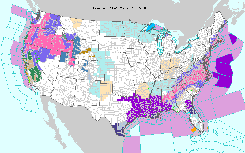
Numerous watches/warnings/advisories remain in place from East Texas to southern New England. The watch/warning map will be changing throughout the day as precipitation comes to an end, but those issuances may be swapped to extreme cold advisories.
The upper trough makes it way into the Atlantic Sunday keeping the strong northwesterly flow in place over the eastern half of the country. The surface high will settle into the Southeast US on Sunday morning, so look for morning lows Sunday morning to be in the range of 10 to 15 degrees. This will definitely be the coldest we’ve seen in quite some time.
Monday the upper ridge begins to come our way and gets here Tuesday. That should warm us up nicely with upper 40s Monday and upper 50s Tuesday. Tuesday and Wednesday the storm track in the upper air pattern is pretty far north so a storm system moving through the Great Lakes Tuesday and into eastern Canada Wednesday will drag a cold front into the Southeast US. The front won’t make much headway south as it becomes parallel to the flow aloft. Looks right now like the best chance for rain should come Tuesday night and Wednesday as the front stalls out across the northern half of Alabama. Don’t worry, temperatures should be warmed up enough to eliminate the risk of any wintery precipitation with highs in the 60s Wednesday.
Thursday and Friday the storm track remains north of us so we stay a little unsettled with the old frontal boundary in the area and the approach of yet another one Friday. The weather should be mild and the GFS MOS guidance for Birmingham even prints out 71 for Thursday. Rainfall through Thursday morning is likely to be the best over the northern half of Alabama but amounts won’t be particularly stellar with values from Tuesday through Thursday morning at a half inch or less. We’ll take what we can get since every little bit helps.
A strong upper trough comes out across the Central Rockies on Friday with the trough axis situated over Oklahoma on Saturday. This will spell another round of wet weather for us good southerly flow out of the Gulf with the surface high to our east and a good fetch of Pacific moisture with southwesterly flow aloft. We’re likely to start Saturday out dry but see it turn wet later in the day along with a west Sunday. Highs should be in the 60s.
Looking further afield, the GFS maintains a pretty active pattern as you would expect for this time of year. The trough comes across on the 15th of January followed by another one around the 17th of January. The next one comes around the 19th followed by a very deep, strong trough around the 22nd. If this one verifies, it has the look of some serious severe weather for the Lower Mississippi River Valley and the Southeast US followed by the potential for winter weather across the Central Plains. But you know how voodoo country can be – here today, gone tomorrow.
WORLD CLASS TENNIS RETURNS TO BIRMINGHAM: The BJCC will host the first-round tie against Switzerland February 3rd-5th. Single-day tickets are on sale now. Get them while they last! Buy tickets here.
The next Weather Xtreme Video will be posted Sunday morning. I’m not going to guarantee it to be coincident with sunrise but I’ll try to get it posted reasonably early. Have a great day, stay warm, be safe in whatever travel you must do. Godspeed.
-Brian-
Category: Alabama's Weather
About the Author (Author Profile)
Brian Peters is one of the television meteorologists at ABC3340 in Birmingham and a retired NWS Warning Coordination Meteorologist. He handles the weekend Weather Xtreme Videos and forecast discussion and is the Webmaster for the popular WeatherBrains podcast.Subscribe
If you enjoyed this article, subscribe to receive more just like it.


