

Severe Thunderstorm Warning Continues For Parts Of Winston County Until 6:45PM

…A SEVERE THUNDERSTORM WARNING REMAINS IN EFFECT UNTIL 645 PM CDT FOR NORTHEASTERN WINSTON COUNTY… At 634 PM CDT, a severe thunderstorm was located near Brushy Lake, or 11 miles southwest of Moulton, moving east at 30 mph.
HAZARD…Quarter size hail.
SOURCE…Radar indicated.
IMPACT…Damage to vehicles is expected. Locations impacted include… Addison, Brushy Lake, Sardis, Moreland, Inmanfield, Upshaw and Grayson.
Severe Thunderstorm Warning Continues For Parts Of Winston County Until 6:45PM
Mar 27th @ 6:04 pm
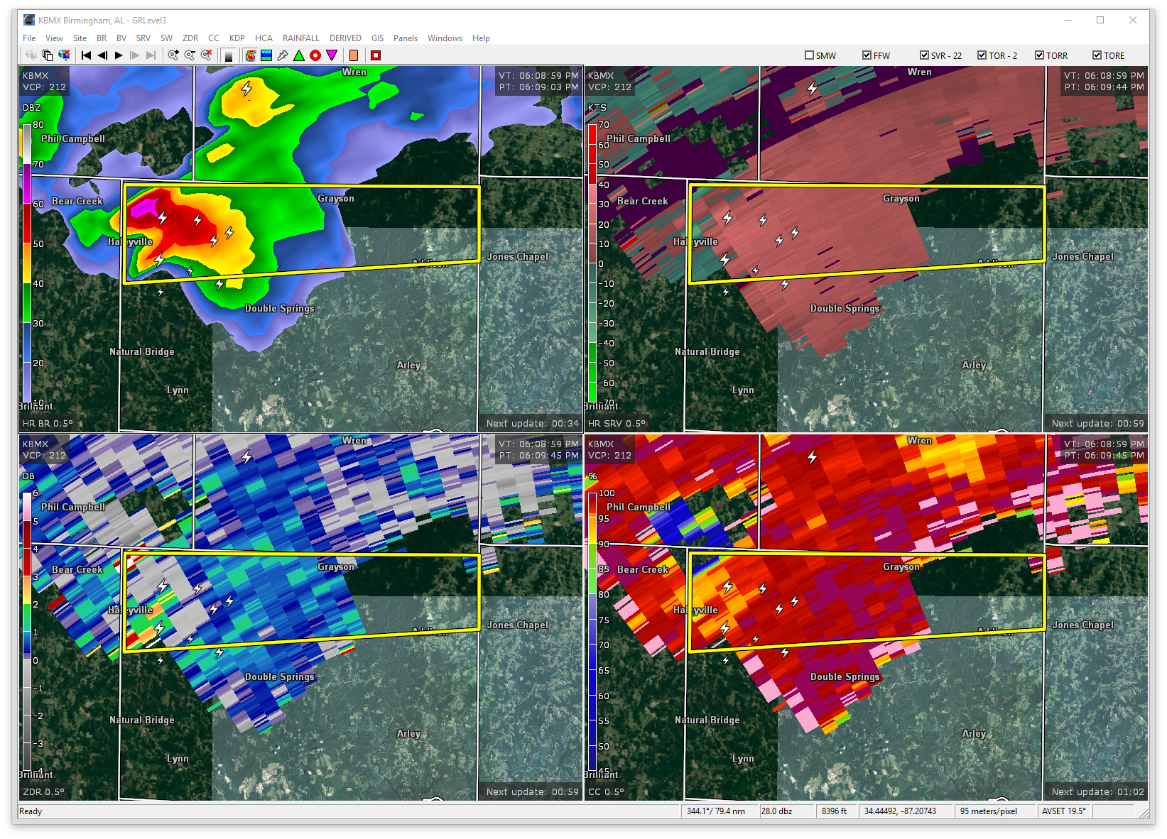

…A SEVERE THUNDERSTORM WARNING REMAINS IN EFFECT UNTIL 645 PM CDT FOR NORTHERN WINSTON COUNTY… At 612 PM CDT, a severe thunderstorm was located near Needmore, or near Haleyville, moving east at 30 mph.
HAZARD…Quarter size hail.
SOURCE…Radar indicated.
IMPACT…Damage to vehicles is expected. Locations impacted include… Haleyville, Addison, Sardis, Brushy Lake, Needmore, Moreland, Inmanfield, Ashridge, Posey Field Airport, Upshaw, Pebble, Sipsey River Rec Area, Grayson and Addison Municipal Airport.
Severe Thunderstorm Warning Canceled For Parts Of Marion County
Mar 27th @ 6:04 pm
…THE SEVERE THUNDERSTORM WARNING FOR NORTHEASTERN MARION COUNTY IS CANCELLED… The severe thunderstorm which prompted the warning has moved out of the warned area. Therefore, the warning has been cancelled. A severe thunderstorm watch remains in effect until 900 PM CDT for northwestern Alabama.
Severe Thunderstorm Warning Issued For Parts Of Marion And Winston Counties Until 6:45PM
Mar 27th @ 6:04 pm
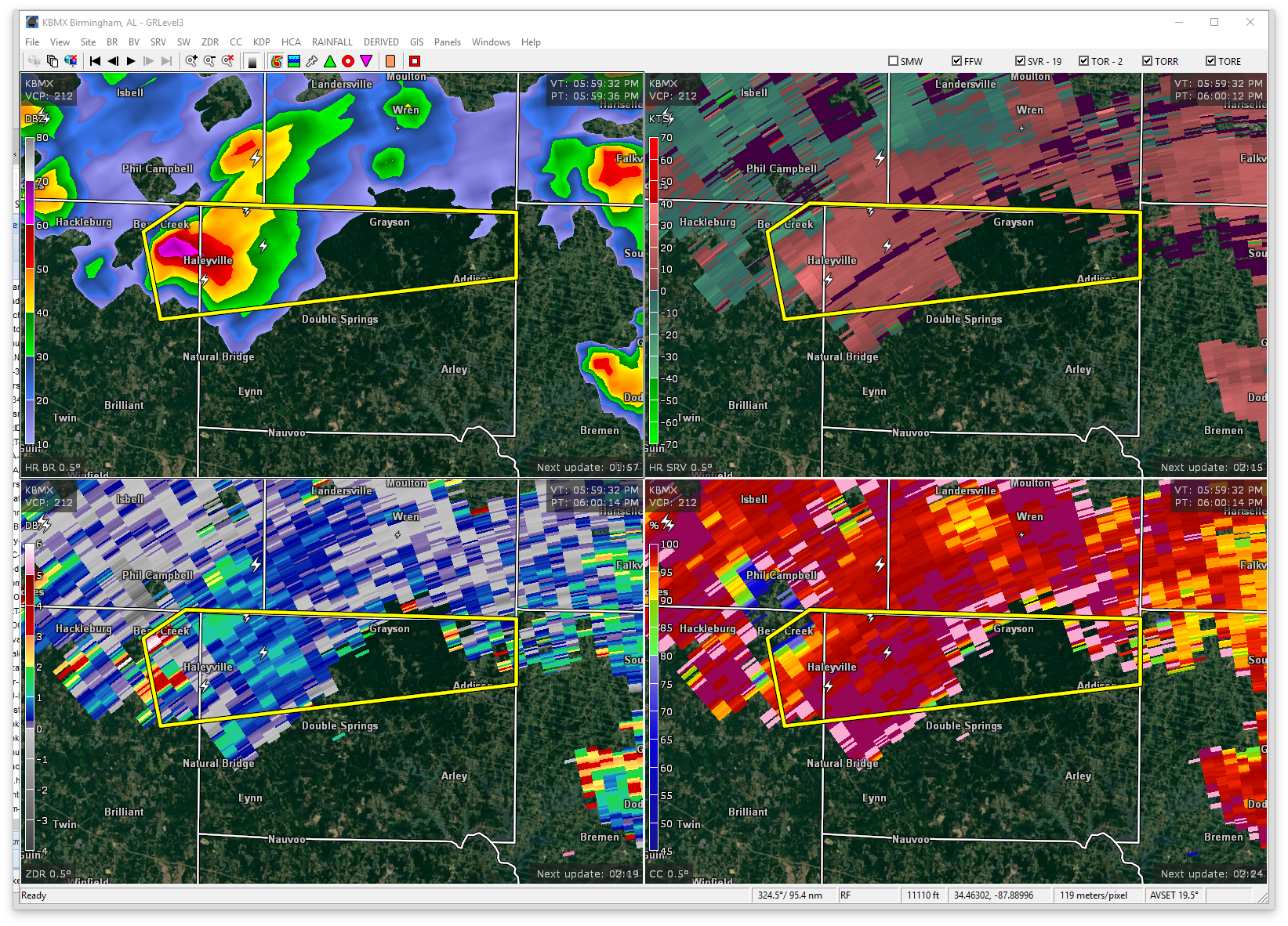

The National Weather Service in Birmingham has issued a
* Severe Thunderstorm Warning for…
Northeastern Marion County in northwestern Alabama…
Northern Winston County in northwestern Alabama…
* Until 645 PM CDT
* At 601 PM CDT, a severe thunderstorm was located over Haleyville, moving east at 30 mph.
HAZARD…Quarter size hail.
SOURCE…Radar indicated.
IMPACT…Damage to vehicles is expected.
* Locations impacted include…
Haleyville, Addison, Sardis, Brushy Lake, Needmore, Moreland, Inmanfield, Ashridge, Bear Creek, Weiss, Posey Field Airport, Upshaw, Pebble, Upper Bear Creek Reservoir, Delmar, Sipsey River
Rec Area, Grayson, Addison Municipal Airport and Bankhead National
Forest.
Category: ALL POSTS, Archived Warnings
About the Author (Author Profile)
Subscribe
If you enjoyed this article, subscribe to receive more just like it.


