

Severe Thunderstorm Warning Continues For Parts Of Blount County Until 6:45PM

…A SEVERE THUNDERSTORM WARNING REMAINS IN EFFECT UNTIL 645 PM CDT FOR EAST CENTRAL BLOUNT COUNTY… At 635 PM CDT, a severe thunderstorm was located near Altoona, or 8 miles east of Oneonta, moving northeast at 35 mph.
HAZARD…Quarter size hail.
SOURCE…Radar indicated.
IMPACT…Damage to vehicles is expected. Locations impacted include… Altoona and Highland Lake.
Severe Thunderstorm Warning Continues For Parts Of Blount County Until 6:45PM
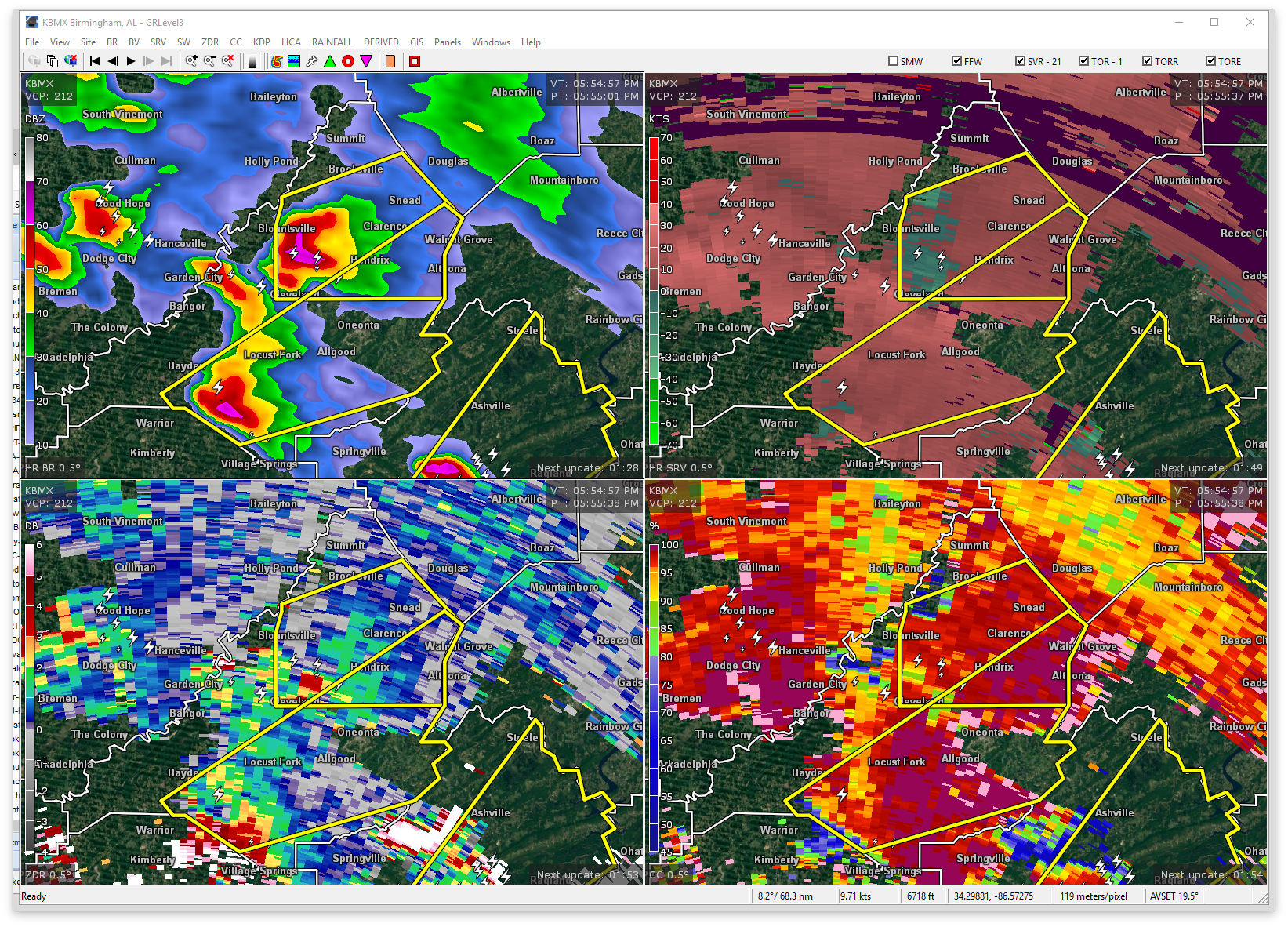
Mar 27th @ 5:55 pm

…A SEVERE THUNDERSTORM WARNING REMAINS IN EFFECT UNTIL 645 PM CDT FOR SOUTHEASTERN BLOUNT COUNTY… At 610 PM CDT, a severe thunderstorm was located near Inland Lake, or 7 miles southwest of Oneonta, moving northeast at 30 mph.
HAZARD…Quarter size hail.
SOURCE…Radar indicated.
IMPACT…Damage to vehicles is expected. Locations impacted include… Oneonta, Locust Fork, Altoona, Allgood, Rosa, Inland Lake, Highland Lake and Clear Springs.
Severe Thunderstorm Warning Issued For Parts Of Blount County Until 6:45PM
Mar 27th @ 5:55 pm

The National Weather Service in Birmingham has issued a
* Severe Thunderstorm Warning for…
Southeastern Blount County in Alabama…
* Until 645 PM CDT
* At 555 PM CDT, a severe thunderstorm was located over Dallas, or 11 miles southwest of Cleveland, moving northeast at 35 mph.
HAZARD…Quarter size hail.
SOURCE…Radar indicated.
IMPACT…Damage to vehicles is expected.
* Locations impacted include…
Oneonta, Cleveland, Dallas, Locust Fork, Altoona, Susan Moore, Walnut Grove, Trafford, Allgood, Fairview, Hayden, Rosa, County
Line, Inland Lake, Highland Lake, Easley, Remlap, Clear Springs and
Hendrix.
Category: ALL POSTS, Archived Warnings
About the Author (Author Profile)
Subscribe
If you enjoyed this article, subscribe to receive more just like it.


