

The Midday Check on Central Alabama’s Weather Situation

Currently at the 11 o’clock hour across Central Alabama, most of the area is dry at this point, with most of the rain activity in the south and southeastern portions of the area. We do have a few more showers that have developed back in the western parts of the area over portions of Marion, Winston, Walker, Tuscaloosa, Lamar, and Fayette counties.
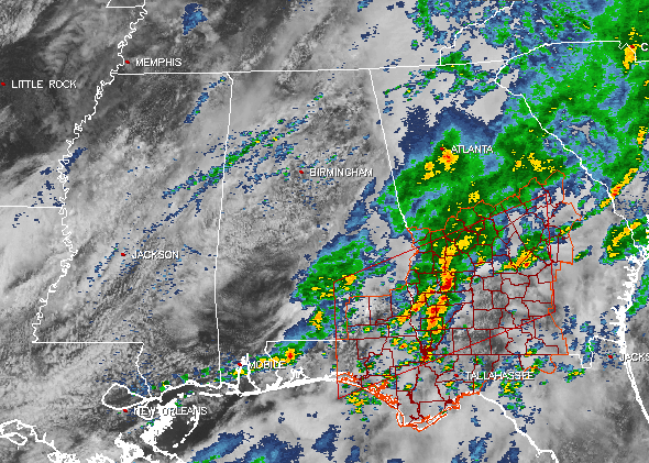
At this point, there are no severe watches in effect for Central Alabama, as a tornado watch was just recently cancelled for the extreme southeastern counties of the area.
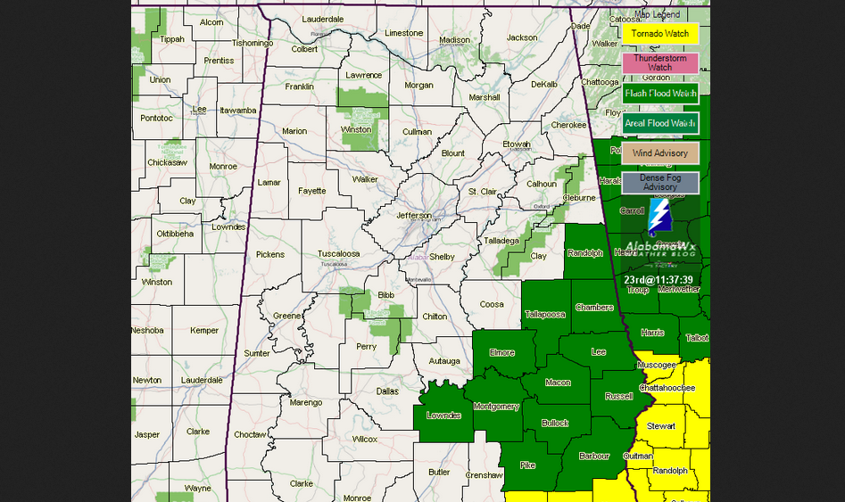
We still have a Flash Flood Watch in effect for the southeastern part of the area until 10:00PM CDT tonight. Locations in the watch area over the past few days have experienced anywhere from 2 to 8 inches of rainfall, and an additional 2 to 4 inches is possible as several more rounds of heavy rain moves through this area. You should monitor your NWS Weather Radio and be prepared to take action should a flash flood warning be issued.
For the rest of the day, we will continue to have scattered to numerous showers and thunderstorms across the area, with the heaviest rainfall coming over the southern-half of the area. As stated earlier, heavy rainfall could result in localized flash flooding in that area. Afternoon highs will be in the mid to upper 70s across the area.
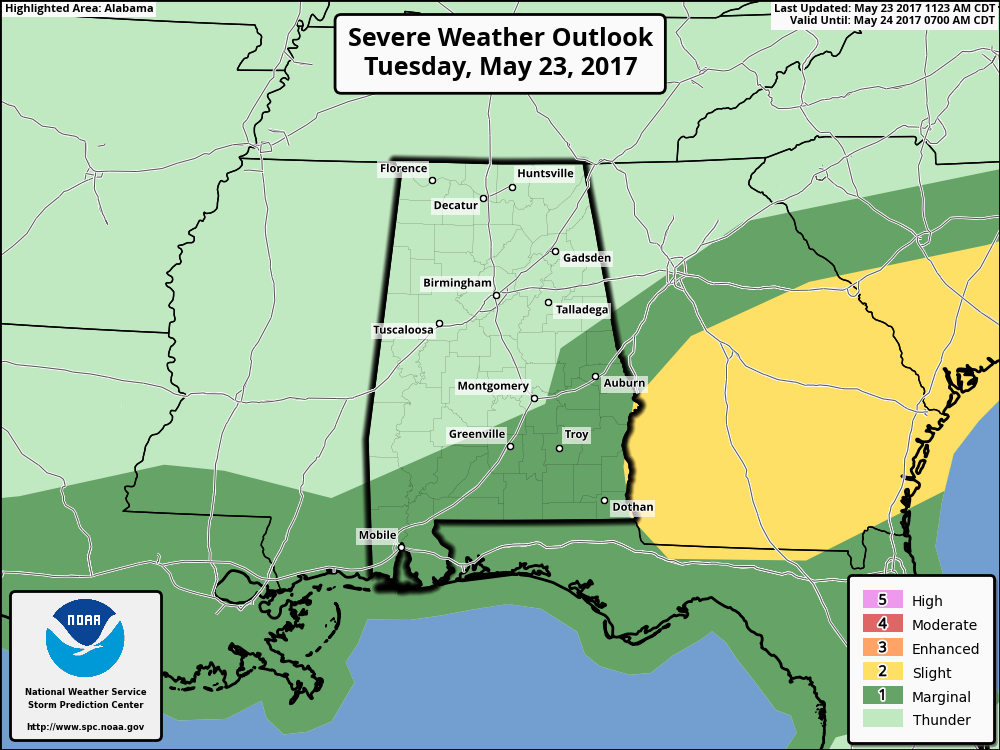
Later this evening and into Wednesday morning, the main trough axis that is bringing us this wet pattern will move into the area. This will bring us another round of showers and thunderstorms. There is a possibility for a few stronger to marginally severe storms in the southeastern counties of the area, as instability values could rise into the 2,000 J/kg range with dewpoints reaching near 70. The good news is that most of the convection will be east of the area before the stronger dynamics reach Central Alabama. There is some uncertainty with the timing on this, so we’ll have to keep an eye on the conditions throughout the day. Even with that being said, the main threat will be from damaging winds, but a brief tornado can’t be ruled out, if conditions become favorable for severe development.
Good news is that the rainfall should diminish throughout the day on Wednesday, and becoming more widely scattered by the time we reach the sunset hour. Afternoon highs on Wednesday will be in the 70s across the area, with lower 70s for the northern half, and mid to upper 70s for the south. There is a possibility that several locations will either tie or set new record low maximum temperatures for May 24th. The old record in Birmingham is 73 degrees set back in 2000. As of now, I’m expecting the high to be at 72 degrees for the Magic City.
We will dry out for Thursday and Friday before we have a risk for a few showers and storms throughout the Memorial Day weekend.
The SEC Baseball Tournament returns to the Hoover Met this week, May 23–28. Come see some of the best college players in the country as they compete for the championship. Also, for the first time ever, you can take advantage of the Hoover Metropolitan Complex which will feature a free, indoor Fan Fest – ferris wheel, sports bar and much more! Tickets start at only $9!
BEACHBOUND: For a detailed look at the weather from Fort Morgan over to Panama City Beach, Click here to see the Beach Forecast Center page. The Beach Forecast is partially underwritten by the support of Brett/Robinson Vacation Rentals in Gulf Shores and Orange Beach. Click here to see Brett/Robinson’s best beach offers now!
ON THIS DAY IN WEATHER HISTORY – 1987
It was a busy day for thunderstorms in the central U.S. Thunderstorms produced wind gusts to 65 mph at Shreveport LA and golf ball size hail at Marfa, TX. Hobart, OK, received 3.55 inches of rain in the morning, and another 4.03 inches of rain that evening. Thunderstorms in Nebraska produced 8.5 inches of rain in two hours north of Potter, and 7.5 inches of rain in ninety minutes north of Minatare. Thunderstorms in Colorado produced five inches of hail at Greeley.
Category: Alabama's Weather, ALL POSTS
About the Author (Author Profile)
Scott Martin is an operational meteorologist, professional graphic artist, musician, husband, and father. Not only is Scott a member of the National Weather Association, but he is also the Central Alabama Chapter of the NWA president. Scott is also the co-founder of Racecast Weather, which provides forecasts for many racing series across the USA. He also supplies forecasts for the BassMaster Elite Series events including the BassMaster Classic.Subscribe
If you enjoyed this article, subscribe to receive more just like it.


