

Blanket Of Moist Air Remains Over Alabama
RADAR CHECK: We have areas of rain on radar at daybreak over parts of Central and South Alabama… generally south of I-20…
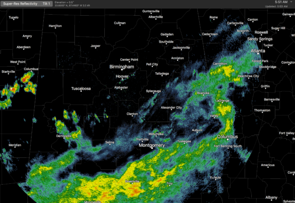
We will maintain the chance of a few passing showers or thunderstorms over much of the state today, but the rain won’t be continuous, and the activity this afternoon will be fairly random and scattered. Chance of any one spot getting wet today is about one in three, and the high will be in the low 80s with only a limited amount of sun. We do note the air is drier over far North Alabama… many communities up in the Tennessee Valley will be dry.
REST OF THE WEEK: Not much change. High dew points and precipitable water values, meaning some risk of showers and thunderstorms each day through Friday. The 06Z GFS hints the air will be a tad drier Thursday over the northern half of the state, but we aren’t buying that solution for now. Understand, as we get into meteorological summer, rain becomes more scattered in nature, and distribution becomes more uneven. And, it is impossible to give rain start/stop times for any one given location. Just be ready for the occasional passing shower or thunderstorm… best chance will come during the afternoon and evening hours, but a late night or morning shower can’t be completely ruled out. Highs will be in the low to mid 80s with intervals of sunshine possible.
No organized severe weather is expected through Friday, although a strong storm is possible.
THE ALABAMA WEEKEND: No real change. Alabama will be covered in an airmass you can wear, with dew points up in the low 70s…. meaning a continued chance of showers and thunderstorms Saturday and Sunday. Most places will see an hour or two of rain both days, with the highest risk of showers coming during the afternoon and evening hours. Not much sun; highs between 80 and 85.
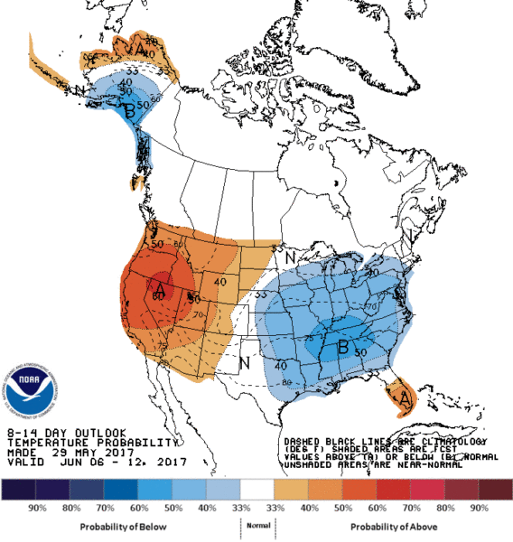
NEXT WEEK: The GFS hints at drier air slipping into the state beginning Tuesday, with only isolated showers for the rest of the week… see the Weather Xtreme video for maps, graphics, and more details. And, it looks like the pattern favors below average temperatures for much of the eastern and southern U.S. through mid-June.
BEACH FORECAST: Click here to see the AlabamaWx Beach Forecast Center page. The Beach Forecast is partially underwritten by the support of Brett/Robinson Vacation Rentals in Gulf Shores and Orange Beach. Click here to see Brett/Robinson’s Own Your Summer specials now!
WEATHER BRAINS: Don’t forget you can listen to our weekly 90 minute netcast anytime on the web, or on iTunes. This is the show all about weather featuring many familiar voices, including our meteorologists here at ABC 33/40.
CONNECT: You can find me on all of the major social networks…
Facebook
Twitter
Google Plus
Instagram
Pinterest
Snapchat: spannwx
Look for the next Weather Xtreme video here by 4:00 this afternoon… enjoy the day!
Category: Alabama's Weather, ALL POSTS
About the Author (Author Profile)
James Spann is one of the most recognized and trusted television meteorologists in the industry. He holds the AMS CCM designation and television seals from the AMS and NWA. He is a past winner of the Broadcast Meteorologist of the Year from both professional organizations.Subscribe
If you enjoyed this article, subscribe to receive more just like it.


