

Dual Threat Of Flooding/Isolated Tornadoes Today
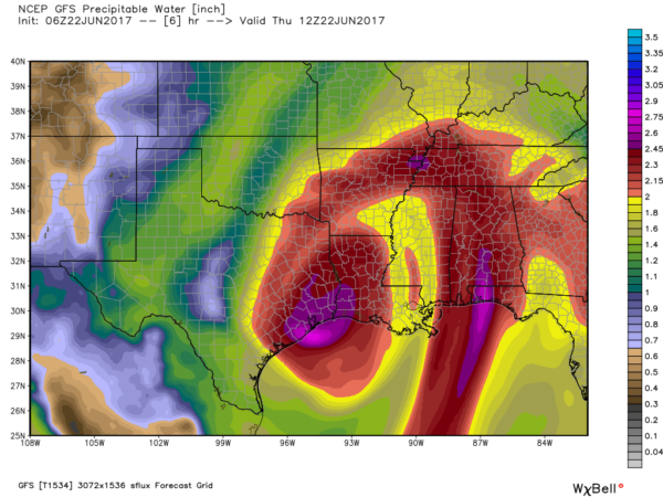
CINDY IS INLAND: Tropical Storm Cindy moved ashore early this morning near the Sabine Pass… the Texas/Louisiana border… well to the west of Alabama. But, as discussed often here, the impact of the tropical storm extends well to the east, and Cindy is responsible for a fetch of moisture from the deep tropics moving right into our state this morning.
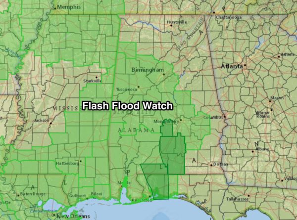
FLOODING POSSIBLE: A flash flood watch is in effect for much of West, Central, and South Alabama… additional rain amounts of 2-4 inches could easily produce flooding problems. Lowndes, Butler, Crenshaw, Covington, and Escambia Counties in South Alabama are under flash flood warnings at daybreak; more warnings are likely later today.
There will be breaks in the rain, but when the rain falls, it will be heavy at times through tonight.
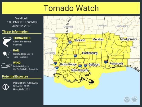
TORNADO WATCH: A tornado watch remains in effect until 1p CT for much of West, Central, and Southwest Alabama… this watch extends westward into Central and South Mississippi.
Storm relative helicity (shear) values will be very high across the western half of Alabama today and tonight, and some cells in feeder bands wrapping around the east side of Cindy will have potential to drop a tornado or two.
It is important to note that tornadoes associated with tropical systems usually are short lived, making it very challenging to provide timely warnings. Often they last only a few minutes, and by the time a warning is disseminated, the tornado has lifted. And, because of the low topped nature of these convective cells, often we can’t see the low level circulation clearly on Doppler Radar velocity.
Pay close attention to the weather conditions today, and listen for flash flood and tornado warnings.
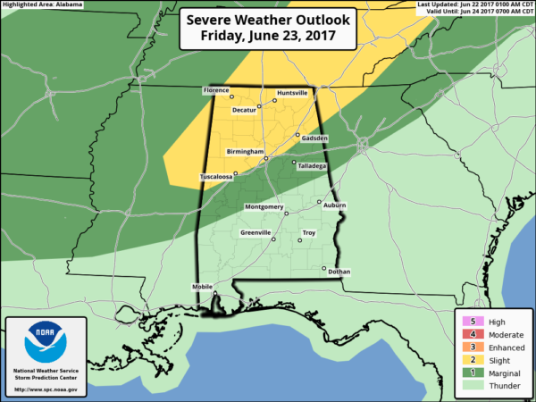
TOMORROW: Rain and storms will become more scattered in nature, but Cindy’s remnant low will be near Memphis, and we will still have very high shear values, meaning the threat of isolated tornadoes will continue, mainly for the northern half of the state.
Weather conditions improve over South Alabama and the Gulf Coast region tomorrow, with only scattered showers and tropical downpours. The sun should peek out at times.
THE WEEKEND: A surface front will approach from the north, and we expect scattered to numerous showers and thunderstorms Saturday, but it won’t rain all day, and we don’t expect any severe weather issues. Then, drier air finally moves into North Alabama Sunday with few, if any showers. We expect highs mostly in the mid 80s.
NEXT WEEK: A dry, continental airmass will cover Alabama most of the week giving us a nice chance to dry out. Mostly sunny warm days, clear cool nights, and lower humidity values. A good chance we see lows in the 50s on a few mornings during the first half of the week… very refreshing for June. See the Weather Xtreme video for maps, graphics, and more details.
BEACH FORECAST: Click here to see the AlabamaWx Beach Forecast Center page. The Beach Forecast is partially underwritten by the support of Brett/Robinson Vacation Rentals in Gulf Shores and Orange Beach. Click here to see Brett/Robinson’s Own Your Summer specials now!
WEATHER BRAINS: Don’t forget you can listen to our weekly 90 minute netcast anytime on the web, or on iTunes. This is the show all about weather featuring many familiar voices, including our meteorologists here at ABC 33/40.
CONNECT: You can find me on all of the major social networks…
Facebook
Twitter
Google Plus
Instagram
Pinterest
Snapchat: spannwx
Look for the next Weather Xtreme video here by 4:00 this afternoon… and we will keep the blog updated often today!
Category: Alabama's Weather, ALL POSTS, Weather Xtreme Videos
About the Author (Author Profile)
James Spann is one of the most recognized and trusted television meteorologists in the industry. He holds the AMS CCM designation and television seals from the AMS and NWA. He is a past winner of the Broadcast Meteorologist of the Year from both professional organizations.Subscribe
If you enjoyed this article, subscribe to receive more just like it.


