

Strong Storms Now Affecting Chilton and Shelby Counties
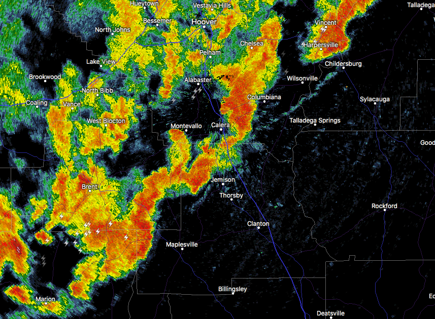
Strong storms are moving into the Chilton and Shelby counties, and are putting down some impressive rainfall. Please stay weather aware as these storms can produce gusty winds that could knock down some trees with the saturated ground. Also, a brief spin-up tornado is possible.
Special Weather Statement
National Weather Service Birmingham AL
357 PM CDT FRI JUN 23 2017
ALZ025-034>036-232130-
Chilton-Bibb-Shelby-Coosa-
357 PM CDT FRI JUN 23 2017
…A STRONG THUNDERSTORM WILL AFFECT NORTHERN CHILTON…SOUTHEASTERN
SHELBY…SOUTHEASTERN BIBB AND NORTHWESTERN COOSA COUNTIES…
At 357 PM CDT, a strong thunderstorm was located over Lawley, or 11
miles southeast of Centreville, moving northeast at 45 mph.
Winds in excess of 40 mph are possible with this storm.
Locations impacted include…
Calera, Clanton, Centreville, Jemison, Thorsby, Maplesville, Lawley,
Gap Of The Mountain, Lay Lake Dam, Talladega National Forest, Chilton
County Motor Sports Park, Shelby, Randolph, Minooka Park, Lomax,
Spring Creek At Lay Lake, Trio, Campbell, I 65 Rest Area and Bibb
County Airport.
Torrential rainfall is also occurring with this storm, and may cause
localized flooding. Do not drive your vehicle through flooded
roadways.
Category: Archived Warnings
About the Author (Author Profile)
Scott Martin is an operational meteorologist, professional graphic artist, musician, husband, and father. Not only is Scott a member of the National Weather Association, but he is also the Central Alabama Chapter of the NWA president. Scott is also the co-founder of Racecast Weather, which provides forecasts for many racing series across the USA. He also supplies forecasts for the BassMaster Elite Series events including the BassMaster Classic.Subscribe
If you enjoyed this article, subscribe to receive more just like it.


