

Bright And Sunny At Midday
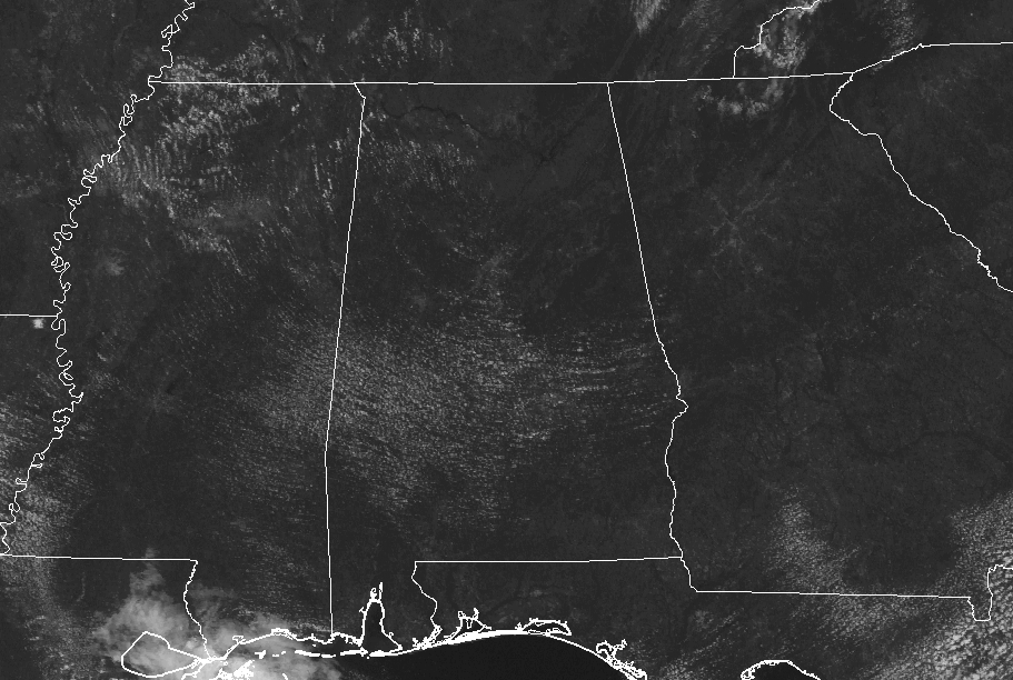
A Pretty Nice Day So Far At Midday
High pressure off to our northeast continues to be in control of our weather across Central Alabama today, and at the midday hour, conditions are not that bad for the last day of July. Skies across the area are mainly clear, with just a few spotty fair-weather clouds over the the western and southern parts. Radar is completely dry and will remain that way throughout the rest of the day.
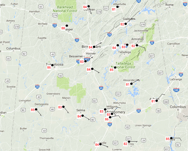
Temperatures Across Central Alabama
At 11:30 AM, temperatures are actually rather nice… still pretty warm, but nice for the “Dog Days of Summer.” Temperatures are ranging from 81 to 86 degrees throughout Central Alabama at this point. Birmingham is at 84 degrees, with Montgomery and Tuscaloosa tied as the warm spots at 86 degrees. The cool spots are Alexander City and Auburn at 81 degrees.
Weather For The Rest Of The Day
No question about it at all, today is one fine summer day in Central Alabama… Skies will remain mostly clear to sunny throughout the remainder of the daytime hours, and afternoon highs will reach the upper 80s to the lower 90s across the area. With the lower humidity levels today, those highs will not be all that bad. Clear skies and nice temperatures for the evening and overnight hours tonight, with lows dropping into the 60s throughout the area.
Tuesday’s Forecast Is Pretty Much The Same As Today’s
Another great day across Central Alabama for tomorrow. High pressure continues to be in control of our weather, keeping us dry and a little cooler. We’ll have a mix of sun and clouds and highs will be in the upper 80s to the lower 90s once again. Dewpoints will be in the lower 60s, so the high temperatures will feel a little more comfortable than what you would expect.
Beach Forecast
Monday and Tuesday will be sunny and dry, but the risk for showers and storms return for Wednesday through Saturday. For a detailed look at the weather from Fort Morgan over to Panama City Beach, click here to see the AlabamaWx Beach Forecast Center page.
The Beach Forecast is partially underwritten by the support of Brett/Robinson Vacation Rentals in Gulf Shores and Orange Beach. Click here to see Brett/Robinson’s Own Your Summer specials now!
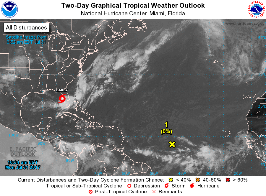
Tropical Outlook
Tropical Storm Emily formed earlier this morning along the west coast of Florida and has already moved ashore around Tampa Bay. Maximum sustained winds are at 45 MPH and movement is to the east at 9 MPH. Emily is forecast to weaken to a depression as she moves across the peninsula and out into the Atlantic by Tuesday morning. She will continue to the northeast and away from the US mainland. Tropical Storm Warnings are up in Florida from Anclote River to Bonita Beach.
The tropical wave located well out in the Atlantic will have a hard time developing as it continues to move to the west-northwest at 10-15 MPH. NHC gives it a 10% chance of developing into a tropical cyclone within the next 5 days.
Advertise With Us!
Now is the time to set your marketing campaign on AlabamaWX. The site has enjoyed a 71% jump in page views this year! The website has already enjoyed 10,157,915 page views this year. We can customize a creative, flexible and affordable package that will suit your organization’s needs. Contact Bill Murray at (205) 687-0782.
E-Forecast
Get the AlabamaWx seven-day forecast delivered directly to your inbox by email twice daily. It is the most detailed weather forecast available in Central Alabama. Click here to subscribe. It’s free!
On This Day In Weather History
1976 – A stationary thunderstorm produced more than ten inches of rain which funneled into the narrow Thompson River Canyon of northeastern Colorado. A wall of water six to eight feet high wreaked a twenty-five-mile path of destruction from Estes Park to Loveland killing 156 persons. The flash flood caught campers and caused extensive structural and highway damage. Ten miles of U.S. Highway 34 were totally destroyed as the river was twenty feet higher than normal at times.
WeatherBrains
Tonight, the panel will entertain Damon Lane from KOCO in Oklahoma City as we talk about that crazy weather market. Check out the show at www.WeatherBrains.com. You can also subscribe on iTunes. You can watch the show live at live.bigbrainsmedia.com on Monday nights starting at 8:30 PM CDT. You will be able to see the show on the James Spann 24×7 weather channel on cable or directly over the air on the dot 2 feed.
Category: Alabama's Weather, ALL POSTS
About the Author (Author Profile)
Scott Martin is an operational meteorologist, professional graphic artist, musician, husband, and father. Not only is Scott a member of the National Weather Association, but he is also the Central Alabama Chapter of the NWA president. Scott is also the co-founder of Racecast Weather, which provides forecasts for many racing series across the USA. He also supplies forecasts for the BassMaster Elite Series events including the BassMaster Classic.Subscribe
If you enjoyed this article, subscribe to receive more just like it.


