Snow Potential For Alabama
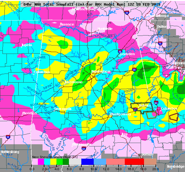
Here is the 12Z NAM accumulated snow chart for Alabama…

Before you hyperventilate, remember, this is model output only. I do believe somebody could see 5 inches of snow across a very narrow area, but I maintain we won’t know that “magic spot” until the the event begins and the heaviest snow band sets up tonight. There is very limited skill in forecasting snow placement and amounts with a cold core upper low in Alabama.
The GFS is also similar, although I don’t have the accumulated snow chart at this point.
We do note the ground is warm, but you can’t ignore what we see to the northwest…
500 mb heights are down to 5430 meters near Wichita, and bands of heavy snow are setting up underneath the ULL.
Seems like a pretty good chance much of North/Central Alabama will potential for 1 to 2 inches of snow, with isolated amounts to 5 inches in a very narrow band. The NWS, most likely, will issue a winter weather advisory, or maybe even a winter storm watch, by late morning.
The best chance of accumulating snow will be from 9:00 tonight to 9:00 tomorrow morning. Stay tuned…
Category: Uncategorized


