Debby F.A.Q…
**Updated as of 7:45 p.m.**
Getting dozens and dozens of questions concerning the tropical storm in the Gulf of Mexico via social media today. Not enough room on Twitter and Facebook, so let’s run through them here. Let me say up front there is plenty of uncertainty in the track of Debby, and this could change. But, based on 12Z data, here are the best answers.
*Will North Alabama get rain from Tropical Storm Debby? Very unlikely. A persistent upper ridge should keep the northern counties generally high and dry during the upcoming week. Wish I had better news about rain around here. Yes, there might be a day or two with isolated showers or storms during the peak of the daytime heating process, but they will be few and far between. And, we stay hot with highs in the 90-95 degree range tomorrow and Tuesday, with upper 90s possible later in the week.
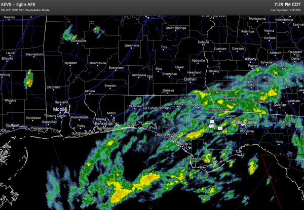
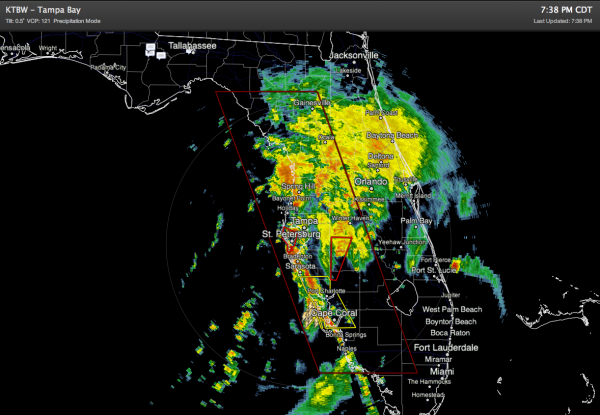
*Tell me how this will impact the Alabama/Northwest Florida Gulf Coast? Most people around here are most concerned about the area from Gulf Shores east to Panama City. Below is a 7:30 p.m. radar capture for that stretch of the coast…
Occasional showers and storms are likely through at least Tuesday, and possibly into Wednesday, mainly for the Florida Panhandle and into the Peninsula.
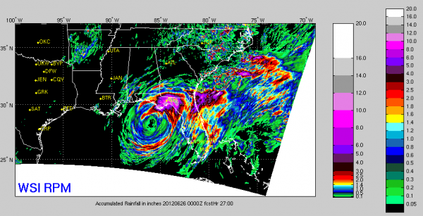
Below is the updated RPM projected rain from Debby for the next 27 hours, and it shows the biggest rains from around Fort Walton Beach eastward, with only light and spotty amounts of the Alabama Gulf Coast. The idea of a west drift is for now off the table, meaning the heaviest rain should stay east of Gulf Shores and Orange Beach.
It is important to note that very rough surf and dangerous rip currents are likely for ALL of the Central Gulf Coast region. The public beaches at Gulf Shores and Orange Beach are closed to swimmers. Don’t be a buffoon and get in the water… this is serious business.
*When will the weather improve on the Gulf Coast? Debby is a slow moving system, and it could be Friday, or even Saturday before seas begin to calm down and the weather improves. The week of July 2 through July 6 should be pleasant on the coast with only the routine risk of scattered showers.
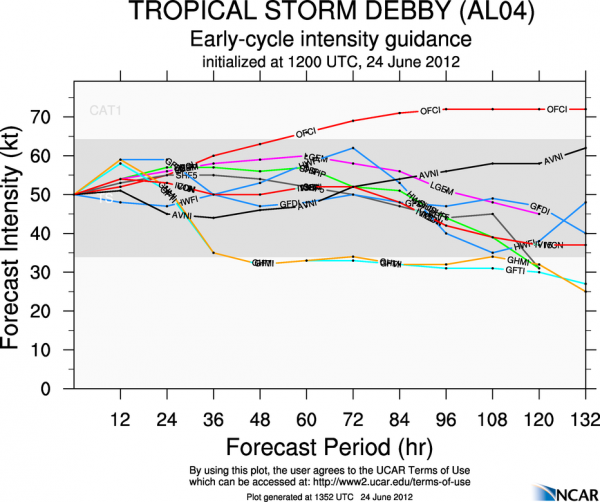
*Will Debby become a hurricane? Possible, but not likely. See model intensity output below. The main risk is from rain, flooding, and small spin-up tornadoes.
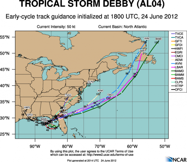
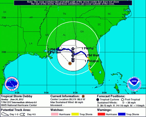
*Where will landfall occur? Model consensus is growing tonight; best bet seems to be east of Apalachicola.
But, understand uncertainty remains. And, Debby is a slow mover. Might not move inland until the latter half of the week. But also remember you really don’t need to focus on the center… most of the serious convection/rain is far removed… especially to the east. Below is the NHC updated forecast…
Don’t be surprised if this track is shifted east a bit in future updates.
*Is there a tornado threat? Yes, mainly over the Florida Peninsula. See the tornado watch up now…
The greatest risk of tornadoes will be east of the storm circulation center in coming days.
I honestly think the worst of the weather associated with Tropical Storm Debby will be from Fort Walton Beach east… but no doubt there will be a few showers and storms in places like Pensacola and Gulf Shores as well. Stay tuned for more updates… I will have a Weather Xtreme video posted by 6:30 a.m. tomorrow…
Category: Tropical


