

Sunday Evening Thoughts
Let’s try and answer your questions concerning Alabama’s weather tonight and tomorrow.
RIGHT NOW: A large rain mass is over North and Central Alabama. The air is cool and stable for now, and there is no severe weather. I don’t expect any through the evening hours.
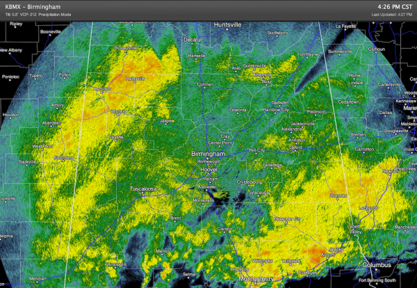
Many churches have Christmas music programs tonight; severe weather won’t be a problem, but needless to say the weather will be wet.
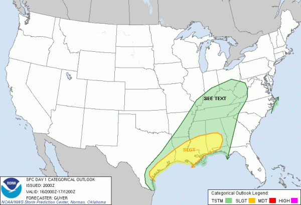
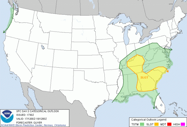
SEVERE WEATHER LATE TONIGHT? SPC maintains their standard “slight risk” of severe weather for roughly the southern half of Alabama… south of a line from Livingston to Clanton to Rockford. The primary risk comes after midnight when better dynamic forcing comes into play.
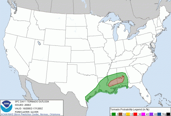
We note there is a low end tornado risk, mainly over Southwest Alabama…
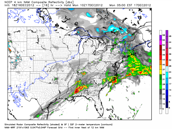
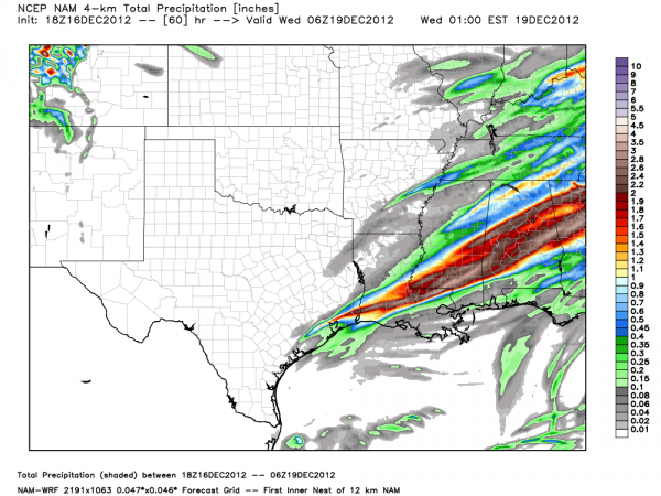
Below is the projected radar reflectivity at 4:00 a.m. tomorrow (from the 4km NAM)
And, tomorrow’s convective outlook…
HEAVY RAIN POTENTIAL: Sure looks like storm totals will exceed two inches around here… below is the projected rain through 60 hours…
I don’t think flash flooding will be a major concern since the ground isn’t saturated, but something to watch.
BOTTOM LINE: A marginal severe weather threat is ahead late tonight and tomorrow morning, mainly for the southern half of Alabama, south of a line from Livingston to Clanton to Roanoke. While an isolated severe storm is possible over North Alabama, the air will be pretty stable there.
An MCS (mesoscale convective system) type feature will likely move across South Alabama after 2:00 a.m., continuing into early Monday morning. There will be sufficient instability and shear for a few severe storms. The main threat will be from damaging winds, although an isolated tornado can’t be ruled out. Be sure your NOAA Weather Radio, or smart phone app you use for warnings, is in proper working order in case some warnings are needed after midnight or early tomorrow.
AND… Another system would bring a severe weather threat to Alabama Wednesday night into Thursday; more about that one tomorrow morning.
NOTE: I get hundreds of questions on social media… mainly about weather for a specific neighborhood, town, or county. Most of the weather threats here in our state are broad and impact a large area; if you take the time to read this discussion (THANK YOU for doing it), then you can see if you are in a risk area. Time doesn’t allow us to go through every small town and neighborhood.
We will have running updates on the blog tonight as the weather unfolds…
Category: Alabama's Weather
About the Author (Author Profile)
James Spann is one of the most recognized and trusted television meteorologists in the industry. He holds the AMS CCM designation and television seals from the AMS and NWA. He is a past winner of the Broadcast Meteorologist of the Year from both professional organizations.Subscribe
If you enjoyed this article, subscribe to receive more just like it.


