

Mid Day Check
Heavy rain has been falling in many areas for much of the morning. Severe weather continues to shift into East Alabama. Several flash flood warnings are in effect including Jefferson County and downtown Birmingham. Other areas to the east under flash flood warning include: St. Clair, Talladega, Calhoun, Cleberne and Clay Counties. Radar estimates in some areas are over two inches.Numerous other locations across the state are reporting excessive run-off and flooding conditions.
Light to moderate rain continues to fall in Tuscaloosa, Birmingham, Cullman, Gadsden and Anniston. The heaviest activity has shifted to our south from Prattville and the Interstate 65 cooridor to Mobile and along the Interstate 85 corridor. As the rain falls, and cooler temperatures settle in the severe weather threat continues to diminish.
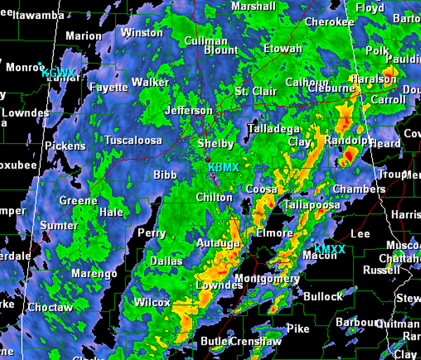
The threat for severe weather continues into the early afternoon in some of our southeastern areas including, Auburn, Tuskegee, Montgomery, Troy and Phenix City.
Category: Alabama's Weather
About the Author (Author Profile)
Macon, Georgia Television Chief Meteorologist, Birmingham native, and long time Contributor on AlabamaWX. Stormchaser. I did not choose Weather, it chose Me. College Football Fanatic. @Ryan_StinnetSubscribe
If you enjoyed this article, subscribe to receive more just like it.


