Severe Cold Wave Ahead
Brian will be along shortly with his discussion and a new Weather Xtreme video.
A few notes on the Arctic cold…
TODAY: Rain showers will break out this afternoon ahead of the Arctic front; the day will be cloudy and breezy with a high in the 50-55 degree range.
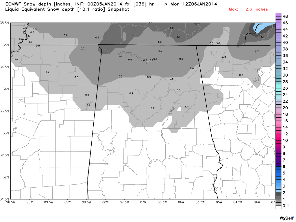
RAIN CHANGING TO LIGHT SNOW TONIGHT: Once the Arctic boundary passes, we will have a rapid drop in temperature (a flash freeze), with temperatures dropping into the 20s in a matter of only 30 minutes or so. The rain changes to freezing rain, and then light snow before ending across North Alabama, with some potential for a dusting to 1/2 inch of snow. As stated in recent days, the snow is no “big deal” in the overall scheme of things… the severe cold is the big story. The ECMWF model still suggests a light dusting down to near I-20.
The NWS offices in Huntsville and Birmingham have issued winter weather advisories for most of North and Central Alabama for the wintry precipitation tonight. The greatest risk of freezing rain/snow will come from 6:00 tonight through 6:00 a.m. tomorrow. The main issue will be with icy spots on roads with the “flash freeze”.
Icy spots on roads are likely as far south as Pickens, Tuscaloosa, Bibb, Shelby, Talladega, Clay, and Randolph Counties. However, isolated icy patches could be seen as far south as U.S. 80, but the roads over the southern half of the state will be mostly dry.
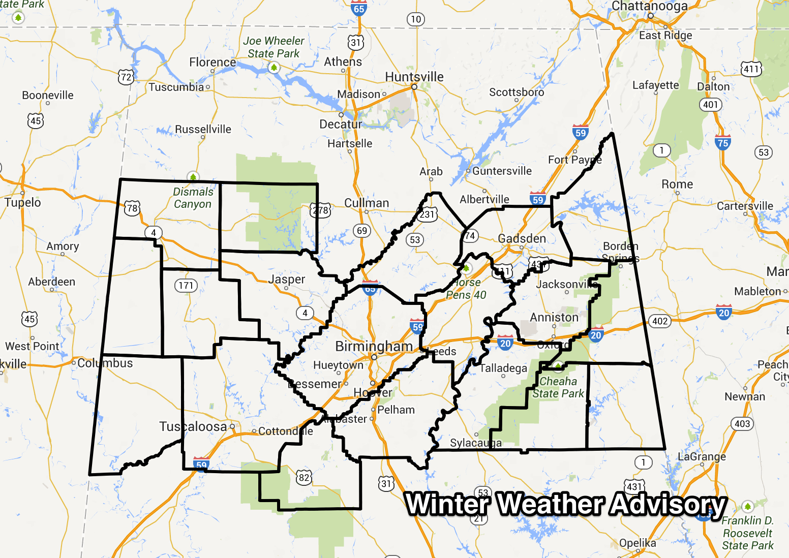
The graphic here is the winter weather advisory for counties in the Birmingham NWS forecast area only; to the north the NWS office in Huntsville has issued a winter weather advisory for Marshall, Jackson, and DeKalb Counties in their county warning area. But, don’t get hung up in weather service county areas… patchy ice is possible over ALL of North Alabama tonight.
DRIVING CONDITIONS: Any standing water from the afternoon rain showers will freeze quickly, and the light snow could also create a few icy spots. While the ice on roads probably won’t be especially widespread, it is a real issue, and if you are driving tonight or tomorrow morning be aware of this potential and be extremely careful. You don’t want to get into an accident with very low temperatures and sub-zero wind chill values late tonight.
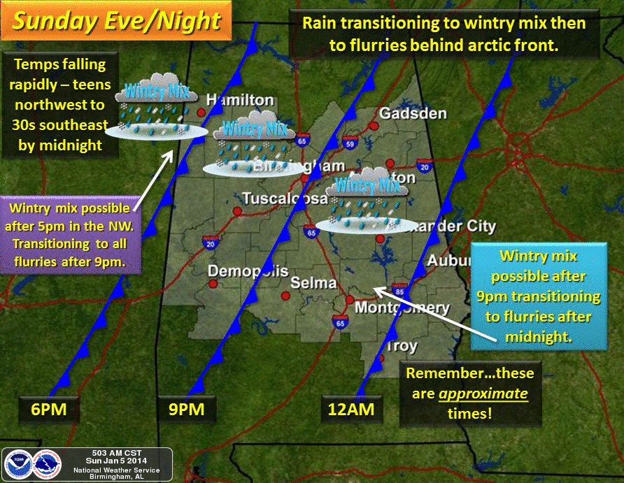
TIMING: The change from rain to freezing rain/snow will begin around the northwest corner of Alabama close to 6:00 p.m… reaching I-59 (Birmingham, Tuscaloosa, Gadsden) around 8-9 p.m… and then into East Alabama by 10:00 p.m.
POWER OUTAGES? While a brief period of freezing rain is expected as we make the change to light snow, ice accumulation will not be enough for power outages. However, with strong north winds of 15-30 mph developing, downed limbs could create isolated outages.
BIG TIME COLD: This is the big story. Most of North-Central Alabama will be below freezing for over 60 consecutive hours, from tonight through midday Wednesday.
TOMORROW: We will drop into the mid teens early tomorrow, and with north winds of 15-30 mph, the wind chill index tomorrow morning will be as low as ten degrees below zero. The high tomorrow will be only in the low 20s, and the wind chill index will stay below zero much of the day due to the harsh winds. A few show showers or flurries are possible in the cold air, mainly tomorrow morning.
The last time we had a day with a high under 25 degrees was on February 4, 1996
SCHOOL DELAYS: Many school systems are delaying opening tomorrow (and in some cases Tuesday and Wednesday). See the list on the ABC 33/40 site here.
TUESDAY: We will see a low between 5 and 10 degrees early Tuesday. The latest guidance is still suggesting there will be enough wind for sub-zero wind chill indices during the morning hours. And, we won’t get past the mid 20s during the day despite a sunny sky. Tuesday morning should be our coldest morning since February 5, 1996 when our low was 6 degrees.
WEDNESDAY: We will be down in the 10-15 degree range at daybreak Wednesday, but finally we climb above freezing by Wednesday afternoon.
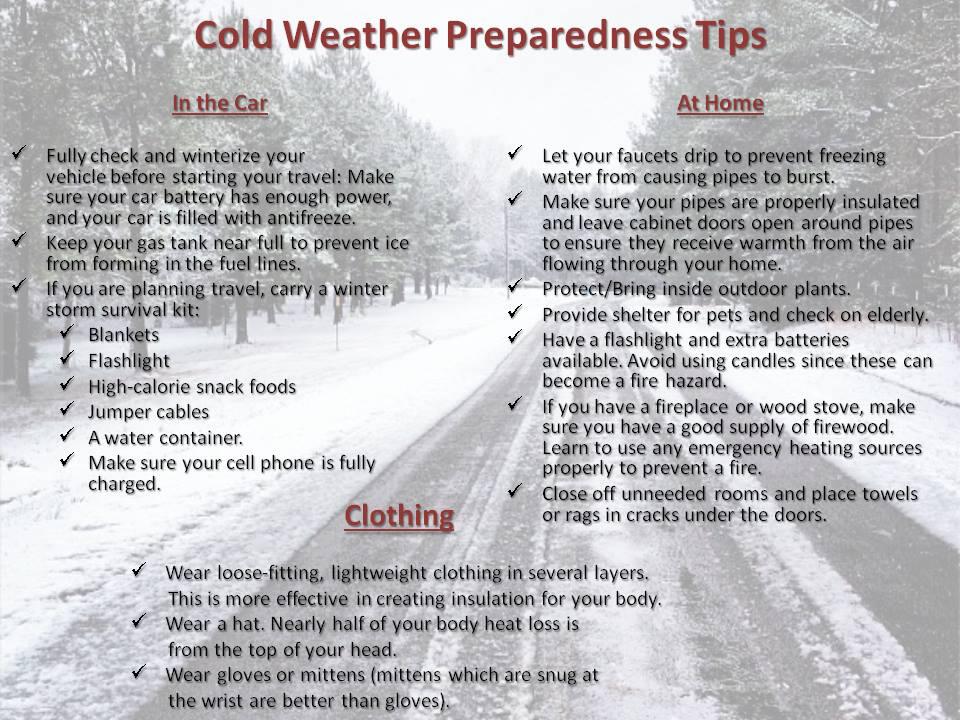
Be sure and check on older people that might not have an adequate source of heat today.
We will have frequent updates on this cold wave, so stay tuned…
Category: Alabama's Weather
About the Author (Author Profile)
James Spann is one of the most recognized and trusted television meteorologists in the industry. He holds the AMS CCM designation and television seals from the AMS and NWA. He is a past winner of the Broadcast Meteorologist of the Year from both professional organizations.Subscribe
If you enjoyed this article, subscribe to receive more just like it.


