

Cold, Wintry Day
**No afternoon Weather Xtreme video; we are in Gadsden for opening night of Storm Alert 2014**
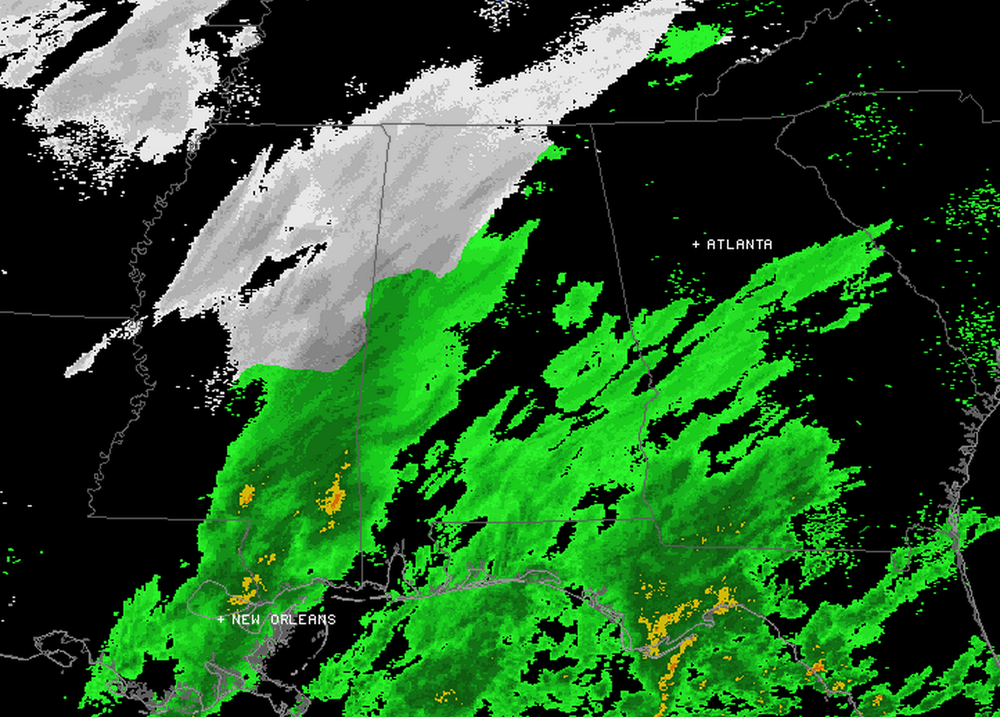
RADAR UPDATE: Sometimes on days like today, the radar can be misleading. Almost everything you see over North Alabama is not reaching the ground due to dry air in the low levels.
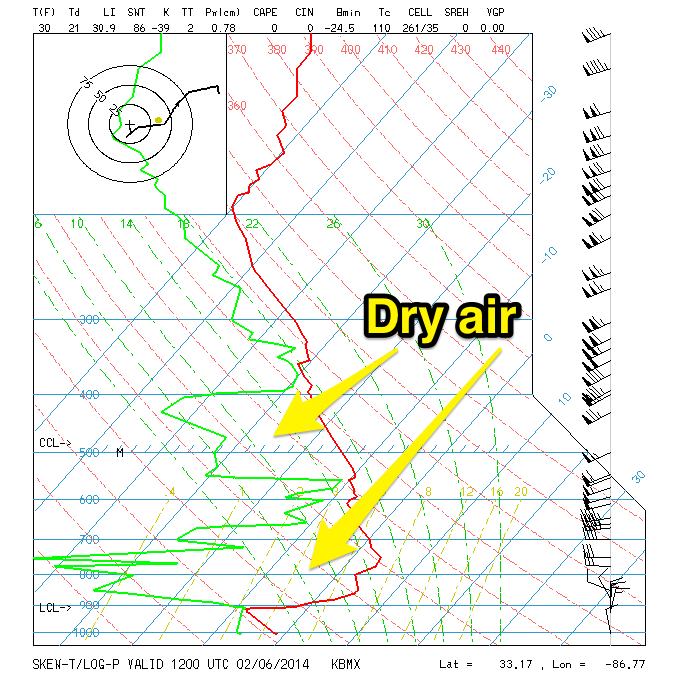
This is the morning sounding from the Shelby County Airport…
Snow flurries are certainly possible for places like Tuscaloosa, Birmingham, Anniston, and Gadsden this evening, but the dry air will prevent any major snow issues. Temperatures are also above freezing in these places.
Yes, I know many schools are closing early. This is simply a function of the “busted” forecast last week, and being safe rather than sorry. But, we do not expect travel issues across the I-20/59 corridor due to the flurries.
TO THE SOUTH: The NWS offices in Birmingham and Mobile have issued a winter weather advisory for Sumter, Marengo, Choctaw, Clarke, Monroe, Washington, Wilcox counties in Southwest Alabama, where moisture is deeper, and some light accumulation of sleet and snow is possible this evening. This is not anywhere near Birmingham… is is basically from Demopolis and Livingston south to Camden, Monroeville, and Butler.
The light wintry mix will end tonight as the wave moves east of Alabama.
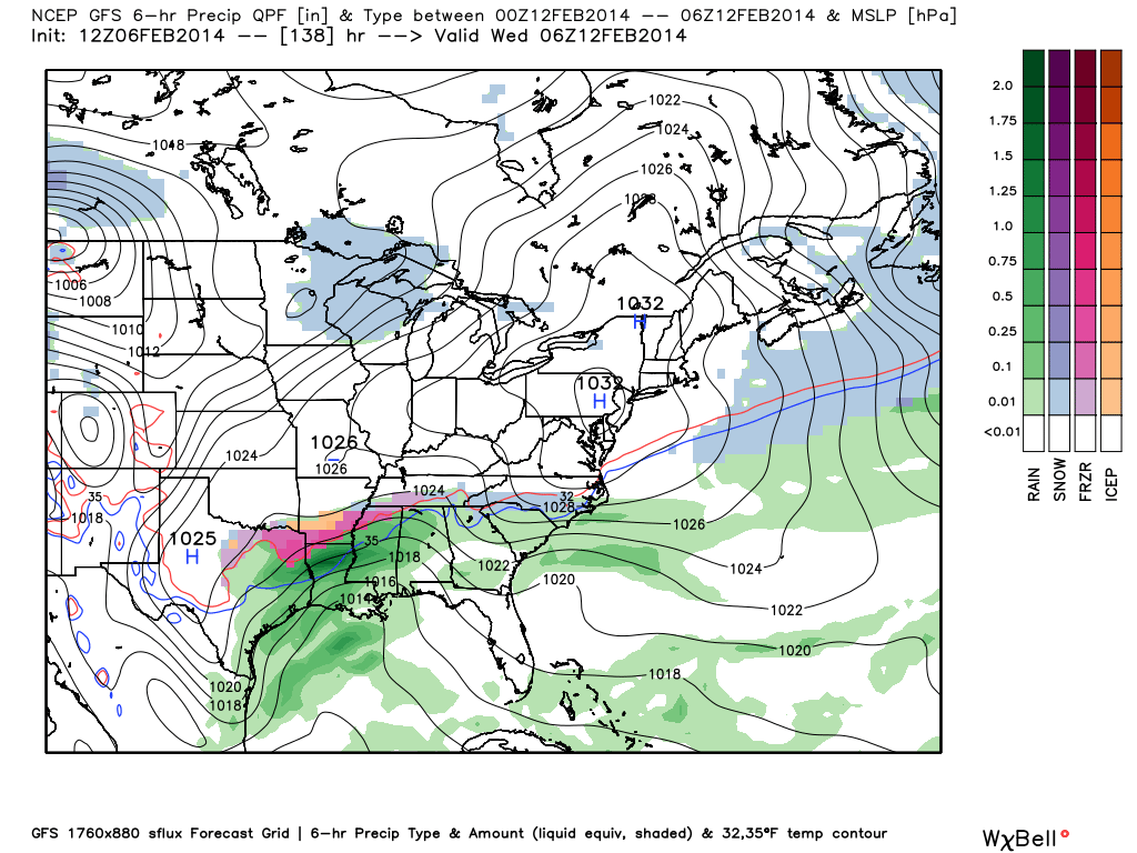
OUR NEXT ISSUE: Another wave will bring the risk of a little light precipitation to Alabama tomorrow night and very early Saturday. Much like the system today, some of this could fall in the form of light snow or sleet over North Alabama. At the moment is looks like the precipitation will be light, but we will need to keep an eye on developments to the west. Some light rain is possible over South Alabama from this wave. The precipitation will end by 6:00 a.m. Saturday in most places.
REST OF THE WEEKEND: Looks dry and warmer. The sun should pop out Saturday afternoon, and Sunday will be partly sunny. The high both days will be in the mid to upper 50s.
NEXT WEEK: The next major wave will bring rain back into Alabama late Tuesday, Tuesday night, and Wednesday. We will need to watch the northern periphery of the precipitation in Alabama for wintry weather potential with this one as well.
Will have much more on this early tomorrow morning.
STORM ALERT 2014: The first stop on our annual severe weather awareness tour is tonight… we will be at Gadsden City High School. The show begins at 6:30… the first 300 get a cool gift, and you will learn how to keep your family safe during severe weather. Hope to see many of you there.
WEATHER BRAINS: Don’t forget you can listen to our weekly 90 minute netcast anytime on the web, or on iTunes. This is the show all about weather featuring many familiar voices, including our meteorologists here at ABC 33/40.
CONNECT: You can find me on all of the major social networks…
Facebook
Twitter
Google Plus
Instagram
Stay tuned to the blog for updates this evening…
Category: Alabama's Weather
About the Author (Author Profile)
James Spann is one of the most recognized and trusted television meteorologists in the industry. He holds the AMS CCM designation and television seals from the AMS and NWA. He is a past winner of the Broadcast Meteorologist of the Year from both professional organizations.Subscribe
If you enjoyed this article, subscribe to receive more just like it.


