

Light Snow Falling over West Alabama
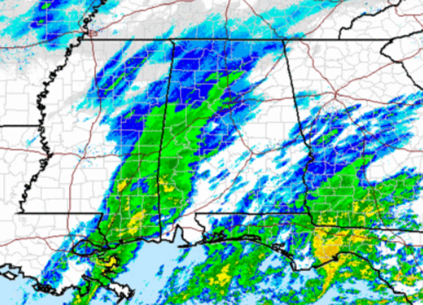
The expected wintry precip for today is pushing into our western counties. Snow is now reaching the ground in Livingston, Cuba, York, Eutaw and Forkland but no significant accumulations being reported. The police chief in Cuba is reporting 1/4″ of snow has accumulated, which is well within the Advisory criteria. He also says no problems with the roads and that they are only wet at this time.
Light snow also being reported in Hamilton in Marion County as well as Northport and Tuscaloosa.
From NWS Jackson, snow has accumulated on grassy areas in Quitman, MS, just south of Meridian.
Surface temps remain above freezing this afternoon. Birmingham is currently at 35, Tuscaloosa at 36, and Anniston is 38. Similar temps across all of Central Alabama.
The air is also very dry. Most of the precipitation is evaporating before reaching the surface and the radar is very misleading today. Most of what is showing up on the radar has yet to reach the surface. The only areas seeing the wintry precip at the surface were the ones mentioned above. The heaviest precip band will stay south of Interstate 20 today.
We could see the Winter Weather Advisory expanded east as this system slides east. This remains a quick hitting winter weather event. The precip has already ended in Central Mississippi and is now approaching the Meridian, Mississippi area. This event is nothing like we saw last week.
Category: Alabama's Weather, Winter Weather
About the Author (Author Profile)
Macon, Georgia Television Chief Meteorologist, Birmingham native, and long time Contributor on AlabamaWX. Stormchaser. I did not choose Weather, it chose Me. College Football Fanatic. @Ryan_StinnetSubscribe
If you enjoyed this article, subscribe to receive more just like it.


