

Cold and Wet
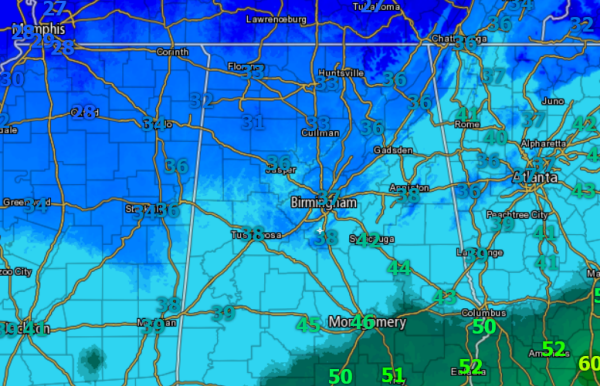
Temperatures continue to drop across north-central Alabama this morning. Most locations along the Interstate 20 corridor have now dropped into the 30s and those temps are going to continue to fall the next few hours. Haleyville has dropped below freezing and many areas along the U.S. 278 corridor are flirting with the freezing mark currently.
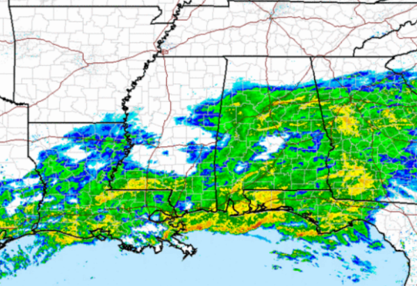
We are beginning to see the precip taper off across northern portions of the state this morning. The back edge of the main precip shield is approaching the Alabama/Mississippi border and we should see the precip taper off from west to east across the state during the morning hours.
We have seen a few reports of some sleet mixing in with the rain in areas to the north. Reports from Etowah, Cullman, Marion, and Fayette Counties confirm light to moderate sleet falling with the rain. We will likely see similar reports the next few hours as we will see a chance of a rain/sleet/snow mixture.
Everything looks fine this morning as well and the forecast looks to remain on track. No road issues being reported currently. The majority of the precip will be exiting the region by mid-morning.
Category: Alabama's Weather, Winter Weather
About the Author (Author Profile)
Macon, Georgia Television Chief Meteorologist, Birmingham native, and long time Contributor on AlabamaWX. Stormchaser. I did not choose Weather, it chose Me. College Football Fanatic. @Ryan_StinnetSubscribe
If you enjoyed this article, subscribe to receive more just like it.


