

Rain/Storms This Afternoon And Tonight
An all new edition of the ABC 33/40 Weather Xtreme video is available in the player on the right sidebar of the blog. You can subscribe to the Weather Xtreme video on iTunes by clicking here.
EARLY THIS MORNING: Not much happening across our state at daybreak; only a lone shower near the Tennessee border as I write this. But, showers and storms should become widespread this afternoon and tonight ahead of a long wave upper trough and a surface cold front. SPC continues the standard “slight risk” of severe weather for a pretty part of North and Central Alabama…
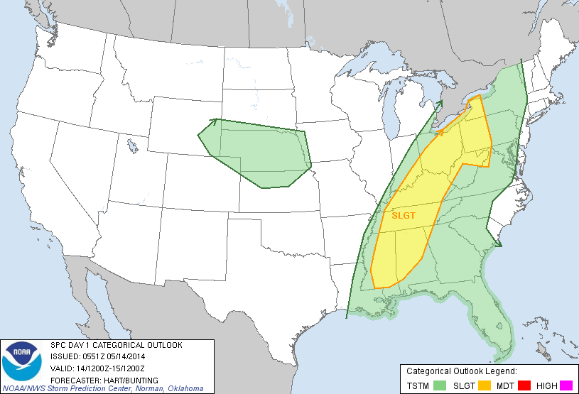
But, severe weather parameters are less than impressive with marginal instability and shear values, and relatively weak wind fields. If we have strong storms this afternoon or early tonight, the main risk is from hail and gusty winds. The tornado threat should be confined to areas well to the north of Alabama.
Rain amounts of 1/2 to 1 inch are likely here, but heavier totals are possible to the south. NWS offices in Mobile and Tallahassee have issued flash flood watches for parts of far South Alabama.
MUCH COOLER TOMORROW: The rain will end from west to east early tomorrow morning; for many communities the rain will be over by daybreak. The day will be breezy and much cooler with a high only in the mid 60s; the average high for May 15 in Birmingham is 81. The sky should become partly sunny during the day as dry air takes over. And, tomorrow night, temperatures will drop quickly, and we expect temperatures down in the mid 40s by early Thursday morning.
FRIDAY AND THE WEEKEND: A long wave upper trough over the eastern third of the nation will keep temperatures below average; the high Friday will be near 70, followed by mid 70s Saturday, and upper 70s Sunday. Each day will be partly sunny, and we can’t completely rule out a touch of light rain over far North Alabama each day, but the air will be pretty dry, and the chance of significant rain for places like Birmingham, Tuscaloosa, Anniston, and Gadsden is tiny.
NEXT WEEK: The first half of the week will be dry with highs getting back in the 80s. See the Weather Xtreme video for the maps, graphics, and details.
AT THE BEACH: Showers and storms are likely today and tonight from Panama City to Gulf Shores, and a flash flood watch is in effect. Showers will end tomorrow, and the weather looks delightful Friday through Sunday with sunny days and fair nights. Highs on the immediate coast will be mostly in the upper 70s, and sea water temperatures are in the mid to upper 70s. A perfect weekend for the Hangout Music Festival in Gulf Shores.
WEATHER RADIO PROGRAMMING: We will be at the Publix on Highway 150 in Hoover today from 3:30 until 6:30… if you need help with your weather radio, come see us.
WEATHER BRAINS: Don’t forget you can listen to our weekly 90 minute netcast anytime on the web, or on iTunes. This is the show all about weather featuring many familiar voices, including our meteorologists here at ABC 33/40.
CONNECT: You can find me on all of the major social networks…
Facebook
Twitter
Google Plus
Instagram
I have a weather program this morning for the kids in the gifted program in St. Clair County (I will speak at the John Pope Eden Vocational School in Ashville). Look for the next Weather Xtreme video here by 4:00 this afternoon. Enjoy the day…
Category: Alabama's Weather
About the Author (Author Profile)
James Spann is one of the most recognized and trusted television meteorologists in the industry. He holds the AMS CCM designation and television seals from the AMS and NWA. He is a past winner of the Broadcast Meteorologist of the Year from both professional organizations.Subscribe
If you enjoyed this article, subscribe to receive more just like it.


