

Cold Front Creeps Into Alabama Later Today
An all new edition of the ABC 33/40 Weather Xtreme video is available in the player on the right sidebar of the blog. You can subscribe to the Weather Xtreme video on iTunes by clicking here.
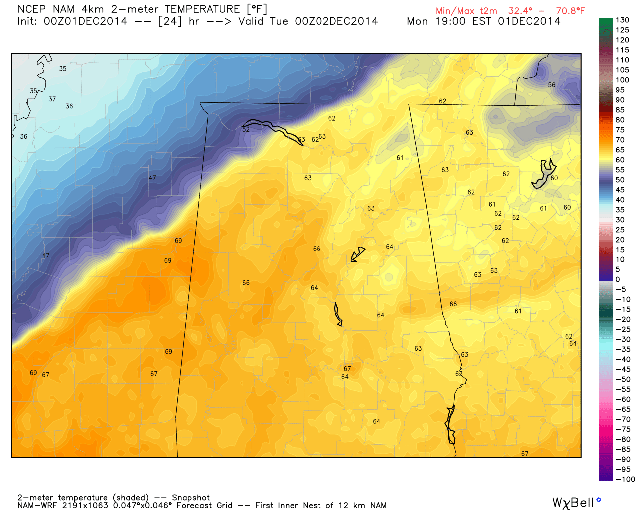
MOST OF THE STATE STAYS MILD: A cold front is approaching Memphis early this morning; ahead of the front it is relatively mild across Alabama, and some dense fog has formed in spots. The NWS in Birmingham has issued a Dense Fog Advisory for that part of the state south of a line from Tuscaloosa to Eufaula. Temperatures will rise into the 67 to 70 degree range this afternoon; the sky will be occasionally cloudy. We can’t rule out a few showers this afternoon and tonight over the northern counties of the state, especially north of Birmingham, close to the surface front. Rain will be light and spotty.
BIG THERMAL CONTRAST: If you live in Muscle Shoals, Florence, Sheffield, or Tuscumbia, up in the northeast corner of the state, you might be in the 60s late this afternoon, or you might be close to 40. It is all a matter of where the front stalls. Gut feeling says the Quad-Cities will be in colder air by late afternoon, but the rest of the state stays mild.
REST OF THE WEEK: The front will slowly wash out and lift northward tomorrow, and we stay in relatively mild air through at least Friday. The average high for December 1 (for Birmingham) is 60 degrees, and we will be about 7 to 10 degrees above that this week. We will mention a small risk of a shower tomorrow afternoon over North Alabama, but Wednesday and Thursday look generally dry with only isolated showers. The sky will be cloudy at times.
An upper wave will approach at the end of the week Friday, and a few showers are possible Friday afternoon and Friday night, especially north of Birmingham. Again, the rain won’t be really heavy or widespread.
THE ALABAMA WEEKEND: Not much change. The weather stays mild with highs in the 60s, and we will mention the chance of a few showers, mainly from Birmingham north. No widespread or heavy rain, just the risk of a passing shower from time to time. A little sun is possible, but there will be more clouds than sun both days.
LONG RANGE: No sign of any open door for really cold, Arctic air here in Alabama through mid-December. The 00Z GFS is showing a potential severe weather setup on December 13, but that is out in voodoo land, and just something to watch now. We do need to remember that November and December is the late fall tornado season, and having severe weather this time of the year is not unusual.
WEATHER BRAINS: Don’t forget you can listen to our weekly 90 minute netcast anytime on the web, or on iTunes. This is the show all about weather featuring many familiar voices, including our meteorologists here at ABC 33/40. We will produce this week’s show tonight at 8:30 CT… you can watch it on “James Spann 24/7” on cable systems around the state, or on the web here.
CONNECT: You can find me on all of the major social networks…
Facebook
Twitter
Google Plus
Instagram
I will be doing a weather program today at Mountain Brook Elementary School today… look for the next Weather Xtreme video here by 4:00 this afternoon. Enjoy the day!
Category: Alabama's Weather
About the Author (Author Profile)
James Spann is one of the most recognized and trusted television meteorologists in the industry. He holds the AMS CCM designation and television seals from the AMS and NWA. He is a past winner of the Broadcast Meteorologist of the Year from both professional organizations.Subscribe
If you enjoyed this article, subscribe to receive more just like it.


