

Wet Beginning To The Weekend
An all new edition of the ABC 33/40 Weather Xtreme video is available in the player on the right sidebar of the blog. You can subscribe to the Weather Xtreme video on iTunes by clicking here.
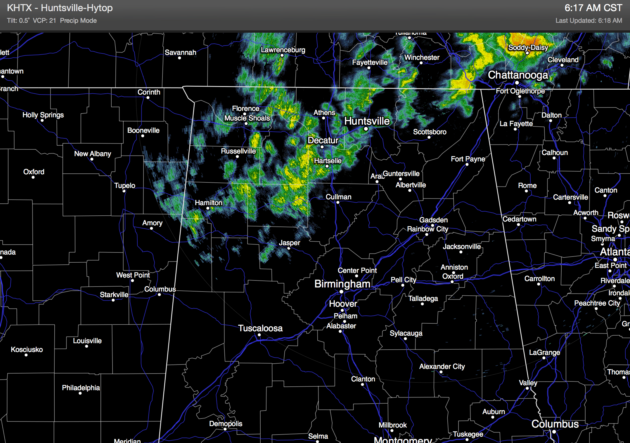
RADAR CHECK: At daybreak we have some rain falling over the Tennessee Valley region of extreme North Alabama; even a few reports of sleet mixed in with the rain around Elkmont and Cloverdale. This will stay generally north of a line from Sulligent to Jasper to Oneonta to Gadsden…
Today will be generally cloudy with a high not too far from the 50 degree mark. We note the average high for December 18 (for Birmingham) is 55 degrees.
WET START TO THE WEEKEND: A southwest flow aloft ahead of an upper trough in the southern branch of the jet stream will keep clouds over Alabama tonight and tomorrow, and with the approach of the main system rain will move in from the southwest during the day tomorrow. The places like Birmingham, Anniston, Gadsden, and Tuscaloosa, the primary threat of wet weather will come from about 2:00 p.m. tomorrow through 10:00 a.m. Saturday. The latest model runs have trended with a more southerly track to the main surface low, which should keep the heavier rain totals over South Alabama. Up our way, rain amounts should be somewhere in the 1/2 to 1 inch range. While some thunder is possible, there is no risk of severe weather for the northern two-thirds of the state.
Sunday looks like a dry day with a high in the 50s, but clouds could linger much of the day as another wave of low pressure forms in the northern Gulf of Mexico. As that wave moves northeast, it looks like we will need to introduce a chance of light rain Sunday night, mainly over the eastern half of the state. That batch of rain will end early Monday morning as the low moves on to the northeast.
CHRISTMAS WEEK: A cold front will bring a band of rain and thunderstorms to the state Tuesday afternoon and Tuesday night with a rapidly deepening surface low just to the north. We might see a few strong storms Tuesday evening, but at this point it looks like the instability values will be insufficient for a severe weather problem. Then, on Wednesday (Christmas Eve), the day will be breezy and colder with lingering clouds and a high in the 40s. There could be a touch of drizzle, or a few light flurries over the Tennessee Valley Wednesday morning, but the deeper moisture will be long gone by then, and precipitation should not be significant.
Christmas Day looks pretty decent with a good supply of sunshine; we start the day with a light freeze (lows between 28 and 32), and then we rise into the low 50s Thursday afternoon.
And, another wave has the potential to bring some rain back into the state Friday. See the Weather Xtreme video for maps, graphics, and more details.
WEATHER BRAINS: Don’t forget you can listen to our weekly 90 minute netcast anytime on the web, or on iTunes. This is the show all about weather featuring many familiar voices, including our meteorologists here at ABC 33/40.
CONNECT: You can find me on all of the major social networks…
Facebook
Twitter
Google Plus
Instagram
I will be doing my last weather program of 2014 today at Cherokee Bend Elementary School in Mountain Brook… look for the next Weather Xtreme video here by 4:00 or so this afternoon. Enjoy the day!
Category: Alabama's Weather
About the Author (Author Profile)
James Spann is one of the most recognized and trusted television meteorologists in the industry. He holds the AMS CCM designation and television seals from the AMS and NWA. He is a past winner of the Broadcast Meteorologist of the Year from both professional organizations.Subscribe
If you enjoyed this article, subscribe to receive more just like it.


