

Hale Storm Crossing Moving Toward Tuscaloosa/Bibb Counties.
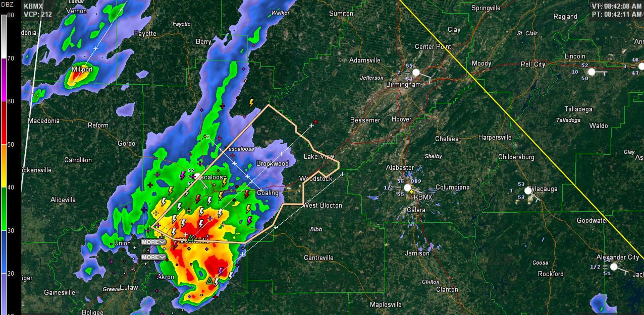
That is a beast of a storm this morning in Hale County. It is elevated in nature, which for our regular readers says that its base is in instability that is well above the surface layer. These storms are less likely to be severe and less likely to produce tornadoes, but can still be prolific hail, lightning and rain producers. And they still can produce strong gusty winds.
That is the case this morning with this storm, which is very organized. It has produced reflectivity returns over 70 dbz this morning which shows very heavy rainfall and has consistently indicated the potential for one inch sized hail.
Reports from Greensboro show nickel sized hail (0.88″) which is just below the severe limit, but larger hail likely fell to the north. Large tree limbs and branches were also reported down in Greensboro.
The storm weakened for a bit but has shown signs of intensifying in the past few minutes. The warning for Hale County continues until 8:45 but will not be extended into Tuscaloosa County. The NWS has chosen to go with a Significant Weather Advisory for Tuscaloosa County.
The storm will also affect northern Bibb County, including West Blocton. It should stay just north of Centreville.
The City of Tuscaloosa will get heavy rain and lightning.
The storm will reach southwestern Jefferson County between 9:30-9:45. It will impact the Birmingham area starting around 9:45 a.m. reaching downtown Birmingham around 10:15 a.m.
Category: Alabama's Weather, Severe Weather
About the Author (Author Profile)
Bill Murray is the President of The Weather Factory. He is the site's official weather historian and a weekend forecaster. He also anchors the site's severe weather coverage. Bill Murray is the proud holder of National Weather Association Digital Seal #0001 @wxhistorianSubscribe
If you enjoyed this article, subscribe to receive more just like it.


