

Cool Alabama Day; Some Afternoon Sun
An all new edition of the ABC 33/40 Weather Xtreme video is available in the player on the right sidebar of the blog. You can subscribe to the Weather Xtreme video on iTunes by clicking here.
THIS MORNING: Clouds are hanging over Alabama early this morning followed showers, and even a few thunderstorms produced by an intense “Alberta Clipper” system late yesterday and last night. Despite a cool, stable airmass and the lack of low level moisture, the very dynamic system was able to bring those showers and storms. Basically like squeezing blood out of a turnip.
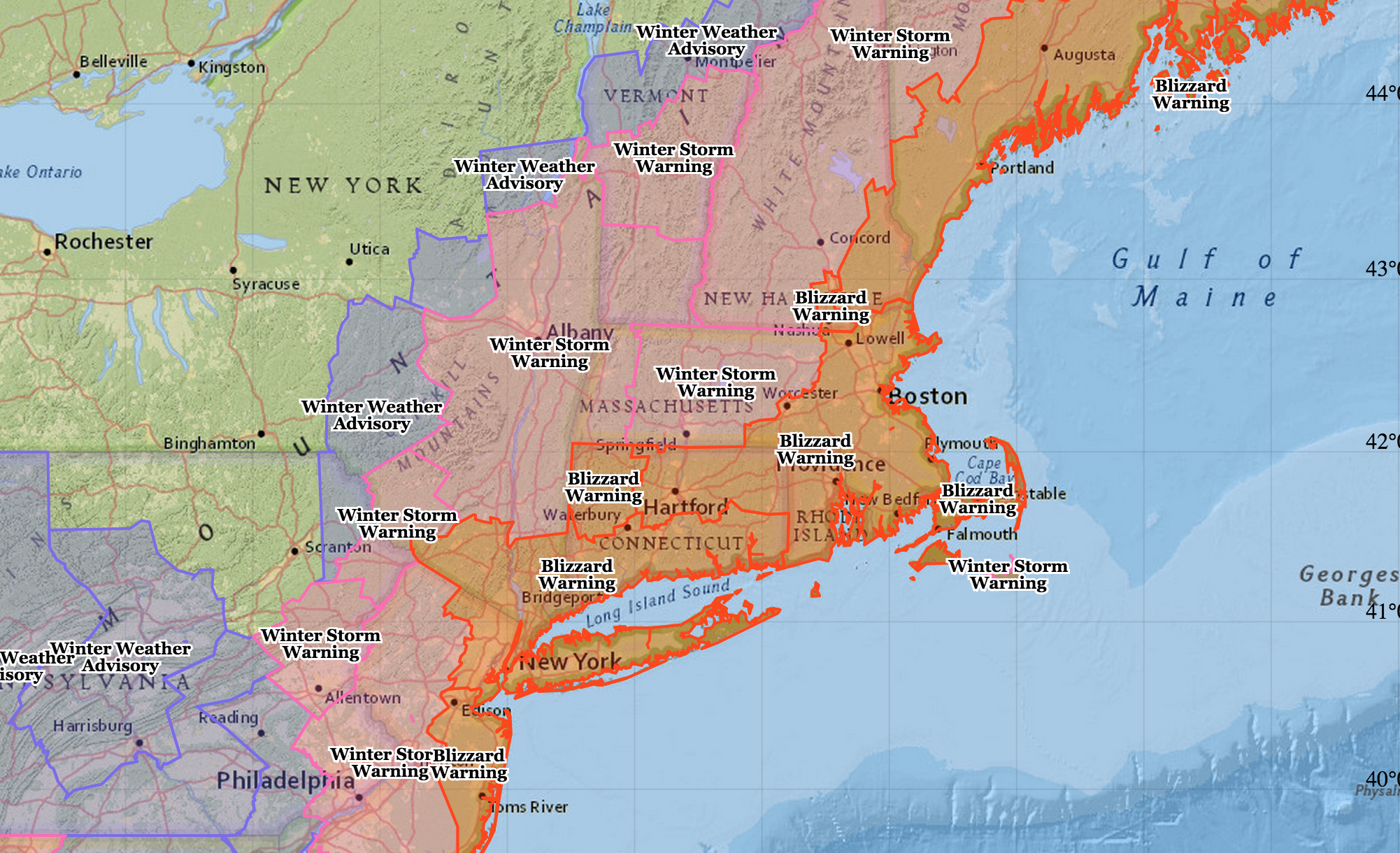
NORTHEAST U.S. BLIZZARD: That dynamic weather system will set up a blizzard from the coast of New Jersey to the coast of Maine tonight and tomorrow; over two feet of snow will fall in spots, and winds near the coast will gust to over 50 mph. New York City and Boston are under blizzard warnings, and air traffic across much of the nation will be greatly impacted.
OUR MONDAY: Clouds will linger across Alabama this morning, but the sun should begin to break through this afternoon for most places. We won’t get past the mid 40s today. Tomorrow will be another cool day with intervals of sunshine and a high in the low 50s. Then, Wednesday promises to be a nice day, with sunshine in full supply and a high in the mid 50s.
ANOTHER CLIPPER: This one will be weaker, but might bring a brief shower to Northeast Alabama late Thursday or Thursday night; the rest of the state will stay dry with a high in the mid 50s Thursday afternoon, along with a mix of sun and clouds. Friday will be dry with a high in the mid 50s with ample sunshine.
THE ALABAMA WEEKEND: Saturday should remain dry, but clouds will begin to increase with a high in the mid 50s. Rain returns Sunday with a surface low moving right over Alabama; looks like rain will be a good possibility much of the day, with potential for 1/2 to one inch for most of the state.
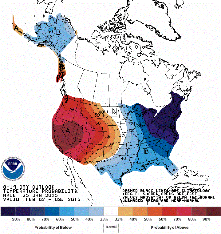
VOODOO LAND: Getting conflicting signals; the latest GFS suggests no real bitterly cold air for Alabama for the first 10 days of February… that same model was flashing different signs last week. The CPC outlook suggests below average temperatures for our state February 2-8, but the coldest air will most likely be shunted northeast of Alabama. And, no sign of any winter precipitation for now.
WEATHER BRAINS: Don’t forget you can listen to our weekly 90 minute netcast anytime on the web, or on iTunes. This is the show all about weather featuring many familiar voices, including our meteorologists here at ABC 33/40. We will produce this week’s show at 8:30 CT tonight, with a special 30 minute pre-show beginning at 8:00 CT that will focus on the Northeast U.S. blizzard. You can watch it on “James Spann 24/7” on cable systems around the state, or on the web here.
CONNECT: You can find me on all of the major social networks…
Facebook
Twitter
Google Plus
Instagram
I have a program today for the kids in the HeadStart program in Sumter County at Livingston; be looking for the next Weather Xtreme video here by 4:00 this afternoon. Enjoy the day!
Category: Alabama's Weather
About the Author (Author Profile)
James Spann is one of the most recognized and trusted television meteorologists in the industry. He holds the AMS CCM designation and television seals from the AMS and NWA. He is a past winner of the Broadcast Meteorologist of the Year from both professional organizations.Subscribe
If you enjoyed this article, subscribe to receive more just like it.


