

Temperatures Slowly Rising

Temperatures are above freezing late tonight along and south of a line from Fayette to Birmingport to the Birmingham Airport to Talladega to Lincoln to Jacksonville.
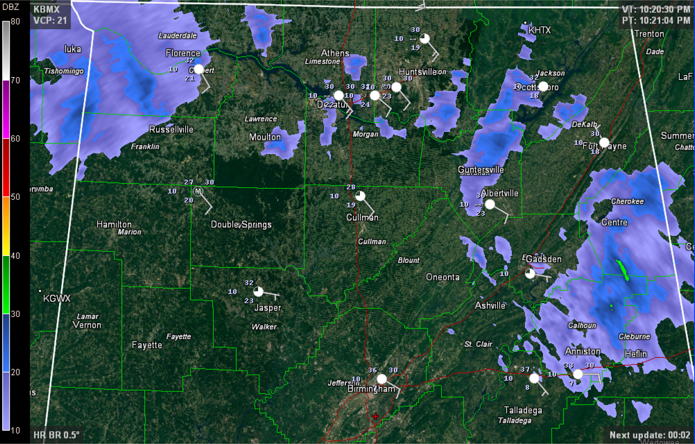
A batch of light to moderate rain and freezing rain is passing out of Cherokee, Calhoun and Cleburne Counties.
Patches of light freezing rain continue across the Tennessee valley. Freezing rain was accumulating again around Scottsboro as well as in Huntsville at UAH and in Guntersville. There is 1.5 inches of snow and 1/8 of an inch of ice at Ider.
Temperatures should continue to slowly warm through the overnight hours across the area with the freezing rain gradually giving over to plain rain.
Roads will continue to be hazardous in areas that have received freezing rain, sleet and snow. Be very, very careful if you must travel.
ALABAMA POWER IS READY, ARE YOU? Our friends at Alabama Power are monitoring the forecast closely, ready to deploy people and assets to quickly address any outages that might occur. Read a special message from Ike Piggot about their commitment to their customers.
Category: Alabama's Weather, Winter Weather
About the Author (Author Profile)
Bill Murray is the President of The Weather Factory. He is the site's official weather historian and a weekend forecaster. He also anchors the site's severe weather coverage. Bill Murray is the proud holder of National Weather Association Digital Seal #0001 @wxhistorianSubscribe
If you enjoyed this article, subscribe to receive more just like it.


