

Strong Storms Possible Later Today
An all new edition of the ABC 33/40 Weather Xtreme video is available in the player on the right sidebar of the blog. You can subscribe to the Weather Xtreme video on iTunes by clicking here.
AT DAYBREAK: It is a cold morning over Northeast Alabama; our Skywatcher at Black Creek (just northeast of Gadsden), Vic Bell, reports 35 degrees… Fort Payne is at 36. A touch of frost is even possible in the colder valleys up that way; but most places are in the upper 40s and low 50s. The sky is generally clear.
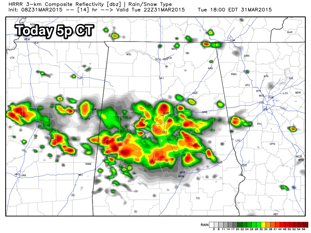
Clouds will increase today, and showers and storms will begin to develop this afternoon. The guys at SPC have much of Alabama in a “marginal” severe weather risk…
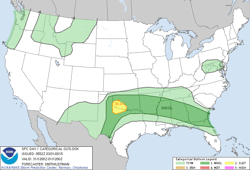
Surface based CAPE values are expected to rise to near 1,000 j/kg this afternoon, and with decent lapse rates we could see a few storms with hail and strong gusty winds. The main threat of the stronger storms will come from about 2:00 until 7:00 p.m.
Temperatures should reach the low to mid 70s this afternoon.
TOMORROW/THURSDAY: Any showers across Alabama tomorrow should be pretty isolated; the day will be partly sunny with a high in the upper 70s; the chance of any one spot getting wet is only about one in five. Scattered showers and storms will be a bit more likely Thursday, but even then it certainly won’t rain all day, and there will be some nice intervals of sunshine. Thursday’s high will be very close to 80 degrees.
FRIDAY FRONT: A cold front will bring an organized band of showers and thunderstorms to the state Friday afternoon and Friday night, and some of these storms could be strong, possibly severe. SPC has a severe weather risk defined for the northwest counties of the state; hail and strong winds will be the primary threat. For now it looks like the core threat of showers and storms will come from about 3:00 p.m. through 12:00 midnight Friday.
EASTER WEEKEND: Cooler and drier moves into the state Saturday; the day will be mostly sunny with a high in the 60s. Sunday morning will be pretty chilly; we drop into the 40-45 degree range, with 30s likely for the colder valleys across North Alabama, where some scattered frost is not out of the question. Then, with a good supply of sunshine we warm into the low 70s Sunday afternoon.
NEXT WEEK: Moist air returns Monday along with a chance of showers and thunderstorms… see the Weather Xtreme video for maps, graphics, and more details.
AT THE BEACH: Very nice weather continues this week from Panama City over to Gulf Shores with mostly sunny days and fair nights; highs will be in the 70s, and lows in the 60s. A few widely scattered showers could show up late Friday and Saturday, but even then most of the weekend will be rain-free. The sea water temperature early this morning at the Dauphin Island Sea Lab is a cool 65 degrees.
WEATHER BRAINS: Don’t forget you can listen to our weekly 90 minute netcast anytime on the web, or on iTunes. This is the show all about weather featuring many familiar voices, including our meteorologists here at ABC 33/40. Scroll down for the show notes on the new episode we recorded last night.
CONNECT: You can find me on all of the major social networks…
Facebook
Twitter
Google Plus
Instagram
I have a weather program this morning at White Plains Elementary School in Calhoun County… be looking for the next Weather Xtreme video here by 4:00 this afternoon… enjoy the day!
Category: Alabama's Weather
About the Author (Author Profile)
James Spann is one of the most recognized and trusted television meteorologists in the industry. He holds the AMS CCM designation and television seals from the AMS and NWA. He is a past winner of the Broadcast Meteorologist of the Year from both professional organizations.Subscribe
If you enjoyed this article, subscribe to receive more just like it.


