

Severe Weather Risk Tomorrow
COOL START: Another cool April morning across North Alabama; Fort Payne reports 37… our Skywatcher at Black Creek (just northeast of Gadsden), Vic Bell, reports 39, and Cullman is at 42. We rise into the 70s this afternoon with intervals of sunshine. The bulk of the day will be dry.
WET TONIGHT: A large mass of rain and storms, associated with a northward moving warm front, will overspread the state. The latest high resolution HRRR model hints that the rain could begin this evening, in the 5:00 to 7:00 time frame. Expect periods of rain and a few thunderstorms through the night; the rain could be heavy at times, and a strong storm is certainly possible. SPC has a “marginal” risk of severe storms into the western half of Alabama late tonight, but most of the storms will be elevated, and the risk of organized severe weather is fairly small (but not zero). Rain amounts of 1/2 to 1 inch look likely overnight.
SEVERE WEATHER THREAT TOMORROW: We have higher confidence in the scenario for tomorrow; SPC maintains the standard “slight” severe weather risk for much of the state, with an “enhanced” risk over far North Alabama and up into Tennessee.
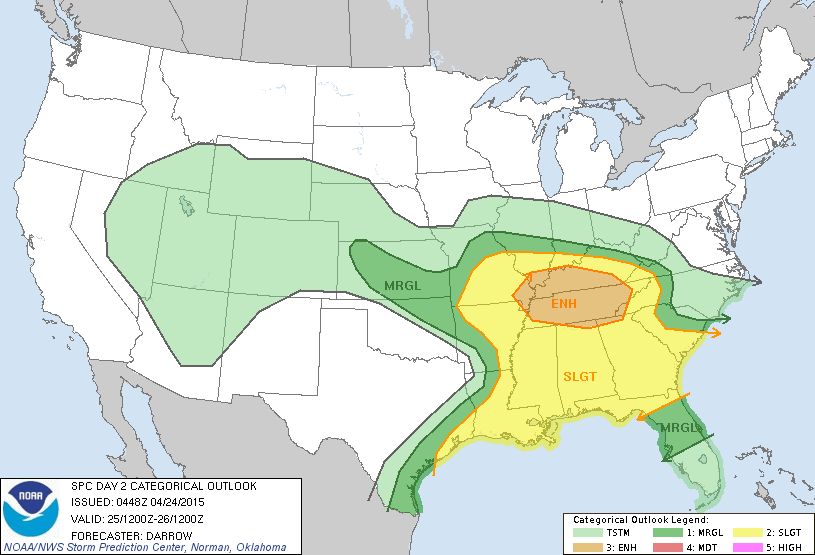
The air will be very unstable tomorrow afternoon, with surface based CAPE values exceeding 3,000 j/kg in spots over North Alabama. Low level helicity values will be supporting of rotating updrafts, and lapse rates hint that some large hail is possible in stronger storms that form late in the day.
Here is what to expect….
*The overnight batch of storms will end early in the day, and a decent part of the mid-day hours will be dry with the sun breaking out. Temperatures will rise into the low 80s, maybe even mid 80s in parts of West Alabama by afternoon.
*New storms will begin to form in the 3:00 to 6:00 p.m. time frame. It is important to note that not everyone will see an afternoon or evening storm; they will be scattered in nature.
*Where storms do form, they would be severe, with potential for large hail, damaging winds, and a few isolated tornadoes.
*The tornado threat is highest across the Tennessee Valley region of far North Alabama, where dynamic support will be greater, and wind fields stronger. But, an isolated tornado can’t be ruled out down into Central Alabama.
*Greatest risk of severe storms will come from roughly 3:00 until 9:00 p.m.
This type of event is pretty common in Alabama in late April; no need to be alarmed or worried. Just pay attention to weather developments, and have a good way of hearing severe weather watches and warnings as they are needed. We will have frequent updates here on the blog.
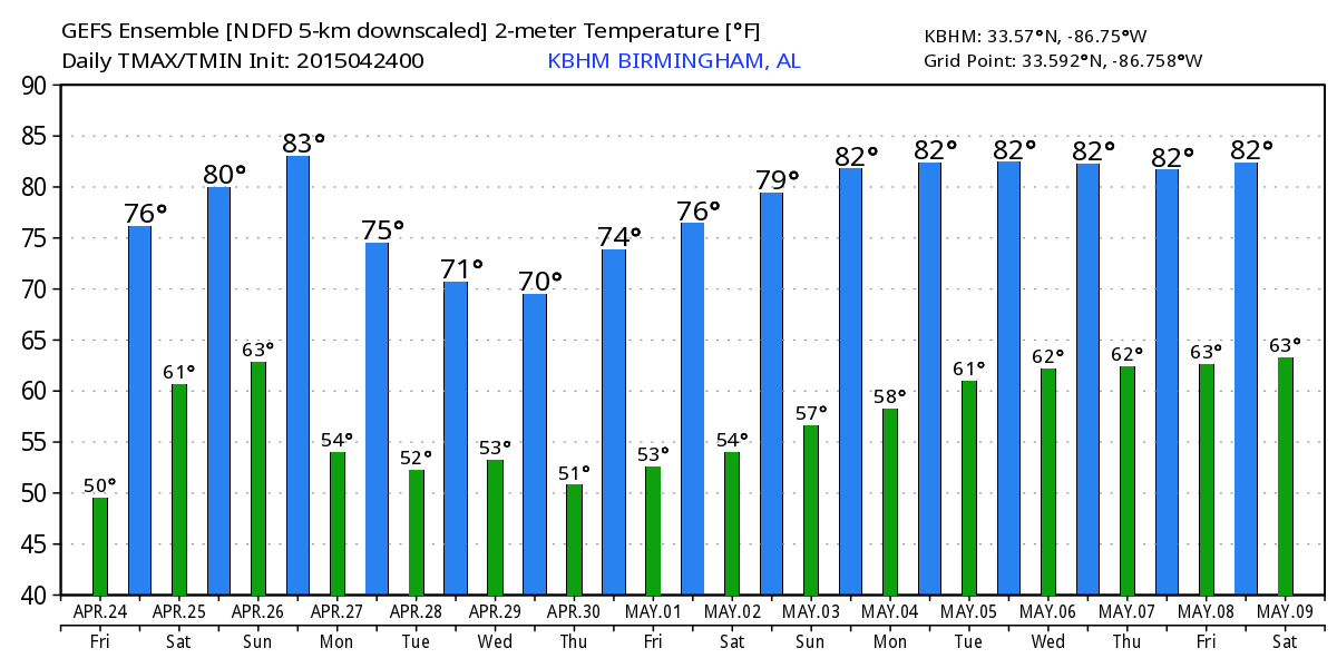
SUNDAY: Interesting to note the guys at SPC have the southern half of Alabama in a “marginal” severe weather risk Sunday. A surface boundary will be somewhere around the middle of our state; along and south of that a few widely scattered showers and storms could develop, and they could be strong. But, for now, we will keep a dry forecast going for the northern half of the state. The NAM is printing a high of 86 degrees for Birmingham Sunday afternoon; it would be a pretty warm day.
The weather stays dry Monday with a high in the 70s.
TUESDAY/WEDNESDAY: The next wave in the jet will bring periods of rain to the state; the GFS is trend weaker and slower, hinting the bulk of the rain will come Tuesday evening through the day Wednesday. Again, the surface low is expected to pass south of here, meaning little if any severe weather risk. Drier air returns Thursday and Friday.
See the Weather Xtreme video for maps, graphics, and more details.
WEATHER BRAINS: Don’t forget you can listen to our weekly 90 minute netcast anytime on the web, or on iTunes. This is the show all about weather featuring many familiar voices, including our meteorologists here at ABC 33/40.
CONNECT: You can find me on all of the major social networks…
Facebook
Twitter
Google Plus
Instagram
I have a weather program this morning at Sulligent Elementary School in Lamar County…. be looking for the next Weather Xtreme video here by 4:00 this afternoon… enjoy the day!
Category: Alabama's Weather
About the Author (Author Profile)
James Spann is one of the most recognized and trusted television meteorologists in the industry. He holds the AMS CCM designation and television seals from the AMS and NWA. He is a past winner of the Broadcast Meteorologist of the Year from both professional organizations.Subscribe
If you enjoyed this article, subscribe to receive more just like it.


