Another Look At Tomorrow
Some notes on what to expect in Alabama during the next 24 hours…
OVERNIGHT: Rain will increase after midnight as a warm front lifts northward; some heavy rain is possible in spots, and thunderstorm intensity will also increase as higher dewpoints advect into North Alabama from the south.
We are still looking at two main windows for severe storms tomorrow…
FIRST ROUND: Storms between 4:00 and 7:00 a.m. could be strong to severe as we get into the warm sector of the storm system approaching from the west. Below is the HRRR model, valid at 5a CDT…
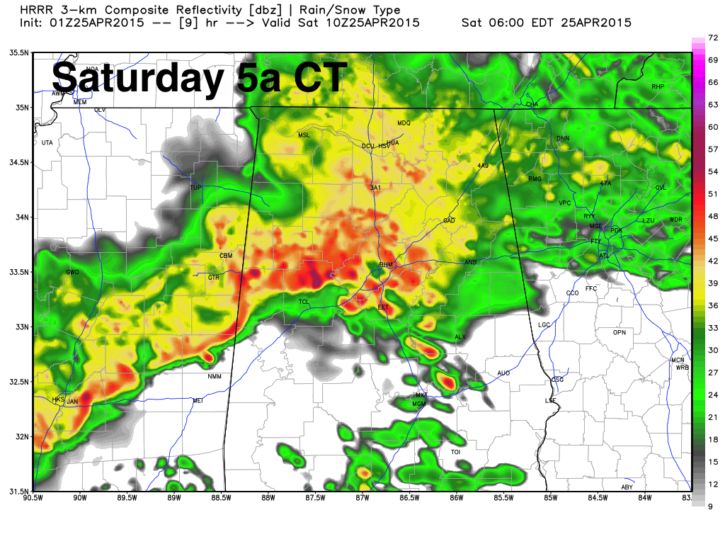
The main threat will come from strong straight line winds and hail, but an isolated tornado is not out of the question.
This first batch of storms will exit the state by mid-morning, and many of the midday hours will be rain-free. The sun should break out at times, and we rise into the low 80s.
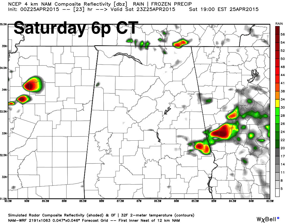
SECOND ROUND: This is a more difficult forecast, but there is as chance that new, scattered storms will begin to form by 3:00 p.m… with the risk extending through about 9:00 p.m. It is important to note that it won’t rain everywhere tomorrow afternoon due to the scattered nature of the storms. However, where the storms develop, they should become severe quickly, and will have potential for hail, strong straight line winds, and a few isolated tornadoes.
Interesting to note the new run of the high resolution NAM model shows little development tomorrow afternoon.
The chance of severe storms developing tomorrow afternoon will simply depend on the state of the atmosphere after the overnight storms, and the degree of instability we see during the day. The best combination of dynamic lift, instability, and shear will be along and east of I-65, although we certainly can’t rule out a storm on the western side as well. But, there is also a chance very few storms will fire up. We will just have to wait and watch.
BIRMINGHAM NOAA WEATHER RADIO: Unfortunately, the Birmingham NOAA Weather Radio transmitter is still down… so we recommend using a smart phone app like MyWarn or WeatherRadio by WDT as a good backup. You can also change the frequency on your weather radio to Mt. Cheaha (162.475) or Tuscaloosa (162.40).
We will have more updates through the night… stay tuned…
Category: Alabama's Weather
About the Author (Author Profile)
James Spann is one of the most recognized and trusted television meteorologists in the industry. He holds the AMS CCM designation and television seals from the AMS and NWA. He is a past winner of the Broadcast Meteorologist of the Year from both professional organizations.Subscribe
If you enjoyed this article, subscribe to receive more just like it.


