

Scattered Showers/Storms Return
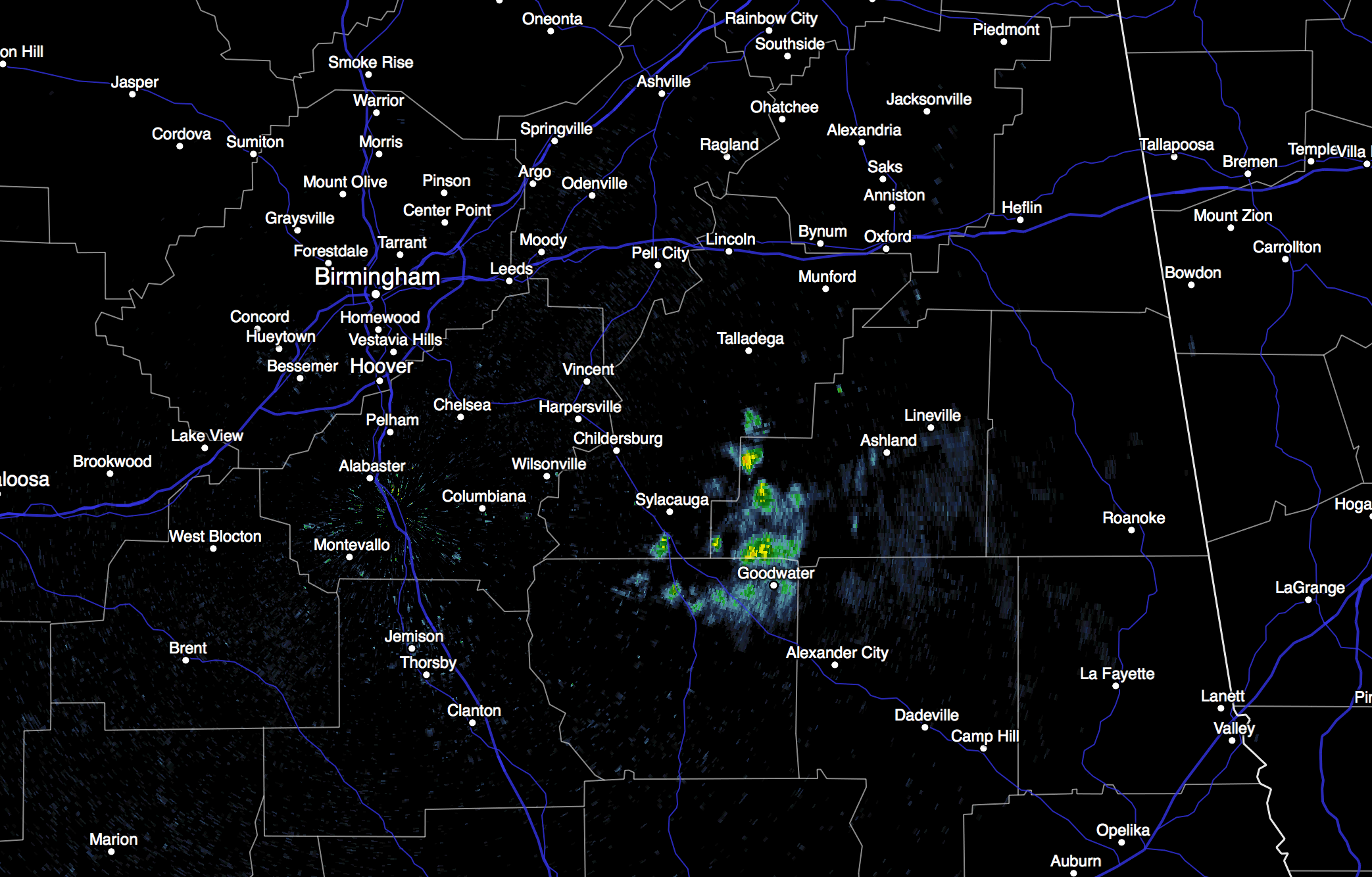
RADAR CHECK: We actually have a few showers at daybreak in progress over Clay and Talladega Counties… they are moving northeast, and seem to be dissipating.
For most Alabama communities, yesterday was the hottest day so far this year. Birmingham and Anniston reached 91, while Tuscaloosa hit 93 degrees. Heat levels will come down a bit today with a high between 87 and 90 degrees… we expect a mix of sun and clouds, and showers and thunderstorms are possible this afternoon and tonight as a surface front approaches the state from the north.
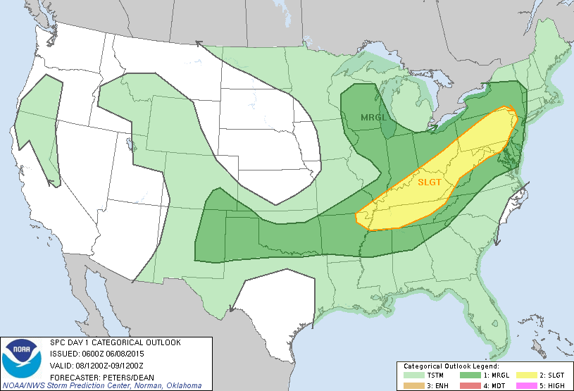
SPC has the northern part of Alabama in a “marginal” severe weather risk later today, with the standard “slight” risk for much of Tennessee. Main issue with the heavier storms here will come from gusty winds and frequent lightning; the overall severe weather threat looks low.
REST OF THE WEEK: The surface front will stall out somewhere near the Alabama/Tennessee border tomorrow; seems like the best chance of scattered showers and storms will be south of U.S. 278 (Hamilton to Cullman to Gadsden), with only isolated showers to the north over the Tennessee Valley. Then, the front dissipates Wednesday, and each day we will have the usual summer forecast, with a mix of sun and clouds and the chance of scattered showers and thunderstorms, most numerous during the afternoon and evening hours. Afternoon highs will be in the upper 80s most days, pretty close to seasonal averages.
THE ALABAMA WEEKEND: An upper ridge begins to build, and the warmer air aloft associated with the ridge will make the air more stable, meaning showers become very widely spaced Saturday and Sunday. We will forecast a good supply of sunshine both days with temperatures creeping back into the low 90s during the afternoon hours.
VOODOO LAND: The GFS continues to try and develop some type of tropical low over the western Gulf of Mexico next week, pushing it up toward the Sabine Pass (Texas/Louisiana border) at mid-week. But, the European global model shows nothing there; see the Weather Xtreme video for maps, graphics, and more details.
AT THE BEACH: Pretty much the standard summer forecast this week, and into the upcoming weekend for the zone from Panama City Beach over to Gulf Shores; about 6 to 8 hours of sunshine each day with scattered showers and thunderstorms; highs on the immediate coast will range from 83 to 86 degrees, with 87-90 degrees a few miles inland. The sea water temperature this morning at the Dauphin Island Sea Lab is 84 degrees.
WEATHER BRAINS: Don’t forget you can listen to our weekly 90 minute netcast anytime on the web, or on iTunes. This is the show all about weather featuring many familiar voices, including our meteorologists here at ABC 33/40. We will produce this week’s show tonight at 8:30p CT… you can watch it on “James Spann 24/7” on cable systems around the state, or on the web here.
CONNECT: You can find me on all of the major social networks…
Facebook
Twitter
Google Plus
Instagram
Look for the next Weather Xtreme video here by 4:00 this afternoon… enjoy the day!
Category: Alabama's Weather
About the Author (Author Profile)
James Spann is one of the most recognized and trusted television meteorologists in the industry. He holds the AMS CCM designation and television seals from the AMS and NWA. He is a past winner of the Broadcast Meteorologist of the Year from both professional organizations.Subscribe
If you enjoyed this article, subscribe to receive more just like it.


