

Dry Air/Lower Humidity By Sunday
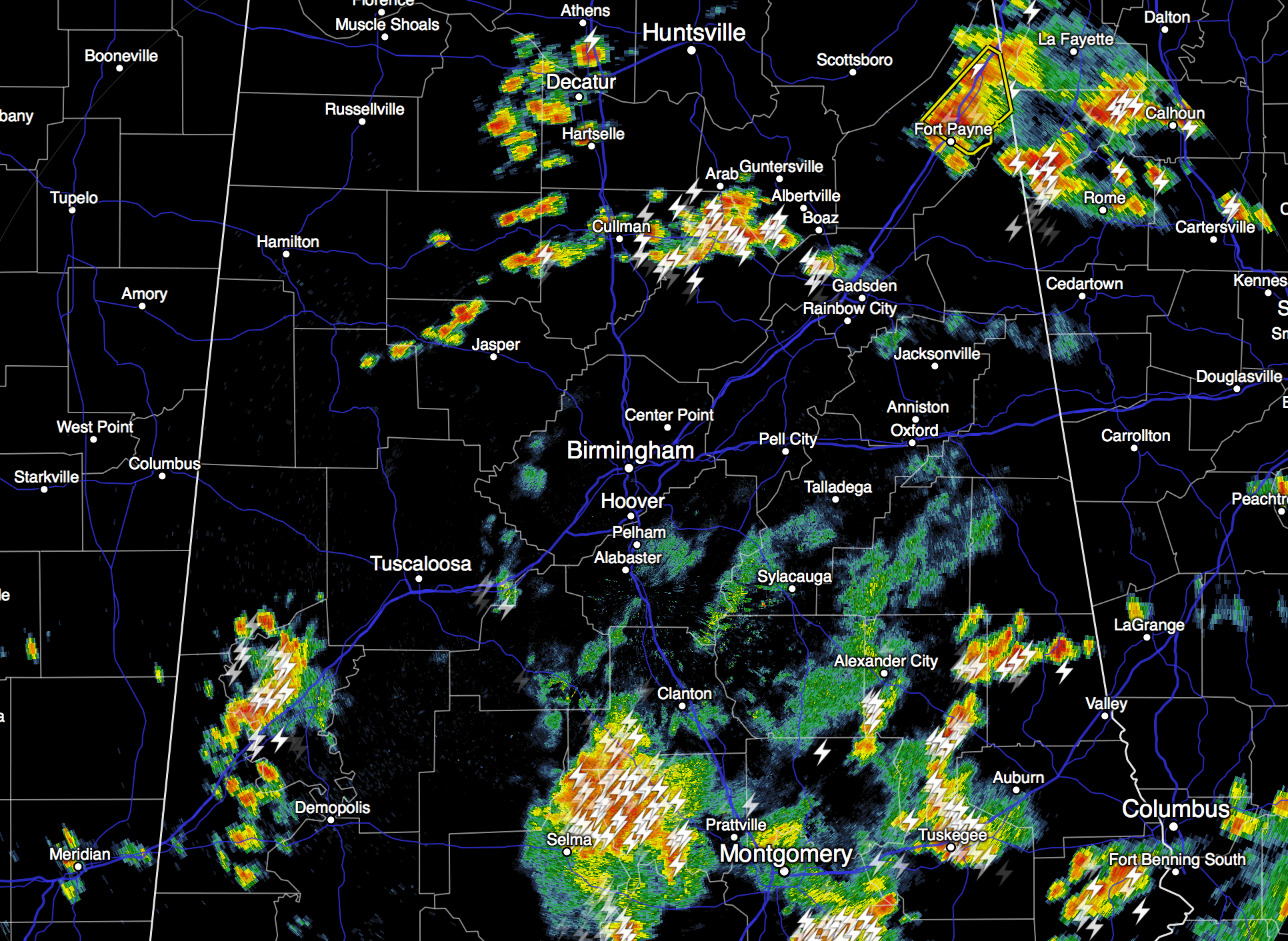
RADAR CHECK: As expected, we have seen a big increase in the number of showers and storms across Central Alabama this afternoon. Heavier storms are producing lots of lightning, gusty winds, and some small hail as they move east/northeast…
Temperatures are only in the low 80s across much of Central Alabama because of clouds and showers. A very nice break from the heat.
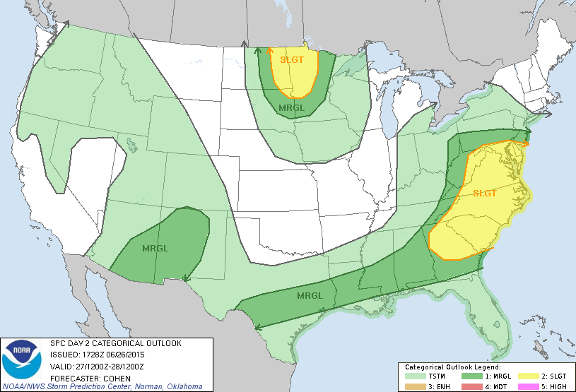
We will maintain the chance of occasional showers and thunderstorms across Alabama tonight and tomorrow as an upper trough develops over the eastern U.S. There will be breaks in the rain tomorrow, and the sun might peek out at times. But, if you have something planned outdoors be prepared for rain delays. Additional rain amounts of 1/2 to 1 inch are likely over the next 24 hours. The high tomorrow will be only in the low to mid 80s. SPC maintains a “marginal” severe weather risk tomorrow for the southern two-thirds of the state.
BRIGHTER/DRIER SUNDAY: A nice surge of dry, continental air moves into Alabama Sunday… we start the day down in the low 60s, and the high will be in the mid 80s with ample sunshine and lower humidity. Monday looks very nice as well with a good supply of sunshine.
REST OF NEXT WEEK: Moisture begins to return Tuesday, and a few spots could see an afternoon shower or thunderstorm. Then, for the rest of the week and the Fourth of July weekend, expect a mix of sun and clouds each day with some risk of scattered showers and thunderstorms on a daily basis. Highs for the latter half of the week will be generally in the 87 to 90 degree range. Not bad at all for early July in Alabama. See the Weather Xtreme video for maps, graphics, and more details.
AT THE BEACH: About 5 to 7 hours of sunshine tomorrow and Sunday on the coast from Panama City Beach west to Gulf Shores with scattered showers and thunderstorms. Storms become fewer in number of next week, with about 7 to 9 hours of sun daily. Highs on the immediate coast will be in the mid to upper 80s, with low 90s possible inland. Sea water temperatures remain mostly in the mid 80s.
TROPICS: The Atlantic basin remains quiet, and tropical storm formation is not expected through early next week.
WEATHER BRAINS: Don’t forget you can listen to our weekly 90 minute netcast anytime on the web, or on iTunes. This is the show all about weather featuring many familiar voices, including our meteorologists here at ABC 33/40.
CONNECT: You can find me on all of the major social networks…
Facebook
Twitter
Google Plus
Instagram
Look for my next Weather Xtreme video by Monday morning at 7:00 a.m…. Brian Peters will have the video updates here tomorrow and Sunday. Enjoy the weekend!
Category: Alabama's Weather
About the Author (Author Profile)
James Spann is one of the most recognized and trusted television meteorologists in the industry. He holds the AMS CCM designation and television seals from the AMS and NWA. He is a past winner of the Broadcast Meteorologist of the Year from both professional organizations.Subscribe
If you enjoyed this article, subscribe to receive more just like it.


